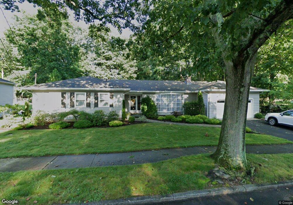
145 Stevenson Rd New Haven, CT 06515
Westville NeighborhoodEstimated Value: $474,000 - $505,000
3
Beds
2
Baths
2,122
Sq Ft
$234/Sq Ft
Est. Value
About This Home
This home is located at 145 Stevenson Rd, New Haven, CT 06515 and is currently estimated at $496,157, approximately $233 per square foot. 145 Stevenson Rd is a home located in New Haven County with nearby schools including Elm City Montessori School and Hopkins School.
Ownership History
Date
Name
Owned For
Owner Type
Purchase Details
Closed on
Jul 12, 2010
Sold by
Sviridoff Allen and Milan Linda
Bought by
Collins John and Collins Jane
Current Estimated Value
Home Financials for this Owner
Home Financials are based on the most recent Mortgage that was taken out on this home.
Original Mortgage
$192,000
Outstanding Balance
$122,053
Interest Rate
3.87%
Estimated Equity
$374,104
Create a Home Valuation Report for This Property
The Home Valuation Report is an in-depth analysis detailing your home's value as well as a comparison with similar homes in the area
Home Values in the Area
Average Home Value in this Area
Purchase History
| Date | Buyer | Sale Price | Title Company |
|---|---|---|---|
| Collins John | $240,000 | -- |
Source: Public Records
Mortgage History
| Date | Status | Borrower | Loan Amount |
|---|---|---|---|
| Open | Collins John | $192,000 | |
| Previous Owner | Collins John | $109,200 | |
| Previous Owner | Collins John | $109,200 | |
| Previous Owner | Collins John | $176,000 |
Source: Public Records
Tax History Compared to Growth
Tax History
| Year | Tax Paid | Tax Assessment Tax Assessment Total Assessment is a certain percentage of the fair market value that is determined by local assessors to be the total taxable value of land and additions on the property. | Land | Improvement |
|---|---|---|---|---|
| 2025 | $9,659 | $245,140 | $64,470 | $180,670 |
| 2024 | $9,438 | $245,140 | $64,470 | $180,670 |
| 2023 | $9,119 | $245,140 | $64,470 | $180,670 |
| 2022 | $9,744 | $245,140 | $64,470 | $180,670 |
| 2021 | $8,198 | $186,830 | $41,930 | $144,900 |
| 2020 | $8,198 | $186,830 | $41,930 | $144,900 |
| 2019 | $8,030 | $186,830 | $41,930 | $144,900 |
| 2018 | $8,030 | $186,830 | $41,930 | $144,900 |
| 2017 | $7,227 | $186,830 | $41,930 | $144,900 |
| 2016 | $7,329 | $176,400 | $43,540 | $132,860 |
| 2015 | $6,992 | $168,280 | $43,540 | $124,740 |
| 2014 | $6,992 | $168,280 | $43,540 | $124,740 |
Source: Public Records
Map
Nearby Homes
- 195 Stevenson Rd
- 36 Birch Dr
- 119 Brooklawn Cir
- 51 Fountain Terrace
- 360 Fountain St Unit 5
- 690 Forest Rd Unit 702
- 690 Forest Rd Unit 392
- 690 Forest Rd Unit 511
- 699 Forest Rd
- 61 Anthony St
- 119 Westwood Rd
- 126 Willard St
- 11 Priscilla Rd
- 55 Marvel Rd
- 303 Central Ave
- 80 W Rock Ave
- 70 Fountain St Unit 4
- 1016 Whalley Ave Unit 6
- 233 Valley St
- 999 Whalley Ave Unit 1H
- 137 Stevenson Rd
- 140 Stevenson Rd
- 150 Stevenson Rd
- 165 Stevenson Rd
- 130 Stevenson Rd
- 160 Stevenson Rd
- 99 Whittier Rd
- 125 Stevenson Rd
- 91 Whittier Rd
- 111 Whittier Rd
- 170 Stevenson Rd
- 175 Stevenson Rd
- 119 Whittier Rd
- 81 Whittier Rd
- 110 Stevenson Rd
- 109 Stevenson Rd
- 185 Stevenson Rd
- 104 Whittier Rd
- 94 Whittier Rd
- 129 Whittier Rd