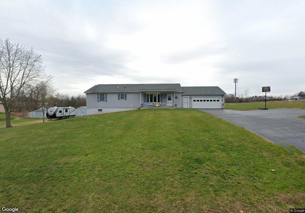
145 Sutton Rd Abbottstown, PA 17301
Estimated Value: $289,000 - $359,936
2
Beds
2
Baths
1,456
Sq Ft
$219/Sq Ft
Est. Value
About This Home
This home is located at 145 Sutton Rd, Abbottstown, PA 17301 and is currently estimated at $319,484, approximately $219 per square foot. 145 Sutton Rd is a home located in Adams County with nearby schools including New Oxford Senior High School, Paradise School, and Oxford Christian Academy.
Ownership History
Date
Name
Owned For
Owner Type
Purchase Details
Closed on
Aug 4, 2017
Sold by
Alwine Dennis G
Bought by
Alwine Scott E and Alwine Susan E
Current Estimated Value
Home Financials for this Owner
Home Financials are based on the most recent Mortgage that was taken out on this home.
Original Mortgage
$134,400
Outstanding Balance
$110,314
Interest Rate
3.37%
Mortgage Type
Adjustable Rate Mortgage/ARM
Estimated Equity
$209,170
Purchase Details
Closed on
Aug 8, 1991
Bought by
Alwine George R and Alwine Imogene D
Create a Home Valuation Report for This Property
The Home Valuation Report is an in-depth analysis detailing your home's value as well as a comparison with similar homes in the area
Home Values in the Area
Average Home Value in this Area
Purchase History
| Date | Buyer | Sale Price | Title Company |
|---|---|---|---|
| Alwine Scott E | $168,000 | None Available | |
| Alwine George R | $9,000 | -- |
Source: Public Records
Mortgage History
| Date | Status | Borrower | Loan Amount |
|---|---|---|---|
| Open | Alwine Scott E | $134,400 |
Source: Public Records
Tax History Compared to Growth
Tax History
| Year | Tax Paid | Tax Assessment Tax Assessment Total Assessment is a certain percentage of the fair market value that is determined by local assessors to be the total taxable value of land and additions on the property. | Land | Improvement |
|---|---|---|---|---|
| 2025 | $5,280 | $215,200 | $59,900 | $155,300 |
| 2024 | $4,887 | $215,200 | $59,900 | $155,300 |
| 2023 | $4,657 | $215,200 | $59,900 | $155,300 |
| 2022 | $4,517 | $215,200 | $59,900 | $155,300 |
| 2021 | $4,403 | $215,200 | $59,900 | $155,300 |
| 2020 | $4,316 | $215,200 | $59,900 | $155,300 |
| 2019 | $4,229 | $215,200 | $59,900 | $155,300 |
| 2018 | $3,927 | $215,200 | $59,900 | $155,300 |
| 2017 | $3,813 | $215,200 | $59,900 | $155,300 |
| 2016 | -- | $215,200 | $59,900 | $155,300 |
| 2015 | -- | $224,300 | $69,000 | $155,300 |
| 2014 | -- | $224,300 | $69,000 | $155,300 |
Source: Public Records
Map
Nearby Homes
- 507 Bullet Way
- 486 W King St
- 224 W King St
- 28 Town Cir Unit 12A
- 0 Woods Rd
- 201 Kinneman Rd Unit 25
- 221 Kinneman Rd Unit 28
- 6 Lobell Rd
- 484 Brough Rd
- 334 Rolling Ln Unit 2
- 290 Woods Rd Unit 1
- 60 Hunters Cir Unit 19
- 6431 York Rd
- 7452 Lincoln Hwy
- 7461 Saint Patrick Ct
- 7463 Saint Patrick Ct
- 7459 Saint Patrick Ct
- 7457 Saint Patrick Ct
- 7455 Saint Patrick Ct Unit 28
- 7435 Saint Patrick Ct Unit 6