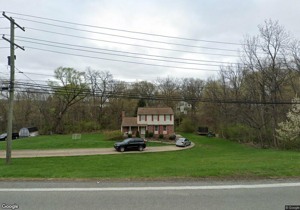
1450 Mayview Rd Pittsburgh, PA 15241
Estimated Value: $361,000 - $428,000
3
Beds
2
Baths
1,688
Sq Ft
$228/Sq Ft
Est. Value
About This Home
This home is located at 1450 Mayview Rd, Pittsburgh, PA 15241 and is currently estimated at $385,492, approximately $228 per square foot. 1450 Mayview Rd is a home located in Allegheny County with nearby schools including Upper St. Clair High School.
Ownership History
Date
Name
Owned For
Owner Type
Purchase Details
Closed on
Aug 28, 2014
Sold by
Graham William P
Bought by
Graham Toni and Slavik Joseph
Current Estimated Value
Home Financials for this Owner
Home Financials are based on the most recent Mortgage that was taken out on this home.
Original Mortgage
$155,000
Outstanding Balance
$118,663
Interest Rate
4.14%
Mortgage Type
New Conventional
Estimated Equity
$266,829
Purchase Details
Closed on
Sep 26, 1989
Bought by
Graham William P and Graham Virginia G
Create a Home Valuation Report for This Property
The Home Valuation Report is an in-depth analysis detailing your home's value as well as a comparison with similar homes in the area
Home Values in the Area
Average Home Value in this Area
Purchase History
| Date | Buyer | Sale Price | Title Company |
|---|---|---|---|
| Graham Toni | $180,000 | -- | |
| Graham William P | $100,000 | -- |
Source: Public Records
Mortgage History
| Date | Status | Borrower | Loan Amount |
|---|---|---|---|
| Open | Graham Toni | $155,000 |
Source: Public Records
Tax History Compared to Growth
Tax History
| Year | Tax Paid | Tax Assessment Tax Assessment Total Assessment is a certain percentage of the fair market value that is determined by local assessors to be the total taxable value of land and additions on the property. | Land | Improvement |
|---|---|---|---|---|
| 2025 | $6,856 | $179,500 | $42,900 | $136,600 |
| 2024 | $6,856 | $179,500 | $42,900 | $136,600 |
| 2023 | $6,664 | $179,500 | $42,900 | $136,600 |
| 2022 | $6,505 | $179,500 | $42,900 | $136,600 |
| 2021 | $849 | $179,500 | $42,900 | $136,600 |
| 2020 | $6,271 | $179,500 | $42,900 | $136,600 |
| 2019 | $6,178 | $179,500 | $42,900 | $136,600 |
| 2018 | $849 | $179,500 | $42,900 | $136,600 |
| 2017 | $5,904 | $179,500 | $42,900 | $136,600 |
| 2016 | $849 | $179,500 | $42,900 | $136,600 |
| 2015 | $849 | $179,500 | $42,900 | $136,600 |
| 2014 | -- | $197,500 | $42,900 | $154,600 |
Source: Public Records
Map
Nearby Homes
- 1331 Morrow Rd
- 1435 Morrow Rd
- 1005 Tall Trees Dr
- 250 Portman Ln Unit A
- 1560 Mayview Rd
- 1251 Greystone Dr
- 1109 Bank St
- 2370 Morrow Rd
- 412 Winfield St
- 2301 Southampton Dr
- 2013 Ashton Row
- 2122 Westcott Ln
- 1115 Sray Ln
- Ashby Plan at Hastings - Single Family
- Royston Plan at Hastings - Single Family
- Corby Plan at Hastings - Single Family
- Helston Plan at Hastings - Single Family
- Marlow Plan at Hastings - Single Family
- Bromley Plan at Hastings - Single Family
- 1438 Hastings Crescent Unit Royston
- 1460 Mayview Rd
- 1133 Galaxy Cir
- 1233 Satellite Cir
- 1129 Galaxy Cir
- 1225 Satellite Cir
- 1215 Satellite Cir
- 1137 Galaxy Cir
- 1241 Satellite Cir
- 1447 Mayview Rd
- 1125 Galaxy Cir
- 1213 Satellite Cir
- 1434 Mayview Rd
- 1470 Mayview Rd
- 1204 Star Ridge Dr
- 1141 Galaxy Cir
- 1245 Satellite Cir
- 1121 Galaxy Cir
- 1224 Satellite Cir
- 1232 Satellite Cir
- 1134 Galaxy Cir