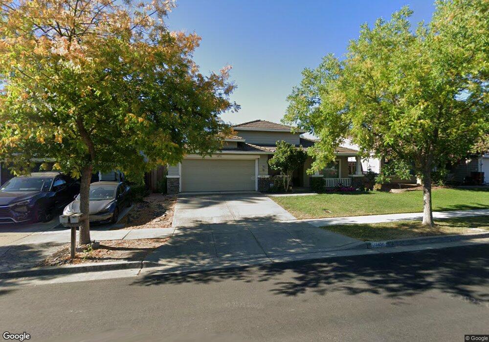
1450 Pheasant Dr Gilroy, CA 95020
Las Animas NeighborhoodEstimated Value: $994,000 - $1,132,000
4
Beds
2
Baths
2,040
Sq Ft
$523/Sq Ft
Est. Value
About This Home
This home is located at 1450 Pheasant Dr, Gilroy, CA 95020 and is currently estimated at $1,067,400, approximately $523 per square foot. 1450 Pheasant Dr is a home located in Santa Clara County with nearby schools including Luigi Aprea Elementary School, Brownell Middle School, and Solorsano Middle School.
Ownership History
Date
Name
Owned For
Owner Type
Purchase Details
Closed on
Jun 28, 2022
Sold by
Stephen Sabath H and Stephen Suzanne J
Bought by
Sabath Suzanne J
Current Estimated Value
Purchase Details
Closed on
Feb 6, 2002
Sold by
Sabath Suzanne J and Lomazzi Suzanne
Bought by
Sabath H Stephen and Sabath Suzanne J
Home Financials for this Owner
Home Financials are based on the most recent Mortgage that was taken out on this home.
Original Mortgage
$175,000
Interest Rate
7.13%
Purchase Details
Closed on
May 30, 1996
Sold by
Kaufman & Broad Monterey Bay Inc
Bought by
Lomazzi Suzanne
Create a Home Valuation Report for This Property
The Home Valuation Report is an in-depth analysis detailing your home's value as well as a comparison with similar homes in the area
Home Values in the Area
Average Home Value in this Area
Purchase History
| Date | Buyer | Sale Price | Title Company |
|---|---|---|---|
| Sabath Suzanne J | -- | None Listed On Document | |
| Sabath H Stephen | -- | Stewart Title | |
| Lomazzi Suzanne | $252,500 | First American Title Guarant |
Source: Public Records
Mortgage History
| Date | Status | Borrower | Loan Amount |
|---|---|---|---|
| Previous Owner | Sabath H Stephen | $175,000 |
Source: Public Records
Tax History
| Year | Tax Paid | Tax Assessment Tax Assessment Total Assessment is a certain percentage of the fair market value that is determined by local assessors to be the total taxable value of land and additions on the property. | Land | Improvement |
|---|---|---|---|---|
| 2025 | $4,970 | $402,812 | $166,113 | $236,699 |
| 2024 | $4,970 | $394,914 | $162,856 | $232,058 |
| 2023 | $4,941 | $387,171 | $159,663 | $227,508 |
| 2022 | $4,772 | $379,581 | $156,533 | $223,048 |
| 2021 | $4,748 | $372,139 | $153,464 | $218,675 |
| 2020 | $4,695 | $368,324 | $151,891 | $216,433 |
| 2019 | $4,651 | $361,103 | $148,913 | $212,190 |
| 2018 | $4,344 | $354,024 | $145,994 | $208,030 |
| 2017 | $4,432 | $347,083 | $143,132 | $203,951 |
| 2016 | $4,337 | $340,278 | $140,326 | $199,952 |
| 2015 | $4,092 | $335,168 | $138,219 | $196,949 |
| 2014 | $4,065 | $328,604 | $135,512 | $193,092 |
Source: Public Records
Map
Nearby Homes
- 9130 Rancho Hills Dr
- 9465 Eagle View Way
- 8980 Acorn Way
- 8940 Acorn Way
- 1655 Valley Oaks Dr
- 1165 Lerma Ln
- 1810 Carob Ct
- 9045 Tea Tree Way
- 1925 Mantelli Dr
- 9250 Mahogany Ct
- 1080 Sunrise Dr
- 1920 Mantelli Dr
- 9632 Cherrywood Ct
- 946 Martiri Ct
- 1206 Sycamore Ct
- 1501 Welburn Ave
- 803 Sunrise Dr
- 1750 Vista Del Sur
- 1180 Day Rd
- 8320 Chantrelle Ct
- 1460 Pheasant Dr
- 1440 Pheasant Dr
- 1451 Swallow Ln
- 1461 Swallow Ln
- 1470 Pheasant Dr
- 1430 Pheasant Dr
- 1441 Swallow Ln
- 1471 Swallow Ln
- 1453 Pheasant Dr
- 1443 Pheasant Dr
- 1480 Pheasant Dr
- 1431 Swallow Ln
- 1420 Pheasant Dr
- 1481 Swallow Ln
- 1463 Pheasant Dr
- 1433 Pheasant Dr
- 1421 Swallow Ln
- 1423 Pheasant Dr
- 1491 Swallow Ln
- 1490 Pheasant Dr
Your Personal Tour Guide
Ask me questions while you tour the home.