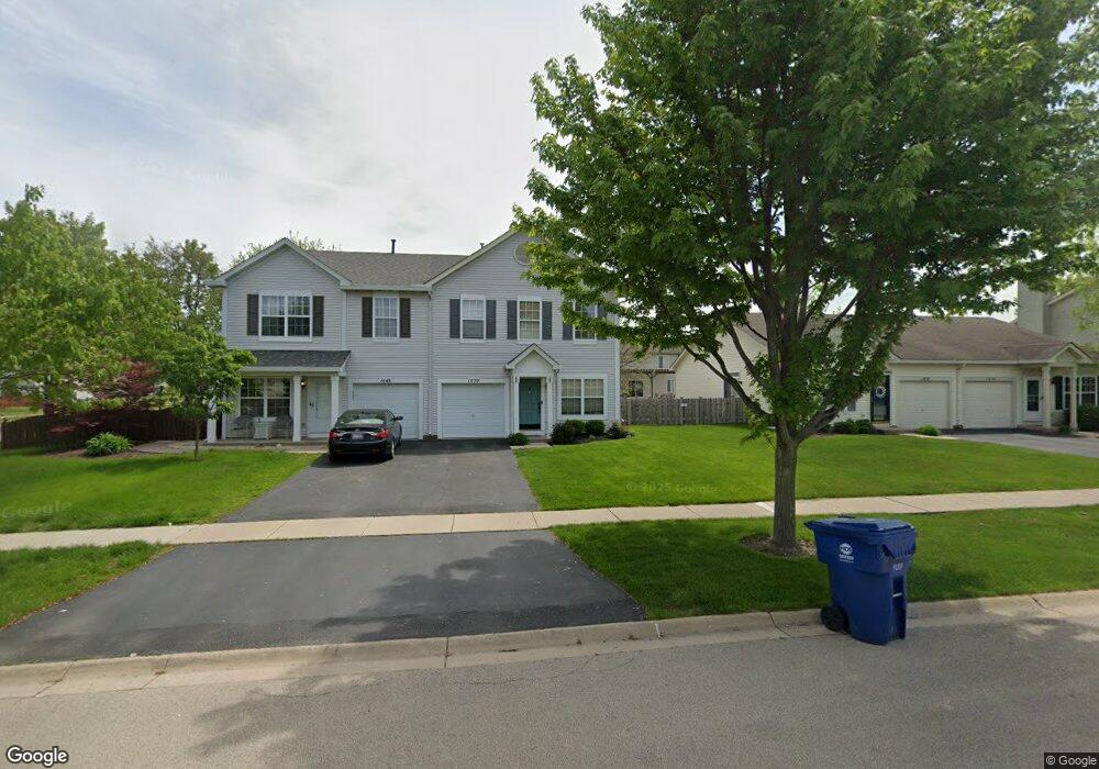
1450 Red Top Ln Unit 2 Minooka, IL 60447
Estimated Value: $266,000 - $273,000
About This Home
This home is located at 1450 Red Top Ln Unit 2, Minooka, IL 60447 and is currently estimated at $269,856, approximately $158 per square foot. 1450 Red Top Ln Unit 2 is a home located in Grundy County with nearby schools including Minooka Primary Center, Minooka Elementary School, and Minooka Junior High School.
Ownership History
We collect this data history from publicly available records. To have your information removed, we recommend requesting removal directly through your county’s website.
Purchase Details
Home Financials for this Owner
Home Financials are based on the most recent Mortgage that was taken out on this home.Purchase History
We collect this data history from publicly available records. To have your information removed, we recommend requesting removal directly through your county’s website.
| Date | Buyer | Sale Price | Title Company |
|---|---|---|---|
| $159,000 | First American Title |
Mortgage History
We collect this data history from publicly available records. To have your information removed, we recommend requesting removal directly through your county’s website.
| Date | Status | Borrower | Loan Amount |
|---|---|---|---|
| Open | $158,083 |
Tax History
We collect this data history from publicly available records. To have your information removed, we recommend requesting removal directly through your county’s website.
| Year | Tax Paid | Tax Assessment Tax Assessment Total Assessment is a certain percentage of the fair market value that is determined by local assessors to be the total taxable value of land and additions on the property. | Land | Improvement |
|---|---|---|---|---|
| 2024 | $5,155 | $64,268 | $8,184 | $56,084 |
| 2023 | $4,699 | $58,580 | $7,460 | $51,120 |
| 2022 | $4,369 | $54,467 | $6,936 | $47,531 |
| 2021 | $4,200 | $51,559 | $6,566 | $44,993 |
| 2020 | $4,110 | $49,321 | $6,281 | $43,040 |
| 2019 | $3,906 | $45,668 | $5,816 | $39,852 |
| 2018 | $3,709 | $42,316 | $5,751 | $36,565 |
| 2017 | $3,615 | $40,409 | $5,492 | $34,917 |
| 2016 | $3,397 | $37,932 | $5,155 | $32,777 |
| 2015 | $2,727 | $34,481 | $4,686 | $29,795 |
| 2014 | $2,238 | $33,064 | $5,575 | $27,489 |
| 2013 | $2,303 | $33,510 | $5,650 | $27,860 |
Map
- 1432 Red Top Ln
- 1434 Plantain Dr
- 506 Prairie View Dr Unit 506
- 641 Chestnut Ridge
- 1756 Waters Edge Dr
- 1742 Waters Edge Dr Unit 1742
- 309 Wabena Ct
- Lots 16,17,18 Waters Edge Dr
- 25136 Westwind Dr
- 25140 Westwind Dr
- 2080 Waters Edge Dr
- 352 Coneflower Dr
- 311 W Frontier Dr
- 810 Heritage Woods Dr
- 808 Heritage Woods Dr
- 2059 Isabella Ln
- 1138 Coneflower Ct
- Lot 26 Isabella Ln
- 2031 Isabella Ln
- 628 Turnbury Dr
- 1560 Bluestem Ln
- 1448 Red Top Ln
- 1450 Red Top Ln
- 1452 Red Top Ln
- 1564 Bluestem Ct
- 1456 Red Top Ln
- 1446 Red Top Ln Unit 1446
- 1444 Red Top Ln
- 1533 Bluestem Ln
- 1548 Bluestem Ln
- 1568 Bluestem Ct
- 1458 Red Top Ln Unit 2
- 1458 Red Top Ln
- 1442 Red Top Ln
- 1460 Red Top Ln
- 1561 Bluestem Ct
- 1440 Red Top Ln Unit 2
- 1440 Red Top Ln
- 1529 Bluestem Ln
- 1462 Red Top Ln
Ask me questions while you tour the home.