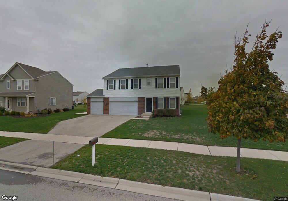
14502 Independence Dr Plainfield, IL 60544
West Plainfield NeighborhoodEstimated Value: $469,000 - $524,000
4
Beds
4
Baths
3,190
Sq Ft
$156/Sq Ft
Est. Value
About This Home
This home is located at 14502 Independence Dr, Plainfield, IL 60544 and is currently estimated at $497,211, approximately $155 per square foot. 14502 Independence Dr is a home located in Will County with nearby schools including Lincoln Elementary School, Richard Ira Jones Middle School, and Plainfield North High School.
Ownership History
Date
Name
Owned For
Owner Type
Purchase Details
Closed on
May 15, 2017
Sold by
Villanueva Julio and Villanueva Ana M
Bought by
Araiza Dominic and Araiza Kaela
Current Estimated Value
Home Financials for this Owner
Home Financials are based on the most recent Mortgage that was taken out on this home.
Original Mortgage
$26,675,000
Outstanding Balance
$22,171,377
Interest Rate
4.08%
Mortgage Type
New Conventional
Estimated Equity
-$21,674,166
Purchase Details
Closed on
Oct 17, 2005
Sold by
Drh Cambridge Homes Inc
Bought by
Villanueva Julio and Villanueva Ana M
Home Financials for this Owner
Home Financials are based on the most recent Mortgage that was taken out on this home.
Original Mortgage
$231,016
Interest Rate
6.25%
Mortgage Type
Purchase Money Mortgage
Create a Home Valuation Report for This Property
The Home Valuation Report is an in-depth analysis detailing your home's value as well as a comparison with similar homes in the area
Home Values in the Area
Average Home Value in this Area
Purchase History
| Date | Buyer | Sale Price | Title Company |
|---|---|---|---|
| Araiza Dominic | $275,000 | Alliance Title Corporation | |
| Villanueva Julio | $289,000 | First American Title |
Source: Public Records
Mortgage History
| Date | Status | Borrower | Loan Amount |
|---|---|---|---|
| Open | Araiza Dominic | $26,675,000 | |
| Previous Owner | Villanueva Julio | $231,016 |
Source: Public Records
Tax History
| Year | Tax Paid | Tax Assessment Tax Assessment Total Assessment is a certain percentage of the fair market value that is determined by local assessors to be the total taxable value of land and additions on the property. | Land | Improvement |
|---|---|---|---|---|
| 2024 | $10,368 | $148,628 | $30,220 | $118,408 |
| 2023 | $10,368 | $134,238 | $27,294 | $106,944 |
| 2022 | $9,300 | $120,564 | $24,514 | $96,050 |
| 2021 | $8,782 | $112,676 | $22,910 | $89,766 |
| 2020 | $8,657 | $109,479 | $22,260 | $87,219 |
| 2019 | $8,350 | $104,315 | $21,210 | $83,105 |
| 2018 | $8,372 | $102,583 | $19,730 | $82,853 |
| 2017 | $8,112 | $97,484 | $18,749 | $78,735 |
| 2016 | $7,912 | $92,975 | $17,882 | $75,093 |
| 2015 | $7,389 | $87,096 | $16,751 | $70,345 |
| 2014 | $7,389 | $84,021 | $16,160 | $67,861 |
| 2013 | $7,389 | $84,021 | $16,160 | $67,861 |
Source: Public Records
Map
Nearby Homes
- 25138 Presidential Ave
- 14722 Colonial Pkwy Unit 3
- 14530 Thomas Jefferson Dr
- 14403 S Charlton Place
- 14343 S Charlton Place
- 14341 S Charlton Place
- 14947 S Mccarthy Cir
- 14924 S Parkview Dr
- 14907 S Parkview Dr
- 14945 S Mccarthy Cir
- 14925 S Parkview Dr
- 14941 S Mccarthy Cir
- 15017 S Darr Dr
- 14946 S Darr Cir
- 14943 S Mccarthy Cir
- 14829 S Henebry Ln
- 14930 S Parkview Dr
- 14942 S Parkview Dr
- 14844 S Parkview Dr
- 14961 S Darr Dr
- 14508 Independence Dr
- 14501 Meadow Ln Unit 3
- 14509 Meadow Ln
- 14514 Independence Dr Unit 3
- 14450 Independence Dr
- 14503 Independence Dr
- 14517 Meadow Ln
- 14509 Independence Dr
- 14451 Meadow Ln
- 14520 Independence Dr
- 14451 Independence Dr
- 14515 Independence Dr
- 14448 Independence Dr Unit 4
- 14525 Meadow Ln
- 14445 Meadow Ln
- 14521 Independence Dr
- 14449 Independence Dr
- 25103 Presidential Ave
- 14526 Independence Dr
- 14533 Meadow Ln
Your Personal Tour Guide
Ask me questions while you tour the home.