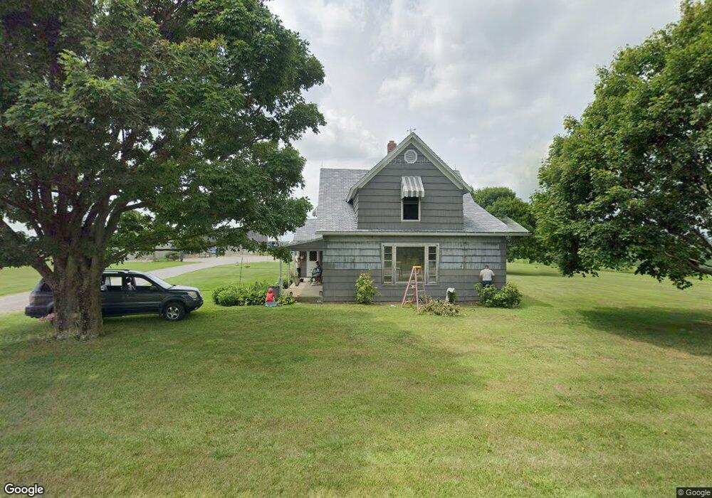
1452 Brindle Rd Ostrander, OH 43061
Scioto NeighborhoodEstimated Value: $510,000 - $1,293,579
3
Beds
2
Baths
2,063
Sq Ft
$437/Sq Ft
Est. Value
About This Home
This home is located at 1452 Brindle Rd, Ostrander, OH 43061 and is currently estimated at $901,790, approximately $437 per square foot. 1452 Brindle Rd is a home located in Delaware County with nearby schools including Buckeye Valley High School.
Ownership History
Date
Name
Owned For
Owner Type
Purchase Details
Closed on
Dec 9, 2021
Bought by
Beverly Lowe
Current Estimated Value
Purchase Details
Closed on
May 31, 2016
Sold by
Odorisio Thomas and Odorisio Thomas M
Bought by
Lowe Jerry L and Lowe Beverly
Purchase Details
Closed on
Feb 24, 1989
Bought by
Lowe Jerry L Beverly
Create a Home Valuation Report for This Property
The Home Valuation Report is an in-depth analysis detailing your home's value as well as a comparison with similar homes in the area
Home Values in the Area
Average Home Value in this Area
Purchase History
| Date | Buyer | Sale Price | Title Company |
|---|---|---|---|
| Beverly Lowe | -- | -- | |
| Lowe Jerry L | $157,700 | Attorney | |
| Lowe Jerry L Beverly | $121,500 | -- |
Source: Public Records
Tax History
| Year | Tax Paid | Tax Assessment Tax Assessment Total Assessment is a certain percentage of the fair market value that is determined by local assessors to be the total taxable value of land and additions on the property. | Land | Improvement |
|---|---|---|---|---|
| 2024 | $5,423 | $561,900 | $505,650 | $56,250 |
| 2023 | $5,443 | $561,900 | $505,650 | $56,250 |
| 2022 | $3,174 | $339,010 | $305,060 | $33,950 |
| 2021 | $3,093 | $339,010 | $305,060 | $33,950 |
| 2020 | $3,112 | $339,010 | $305,060 | $33,950 |
| 2019 | $4,816 | $286,550 | $254,210 | $32,340 |
| 2018 | $4,904 | $286,550 | $254,210 | $32,340 |
| 2017 | $5,317 | $223,170 | $190,510 | $32,660 |
| 2016 | $5,785 | $223,170 | $190,510 | $32,660 |
| 2015 | $6,105 | $223,170 | $190,510 | $32,660 |
| 2014 | $5,871 | $226,420 | $190,510 | $35,910 |
| 2013 | $3,470 | $196,320 | $166,290 | $30,030 |
Source: Public Records
Map
Nearby Homes
- 0 Carr Rd Unit 225016840
- 535 Brayshaw Dr
- 0 Burnt Pond Rd Unit Tract 2
- 0 Burnt Pond Rd Unit Tract 4
- 0 Burnt Pond Rd Unit Tract 3
- 0 Burnt Pond Rd Unit Tract 5
- 6685 State Route 37 W
- 3480 Ostrander Rd
- 231 Bluegrass Way
- 311 Ben Curtis Dr
- 715 Tyler Rd
- 0 E High St Unit Tract 1 225034753
- 0 E High St Unit Tract 4 225034758
- 0 E High St Unit Tract 3 225034757
- 0 Delaware County Line Rd
- 20478 Delaware County Line Rd
- 101 S Main St
- 0 Dean Rd Unit 225032132
- 0 Dean Rd Unit 225032131
- 1817 Lawrence Rd
- 1423 Brindle Rd
- 1539 Brindle Rd
- 1644 Brindle Rd
- 1189 Brindle Rd
- 1730 Brindle Rd
- 6993 Degood Rd
- 1860 Brindle Rd
- 6920 Degood Rd
- 6658 Degood Rd
- 6998 Degood Rd
- 1729 Ostrander Rd
- 6862 Degood Rd
- 1916 Brindle Rd
- 944 Brindle Rd
- 1885 Ostrander Rd
- 7040 Degood Rd
- 0 Degood Rd Unit 9 9917116
- 0 Degood Rd Unit 14 9807177
- 0 Degood Rd Unit 15 9807174
- 0 Degood Rd Unit 10 9807181
Your Personal Tour Guide
Ask me questions while you tour the home.