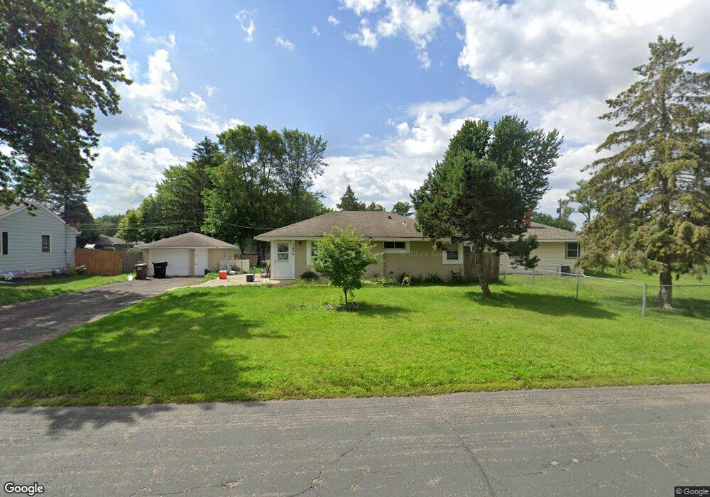
1452 Sherren Ave E Saint Paul, MN 55109
Sherwood Glen NeighborhoodEstimated Value: $296,000 - $347,000
4
Beds
2
Baths
1,768
Sq Ft
$178/Sq Ft
Est. Value
About This Home
This home is located at 1452 Sherren Ave E, Saint Paul, MN 55109 and is currently estimated at $314,471, approximately $177 per square foot. 1452 Sherren Ave E is a home located in Ramsey County with nearby schools including Weaver Elementary School, John Glenn Middle School, and Presentation Of Mary School.
Ownership History
Date
Name
Owned For
Owner Type
Purchase Details
Closed on
Nov 17, 2019
Sold by
Berrisford William Herbert and Berrisford Jeanne Elizabeth
Bought by
Vang Pa and Lee Kou
Current Estimated Value
Home Financials for this Owner
Home Financials are based on the most recent Mortgage that was taken out on this home.
Original Mortgage
$238,598
Outstanding Balance
$209,988
Interest Rate
3.62%
Mortgage Type
FHA
Estimated Equity
$104,483
Create a Home Valuation Report for This Property
The Home Valuation Report is an in-depth analysis detailing your home's value as well as a comparison with similar homes in the area
Home Values in the Area
Average Home Value in this Area
Purchase History
| Date | Buyer | Sale Price | Title Company |
|---|---|---|---|
| Vang Pa | $243,000 | Multiple |
Source: Public Records
Mortgage History
| Date | Status | Borrower | Loan Amount |
|---|---|---|---|
| Open | Vang Pa | $238,598 |
Source: Public Records
Tax History
| Year | Tax Paid | Tax Assessment Tax Assessment Total Assessment is a certain percentage of the fair market value that is determined by local assessors to be the total taxable value of land and additions on the property. | Land | Improvement |
|---|---|---|---|---|
| 2025 | $3,682 | $302,800 | $58,200 | $244,600 |
| 2023 | $3,682 | $269,500 | $58,200 | $211,300 |
| 2022 | $3,422 | $265,300 | $58,200 | $207,100 |
| 2021 | $2,946 | $241,200 | $58,200 | $183,000 |
| 2020 | $2,712 | $215,900 | $58,200 | $157,700 |
| 2019 | $2,502 | $189,200 | $58,200 | $131,000 |
| 2018 | $2,376 | $179,100 | $58,200 | $120,900 |
| 2017 | $2,268 | $167,600 | $58,200 | $109,400 |
| 2016 | $1,862 | $0 | $0 | $0 |
| 2015 | $1,726 | $133,400 | $53,400 | $80,000 |
| 2014 | $1,554 | $0 | $0 | $0 |
Source: Public Records
Map
Nearby Homes
- 1461 Grandview Ave E
- 1579 Grandview Ave E
- 1481 Sextant Ave E
- 2125 Hazelwood St
- 1290 Belmont Ln E
- 1200 Leland Rd E
- 2022 English St
- 1984 Prosperity Rd
- 2615 Flandrau St
- 1894 Maryknoll Ave N
- 1855 Birmingham St
- 2190 German St
- 1995 11th Ave E Unit 2
- 1995 11th Ave E Unit 1
- 1764 English St
- 1800 Edward St
- 1083 Gordon Ave
- 1873 Kohlman Ave
- 2445 Crestwood Dr
- 1745 Duluth St
- 1444 Sherren Ave E
- 1460 Sherren Ave E
- 1451 Cope Ave E
- 1443 Cope Ave E
- 1459 Cope Ave E
- 1466 Sherren Ave E
- 1453 Sherren Ave E
- 1445 Sherren Ave E
- 1465 Cope Ave E
- 1461 Sherren Ave E
- 1474 Sherren Ave E
- 1439 Sherren Ave E
- 1467 Sherren Ave E
- 2297 Barclay St
- 2305 Barclay St
- 1473 Cope Ave E
- 1431 Cope Ave E
- 2315 Barclay St
- 1475 Sherren Ave E
- 1458 Cope Ave E
Your Personal Tour Guide
Ask me questions while you tour the home.