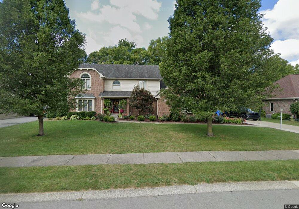
1453 Queensborough D Carmel, IN 46033
East Carmel NeighborhoodEstimated Value: $506,000 - $596,984
4
Beds
4
Baths
6,363
Sq Ft
$86/Sq Ft
Est. Value
About This Home
This home is located at 1453 Queensborough D, Carmel, IN 46033 and is currently estimated at $549,996, approximately $86 per square foot. 1453 Queensborough D is a home located in Hamilton County with nearby schools including Cherry Tree Elementary School, Clay Middle School, and Carmel High School.
Ownership History
Date
Name
Owned For
Owner Type
Purchase Details
Closed on
Apr 23, 2008
Sold by
Scanlan Patrick Q and Scanlan Kathy L
Bought by
Powell Kimberly J
Current Estimated Value
Home Financials for this Owner
Home Financials are based on the most recent Mortgage that was taken out on this home.
Original Mortgage
$174,320
Outstanding Balance
$107,706
Interest Rate
5.93%
Mortgage Type
Purchase Money Mortgage
Estimated Equity
$442,290
Create a Home Valuation Report for This Property
The Home Valuation Report is an in-depth analysis detailing your home's value as well as a comparison with similar homes in the area
Home Values in the Area
Average Home Value in this Area
Purchase History
| Date | Buyer | Sale Price | Title Company |
|---|---|---|---|
| Powell Kimberly J | -- | Title Services |
Source: Public Records
Mortgage History
| Date | Status | Borrower | Loan Amount |
|---|---|---|---|
| Open | Powell Kimberly J | $174,320 |
Source: Public Records
Tax History
| Year | Tax Paid | Tax Assessment Tax Assessment Total Assessment is a certain percentage of the fair market value that is determined by local assessors to be the total taxable value of land and additions on the property. | Land | Improvement |
|---|---|---|---|---|
| 2025 | $5,354 | $517,300 | $170,400 | $346,900 |
| 2024 | $4,414 | $476,800 | $170,400 | $306,400 |
| 2023 | $4,414 | $412,900 | $106,500 | $306,400 |
| 2022 | $3,896 | $343,100 | $106,500 | $236,600 |
| 2021 | $3,647 | $323,900 | $106,500 | $217,400 |
| 2020 | $3,440 | $304,500 | $106,500 | $198,000 |
| 2019 | $2,516 | $233,400 | $62,700 | $170,700 |
| 2018 | $2,493 | $233,400 | $62,700 | $170,700 |
| 2017 | $2,304 | $219,700 | $62,700 | $157,000 |
| 2016 | $2,326 | $219,700 | $62,700 | $157,000 |
| 2014 | $1,961 | $203,800 | $57,400 | $146,400 |
| 2013 | $1,961 | $195,100 | $57,400 | $137,700 |
Source: Public Records
Map
Nearby Homes
- 1490 Warwick Ct
- 4314 Worchester Ct
- 1260 Driftwood Dr
- 14340 Sydney Ln
- 14311 Devonport Dr
- 3030 E Village Park Cir
- 13727 Smokey Ridge Overlook
- 727 Johnson Dr
- 3122 E Village Park North Dr
- 2945 Millgate Dr
- 329 4th Ct E
- 4030 Birkdale Dr
- 2645 Faust Ct
- 4904 Deer Ridge Dr S
- 14476 Dublin Dr
- 5450 Woodfield Way
- 15103 Grassy Creek Ct
- 4967 Deer Ridge Dr N
- 16405 Carey Rd
- 14910 Oak Rd
- 1453 Queensborough Dr
- 1449 Queensborough Dr
- 1457 Queensborough Dr
- 14433 Hawthorne Dr
- 14471 Hawthorne Dr
- 1445 Queensborough D
- 1445 Queensborough Dr
- 1450 Queensborough Dr
- 14407 Hawthorne Dr
- 1446 Queensborough Dr
- 1460 Queensborough Dr
- 14495 Hawthorne Dr
- 1441 Queensborough Dr
- 1442 Queensborough Dr
- 14375 Hawthorne Dr
- 1463 Queensborough Dr
- 3598 Foster Ridge Ln
- 1469 Woodgate Cir
- 1468 Queensborough Dr
- 1438 Queensborough Dr
Your Personal Tour Guide
Ask me questions while you tour the home.