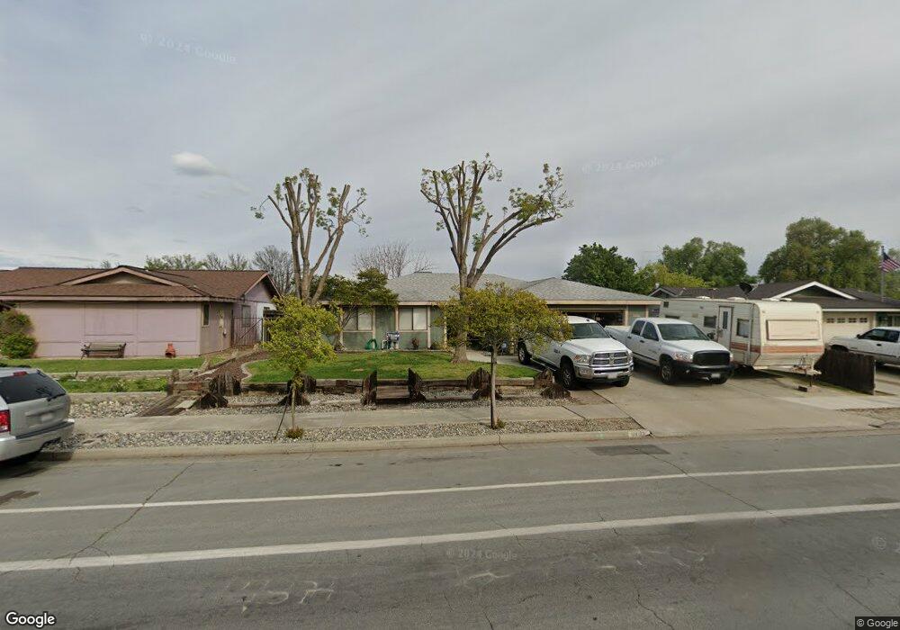
1453 University Ave Hanford, CA 93230
Estimated Value: $327,000 - $342,000
3
Beds
2
Baths
1,483
Sq Ft
$226/Sq Ft
Est. Value
About This Home
This home is located at 1453 University Ave, Hanford, CA 93230 and is currently estimated at $335,021, approximately $225 per square foot. 1453 University Ave is a home located in Kings County with nearby schools including Joseph M. Simas, Woodrow Wilson Junior High School, and Hanford West High School.
Ownership History
Date
Name
Owned For
Owner Type
Purchase Details
Closed on
Dec 16, 2004
Sold by
Brooks Maria Alice
Bought by
Brooks Daniel Brian
Current Estimated Value
Home Financials for this Owner
Home Financials are based on the most recent Mortgage that was taken out on this home.
Original Mortgage
$130,000
Outstanding Balance
$71,153
Interest Rate
7.15%
Mortgage Type
New Conventional
Estimated Equity
$263,868
Purchase Details
Closed on
Oct 13, 1996
Sold by
Gong James L
Bought by
Brooks Daniel Brian and Brooks Maria Alice
Home Financials for this Owner
Home Financials are based on the most recent Mortgage that was taken out on this home.
Original Mortgage
$89,632
Interest Rate
7.86%
Mortgage Type
FHA
Create a Home Valuation Report for This Property
The Home Valuation Report is an in-depth analysis detailing your home's value as well as a comparison with similar homes in the area
Home Values in the Area
Average Home Value in this Area
Purchase History
| Date | Buyer | Sale Price | Title Company |
|---|---|---|---|
| Brooks Daniel Brian | -- | North American Title Company | |
| Brooks Daniel Brian | $90,000 | Central Title Company |
Source: Public Records
Mortgage History
| Date | Status | Borrower | Loan Amount |
|---|---|---|---|
| Open | Brooks Daniel Brian | $130,000 | |
| Previous Owner | Brooks Daniel Brian | $89,632 |
Source: Public Records
Tax History Compared to Growth
Tax History
| Year | Tax Paid | Tax Assessment Tax Assessment Total Assessment is a certain percentage of the fair market value that is determined by local assessors to be the total taxable value of land and additions on the property. | Land | Improvement |
|---|---|---|---|---|
| 2025 | $1,480 | $146,583 | $48,860 | $97,723 |
| 2023 | $1,480 | $140,892 | $46,963 | $93,929 |
| 2022 | $1,446 | $138,131 | $46,043 | $92,088 |
| 2021 | $1,414 | $135,424 | $45,141 | $90,283 |
| 2020 | $1,428 | $134,035 | $44,678 | $89,357 |
| 2019 | $1,402 | $131,407 | $43,802 | $87,605 |
| 2018 | $1,360 | $128,830 | $42,943 | $85,887 |
| 2017 | $1,338 | $126,304 | $42,101 | $84,203 |
| 2016 | $1,319 | $123,827 | $41,275 | $82,552 |
| 2015 | $1,310 | $121,967 | $40,655 | $81,312 |
| 2014 | $1,283 | $119,578 | $39,859 | $79,719 |
Source: Public Records
Map
Nearby Homes
- 1389 Cornell Place
- 1255 W Grangeville Blvd Unit 1
- 1255 W Grangeville Blvd
- 1255 W Grangeville Blvd Unit 75
- #1 W Grangeville Blvd
- 1209 W Water St
- 1200 Oxford Way
- 1255 Fitzgerald Ln
- 1585 Fitzgerald Ln
- 1348 Greenfield Ave
- 1152 W Grangeville Blvd
- 1769 N Jennie Lake
- 2035 W Chianti Way
- 1401 N Richmond Ave
- 1093 Raymond Rd
- 1684 W Berkshire Ln
- 1932 W Hayward St
- 1475 University Ave
- 1401 University Ave
- 1497 University Ave
- 1402 University Ave
- 1355 Cornell Place
- 1509 University Ave
- 1347 W Malone St
- 1356 W Malone St
- 1367 Cornell Place
- 1339 W Malone St
- 1398 University Ave
- 1525 University Ave
- 1374 W Malone St
- 1354 Cornell Place
- 1373 Cornell Place
- 1367 W Malone St
- 1321 University Ave
- 1362 Cornell Place
- 1547 University Ave
- 1338 Harvard Place