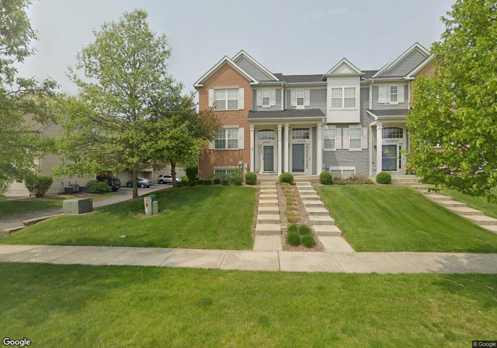
14530 Samuel Adams Dr Plainfield, IL 60544
West Plainfield NeighborhoodEstimated Value: $312,000 - $324,000
2
Beds
3
Baths
1,495
Sq Ft
$213/Sq Ft
Est. Value
About This Home
This home is located at 14530 Samuel Adams Dr, Plainfield, IL 60544 and is currently estimated at $318,060, approximately $212 per square foot. 14530 Samuel Adams Dr is a home located in Will County with nearby schools including Richard Ira Jones Middle School, Plainfield North High School, and St Mary Immaculate Parish School.
Ownership History
Date
Name
Owned For
Owner Type
Purchase Details
Closed on
Aug 8, 2005
Sold by
Drh Cambridge Homes Inc
Bought by
Wroble Douglas P and Brodmerkel James P
Current Estimated Value
Home Financials for this Owner
Home Financials are based on the most recent Mortgage that was taken out on this home.
Original Mortgage
$212,850
Outstanding Balance
$111,813
Interest Rate
5.66%
Mortgage Type
Fannie Mae Freddie Mac
Estimated Equity
$206,247
Create a Home Valuation Report for This Property
The Home Valuation Report is an in-depth analysis detailing your home's value as well as a comparison with similar homes in the area
Home Values in the Area
Average Home Value in this Area
Purchase History
| Date | Buyer | Sale Price | Title Company |
|---|---|---|---|
| Wroble Douglas P | $224,500 | First American |
Source: Public Records
Mortgage History
| Date | Status | Borrower | Loan Amount |
|---|---|---|---|
| Open | Wroble Douglas P | $212,850 |
Source: Public Records
Tax History Compared to Growth
Tax History
| Year | Tax Paid | Tax Assessment Tax Assessment Total Assessment is a certain percentage of the fair market value that is determined by local assessors to be the total taxable value of land and additions on the property. | Land | Improvement |
|---|---|---|---|---|
| 2024 | $5,811 | $86,822 | $9,069 | $77,753 |
| 2023 | $5,811 | $78,416 | $8,191 | $70,225 |
| 2022 | $5,536 | $73,782 | $7,707 | $66,075 |
| 2021 | $5,183 | $68,955 | $7,203 | $61,752 |
| 2020 | $5,529 | $72,085 | $6,999 | $65,086 |
| 2019 | $5,324 | $68,685 | $6,669 | $62,016 |
| 2018 | $5,074 | $64,533 | $6,266 | $58,267 |
| 2017 | $4,906 | $61,326 | $5,955 | $55,371 |
| 2016 | $4,775 | $58,490 | $5,680 | $52,810 |
| 2015 | $4,437 | $54,792 | $5,321 | $49,471 |
| 2014 | $4,437 | $52,857 | $5,133 | $47,724 |
| 2013 | $4,437 | $52,857 | $5,133 | $47,724 |
Source: Public Records
Map
Nearby Homes
- 24622 George Washington Dr
- 14829 S Henebry Ln
- 14840 S Henebry Ln
- 14909 S Mccarthy Cir
- 25531 W Sandalwood Dr
- 14950 S Darr Dr
- 14952 S Dyer Ln
- 14961 S Darr Dr
- 14905 S Mccarthy Cir
- 14954 S Dyer Ln
- 14944 S Dyer Ln
- 14930 S Parkview Dr
- 14924 S Parkview Dr
- 14949 S Darr Dr
- 14942 S Dyer Ln
- 14946 S Dyer Ln
- 14925 S Parkview Dr
- 14936 S Parkview Dr
- 14942 S Parkview Dr
- 14904 S Mc Carthy Cir
- 14526 Samuel Adams Dr
- 14522 Samuel Adams Dr
- 14518 Samuel Adams Dr
- 14518 Samuel Adams Dr Unit 1451
- 24624 John Adams Dr
- 24628 John Adams Dr
- 24632 John Adams Dr
- 24632 John Adams Dr Unit 1
- 24636 John Adams Dr
- 14531 Patriot Square Dr E
- 14527 Patriot Square Dr E
- 14514 Samuel Adams Dr
- 24640 John Adams Dr
- 24640 John Adams Dr Unit 2464
- 14523 Patriot Square Dr E
- 14519 Patriot Square Dr E
- 24644 John Adams Dr
- 14510 Samuel Adams Dr
- 14515 Patriot Square Dr E
- 14506 Samuel Adams Dr