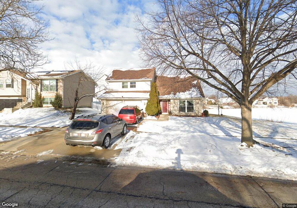
1455 Brookside Dr Hoffman Estates, IL 60169
South Hoffman Estates NeighborhoodEstimated Value: $375,000 - $479,000
4
Beds
3
Baths
2,006
Sq Ft
$212/Sq Ft
Est. Value
About This Home
This home is located at 1455 Brookside Dr, Hoffman Estates, IL 60169 and is currently estimated at $424,580, approximately $211 per square foot. 1455 Brookside Dr is a home located in Cook County with nearby schools including Neil Armstrong Elementary School, Dwight D Eisenhower Junior High School, and Hoffman Estates High School.
Ownership History
Date
Name
Owned For
Owner Type
Purchase Details
Closed on
Nov 7, 1996
Sold by
Cabell Edward L and Cabell Loretta E
Bought by
Kazakos Christos G and Kazakos Constantina
Current Estimated Value
Home Financials for this Owner
Home Financials are based on the most recent Mortgage that was taken out on this home.
Original Mortgage
$117,750
Outstanding Balance
$10,069
Interest Rate
9.12%
Estimated Equity
$414,511
Purchase Details
Closed on
Nov 24, 1993
Sold by
Cabell Edward L and Cabell Loretta E
Bought by
Cabell Edward L and Cabell Loretta E
Home Financials for this Owner
Home Financials are based on the most recent Mortgage that was taken out on this home.
Original Mortgage
$63,000
Interest Rate
6.95%
Create a Home Valuation Report for This Property
The Home Valuation Report is an in-depth analysis detailing your home's value as well as a comparison with similar homes in the area
Home Values in the Area
Average Home Value in this Area
Purchase History
| Date | Buyer | Sale Price | Title Company |
|---|---|---|---|
| Kazakos Christos G | $157,000 | -- | |
| Cabell Edward L | -- | -- |
Source: Public Records
Mortgage History
| Date | Status | Borrower | Loan Amount |
|---|---|---|---|
| Open | Kazakos Christos G | $117,750 | |
| Previous Owner | Cabell Edward L | $63,000 |
Source: Public Records
Tax History
| Year | Tax Paid | Tax Assessment Tax Assessment Total Assessment is a certain percentage of the fair market value that is determined by local assessors to be the total taxable value of land and additions on the property. | Land | Improvement |
|---|---|---|---|---|
| 2025 | $7,989 | $42,000 | $7,829 | $34,171 |
| 2024 | $7,989 | $32,000 | $7,117 | $24,883 |
| 2023 | $7,675 | $32,000 | $7,117 | $24,883 |
| 2022 | $7,675 | $32,000 | $7,117 | $24,883 |
| 2021 | $8,799 | $32,256 | $11,209 | $21,047 |
| 2020 | $8,727 | $32,256 | $11,209 | $21,047 |
| 2019 | $8,686 | $35,840 | $11,209 | $24,631 |
| 2018 | $7,418 | $26,183 | $9,785 | $16,398 |
| 2017 | $7,305 | $26,183 | $9,785 | $16,398 |
| 2016 | $7,057 | $26,183 | $9,785 | $16,398 |
| 2015 | $7,240 | $25,166 | $8,540 | $16,626 |
| 2014 | $7,130 | $25,166 | $8,540 | $16,626 |
| 2013 | $6,929 | $25,166 | $8,540 | $16,626 |
Source: Public Records
Map
Nearby Homes
- 1587 Brookside Dr
- 1880 Bonnie Ln Unit 416
- 1880 Bonnie Ln Unit 112
- 2222 Seaver Ln
- 1659 Islandview Ct
- 1792 Williamsburg Dr
- 1975 Windsong Dr Unit 333E1
- 1769 Sessions Walk Unit C
- 1724 Fayette Walk Unit J
- 1026 Denham Place Unit 1
- 1712 Fayette Walk Unit D
- 1708 Southbridge Ct
- 1933 Williamsburg Dr Unit 1
- 1103 Southbridge Ln
- 1975 Leiter Way Unit 12002
- 1982 Leiter Way Unit 13004
- 1985 Leiter Way Unit 1102
- 1988 Leiter Way Unit 13001
- 1979 Leiter Way Unit 12004
- 1981 Leiter Way Unit 12005
- 1465 Brookside Dr
- 1995 Brookside Ln
- 1475 Brookside Dr
- 1985 Brookside Ln
- 1460 Brookside Dr
- 1470 Brookside Dr
- 1975 Brookside Ln
- 1440 Brookside Dr
- 1500 Brookside Dr
- 2040 Greens Ct
- 1474 Brookside Dr
- 2000 Brookside Ln
- 1990 Brookside Ln Unit 4
- 2030 Greens Ct
- 1965 Brookside Ln
- 2050 Greens Ct
- 1510 Brookside Dr
- 1478 Brookside Dr
- 1490 Brookside Dr
- 1955 Brookside Ln Unit 4
Your Personal Tour Guide
Ask me questions while you tour the home.