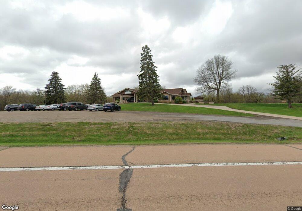
1455 County Road 27 Watertown, MN 55388
Estimated Value: $1,945,089
--
Bed
--
Bath
5,370
Sq Ft
$362/Sq Ft
Est. Value
About This Home
This home is located at 1455 County Road 27, Watertown, MN 55388 and is currently estimated at $1,945,089, approximately $362 per square foot. 1455 County Road 27 is a home located in Carver County with nearby schools including Watertown-Mayer Elementary School, Watertown-Mayer Middle School, and Watertown Mayer High School.
Ownership History
Date
Name
Owned For
Owner Type
Purchase Details
Closed on
Aug 14, 2007
Sold by
Mikes Rivers Edge Llc
Bought by
Byrans Golf & Dining Llc
Current Estimated Value
Home Financials for this Owner
Home Financials are based on the most recent Mortgage that was taken out on this home.
Original Mortgage
$600,000
Interest Rate
6.79%
Mortgage Type
Commercial
Purchase Details
Closed on
Oct 17, 2003
Sold by
Rivers Edge County Club Inc
Bought by
Golf Cliff Llc and Mikes Rivers Edge Llc
Create a Home Valuation Report for This Property
The Home Valuation Report is an in-depth analysis detailing your home's value as well as a comparison with similar homes in the area
Home Values in the Area
Average Home Value in this Area
Purchase History
| Date | Buyer | Sale Price | Title Company |
|---|---|---|---|
| Byrans Golf & Dining Llc | $559,000 | -- | |
| Golf Cliff Llc | $1,014,000 | -- |
Source: Public Records
Mortgage History
| Date | Status | Borrower | Loan Amount |
|---|---|---|---|
| Closed | Byrans Golf & Dining Llc | $600,000 |
Source: Public Records
Tax History Compared to Growth
Tax History
| Year | Tax Paid | Tax Assessment Tax Assessment Total Assessment is a certain percentage of the fair market value that is determined by local assessors to be the total taxable value of land and additions on the property. | Land | Improvement |
|---|---|---|---|---|
| 2025 | $11,640 | $683,400 | $423,900 | $259,500 |
| 2024 | $10,976 | $684,300 | $423,900 | $260,400 |
| 2023 | $10,414 | $677,700 | $423,900 | $253,800 |
| 2022 | $11,634 | $374,600 | $374,600 | $0 |
| 2021 | $13,036 | $374,600 | $374,600 | $0 |
| 2020 | $13,892 | $348,400 | $348,400 | $0 |
| 2019 | $14,042 | $348,400 | $348,400 | $0 |
| 2018 | $14,724 | $664,600 | $397,700 | $266,900 |
| 2017 | $18,042 | $682,000 | $0 | $0 |
| 2016 | $18,290 | $730,100 | $0 | $0 |
| 2015 | $19,850 | $745,900 | $0 | $0 |
| 2014 | $19,850 | $739,100 | $0 | $0 |
Source: Public Records
Map
Nearby Homes
- 600 Paul Ave
- 160 Wildwood Cir Unit 160
- 823 Poplar Ln
- 85 Riverside Terrace Dr Unit 85
- 120 Riverside Terrace Dr Unit 102
- The Calhoun Plan at Forest Hills
- The Rockwell Plan at Forest Hills
- The Stratford Plan at Forest Hills
- The Springfield Plan at Forest Hills
- The Wentworth Plan at Forest Hills
- The Arlington Plan at Forest Hills
- The Linden II Plan at Forest Hills
- The Meadow Plan at Forest Hills
- The Poplar II Plan at Forest Hills
- The Summit Plan at Forest Hills
- The Birch Plan at Forest Hills
- The Everest Plan at Forest Hills
- The Willow Plan at Forest Hills
- The Hickory Plan at Forest Hills
- The Afton Plan at Forest Hills
- 845 Mill Ave
- xxxx Mill Avenue Ne & Ironwood Ave
- xxx NE Mill Ave
- 1725 Mill Ave N
- 829 Mill Ave
- 1485 County Road 27
- 979 Hickory Curve
- 985 Hickory Curve
- 815 Mill Ave
- 971 Hickory Curve
- 11899 County Road 16 SE
- 11744 Dalton Ave SE
- 965 Hickory Curve
- 959 Hickory Curve
- 949 Hickory Curve
- 1725 Mill Ave
- 11988 11988 Dalton-Avenue-se
- 972 Hickory Curve
- 982 Hickory Curve
- 990 Hickory Curve