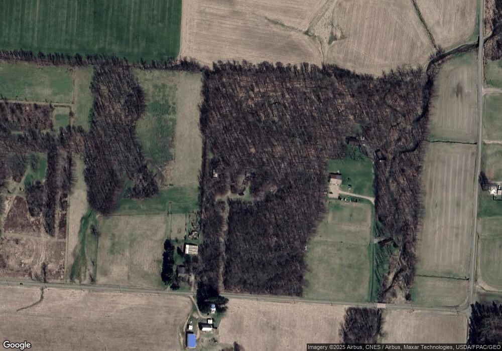
14583 Gilchrist Rd Mount Vernon, OH 43050
Estimated Value: $256,000 - $439,265
2
Beds
1
Bath
1,225
Sq Ft
$248/Sq Ft
Est. Value
About This Home
This home is located at 14583 Gilchrist Rd, Mount Vernon, OH 43050 and is currently estimated at $303,316, approximately $247 per square foot. 14583 Gilchrist Rd is a home with nearby schools including Mount Vernon High School.
Ownership History
Date
Name
Owned For
Owner Type
Purchase Details
Closed on
Jul 12, 2024
Sold by
Umphries John H and Deboard Revocable Living Trust
Bought by
Hart Phyllis D and Hart Freddie A
Current Estimated Value
Home Financials for this Owner
Home Financials are based on the most recent Mortgage that was taken out on this home.
Original Mortgage
$220,000
Outstanding Balance
$209,369
Interest Rate
6.36%
Mortgage Type
New Conventional
Estimated Equity
$93,947
Purchase Details
Closed on
Nov 21, 2005
Sold by
Deboard James R and Deborah Jennifer K
Bought by
Deborah James R and Deborah Jennifer K
Create a Home Valuation Report for This Property
The Home Valuation Report is an in-depth analysis detailing your home's value as well as a comparison with similar homes in the area
Home Values in the Area
Average Home Value in this Area
Purchase History
| Date | Buyer | Sale Price | Title Company |
|---|---|---|---|
| Hart Phyllis D | -- | None Listed On Document | |
| Deborah James R | -- | None Available |
Source: Public Records
Mortgage History
| Date | Status | Borrower | Loan Amount |
|---|---|---|---|
| Open | Hart Phyllis D | $220,000 |
Source: Public Records
Tax History Compared to Growth
Tax History
| Year | Tax Paid | Tax Assessment Tax Assessment Total Assessment is a certain percentage of the fair market value that is determined by local assessors to be the total taxable value of land and additions on the property. | Land | Improvement |
|---|---|---|---|---|
| 2024 | $3,930 | $90,500 | $55,790 | $34,710 |
| 2023 | $3,930 | $91,120 | $56,410 | $34,710 |
| 2022 | $2,525 | $62,850 | $38,910 | $23,940 |
| 2021 | $2,525 | $62,850 | $38,910 | $23,940 |
| 2020 | $2,464 | $62,850 | $38,910 | $23,940 |
| 2019 | $2,233 | $54,260 | $30,830 | $23,430 |
| 2018 | $2,235 | $54,260 | $30,830 | $23,430 |
| 2017 | $2,200 | $54,260 | $30,830 | $23,430 |
| 2016 | $1,871 | $47,180 | $26,810 | $20,370 |
| 2015 | $1,879 | $47,180 | $26,810 | $20,370 |
| 2014 | $1,887 | $47,180 | $26,810 | $20,370 |
| 2013 | $2,099 | $50,270 | $26,810 | $23,460 |
Source: Public Records
Map
Nearby Homes
- 0 Monroe Mills Rd
- 15014 Monroe Mills Rd
- 0 Greenlawn Dr Unit 225012211
- 0 Greenlawn Dr Unit 20250232
- 0 Berry Rd Unit 225024403
- 0 Berry Rd Unit 9067495
- 0 Berry Rd
- 843 Country Club Dr
- 847 Fairway Dr
- 15066 Monroe Mills Rd
- 14021 Gilchrist Rd
- 1709 Apple Valley Dr
- 15770 Pleasant View Rd
- 17970 Scott Rd
- 629 Mcintosh Dr
- 2028 Apple Valley Dr
- 43 Hawkeye Ct
- 2536 Apple Valley Dr
- 2536 Apple Valley Dr Unit Lot 298
- 2100 Apple Valley Dr Unit Lot 63
- 14669 Gilchrist Rd
- 14790 Gilchrist Rd
- 14479 Gilchrist Rd
- 14568 Obrien Rd
- 14568 O'Brien Rd
- 14538 Obrien Rd
- 14640 O'Brien Rd
- 14640 Obrien Rd
- 14640 Obrien Rd
- 14429 Gilchrist Rd
- 20467 Harding Rd
- 14280 Vincent Rd
- 14318 Vincent Rd
- 13901 Vincent Rd
- 13901 Vincet Rd
- 14801 Obrien Rd
- 14100 Vincent Rd
- 13887 Vincent Rd
- 14892 O'Brien Rd
- 20653 Harding Rd
