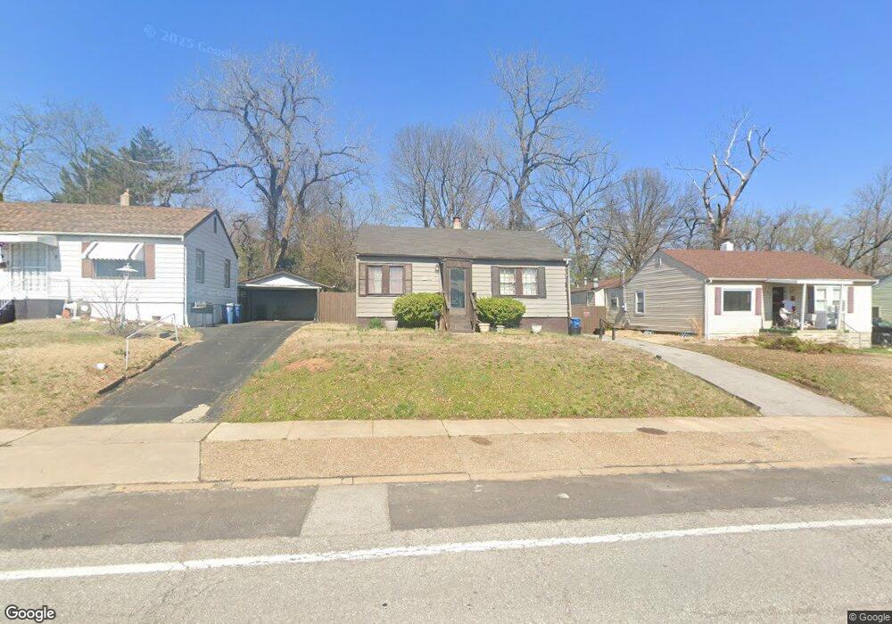
1459 Ferguson Ave Saint Louis, MO 63133
Estimated Value: $66,029 - $88,000
2
Beds
1
Bath
768
Sq Ft
$102/Sq Ft
Est. Value
About This Home
This home is located at 1459 Ferguson Ave, Saint Louis, MO 63133 and is currently estimated at $78,257, approximately $101 per square foot. 1459 Ferguson Ave is a home located in St. Louis County with nearby schools including Normandy High School, The Leadership School, and Christ The King Catholic School.
Ownership History
Date
Name
Owned For
Owner Type
Purchase Details
Closed on
Jul 18, 2005
Sold by
Middlewest Properties Inc
Bought by
Moore Brenda J
Current Estimated Value
Home Financials for this Owner
Home Financials are based on the most recent Mortgage that was taken out on this home.
Original Mortgage
$41,920
Outstanding Balance
$21,812
Interest Rate
5.61%
Mortgage Type
Seller Take Back
Estimated Equity
$56,445
Purchase Details
Closed on
May 12, 2005
Sold by
Dowd Woodrow T and Moore Sharon
Bought by
Middlewest Properties Inc
Create a Home Valuation Report for This Property
The Home Valuation Report is an in-depth analysis detailing your home's value as well as a comparison with similar homes in the area
Home Values in the Area
Average Home Value in this Area
Purchase History
| Date | Buyer | Sale Price | Title Company |
|---|---|---|---|
| Moore Brenda J | $44,400 | -- | |
| Middlewest Properties Inc | $29,000 | -- |
Source: Public Records
Mortgage History
| Date | Status | Borrower | Loan Amount |
|---|---|---|---|
| Open | Moore Brenda J | $41,920 |
Source: Public Records
Tax History Compared to Growth
Tax History
| Year | Tax Paid | Tax Assessment Tax Assessment Total Assessment is a certain percentage of the fair market value that is determined by local assessors to be the total taxable value of land and additions on the property. | Land | Improvement |
|---|---|---|---|---|
| 2025 | $741 | $14,180 | $2,190 | $11,990 |
| 2024 | $741 | $7,870 | $360 | $7,510 |
| 2023 | $741 | $7,870 | $360 | $7,510 |
| 2022 | $672 | $5,760 | $1,100 | $4,660 |
| 2021 | $645 | $5,760 | $1,100 | $4,660 |
| 2020 | $582 | $4,770 | $800 | $3,970 |
| 2019 | $573 | $4,770 | $800 | $3,970 |
| 2018 | $785 | $6,200 | $860 | $5,340 |
| 2017 | $789 | $6,200 | $860 | $5,340 |
| 2016 | $786 | $5,950 | $1,200 | $4,750 |
| 2015 | $763 | $5,950 | $1,200 | $4,750 |
| 2014 | $902 | $7,100 | $1,270 | $5,830 |
Source: Public Records
Map
Nearby Homes
- 1487 Engelholm Ave
- 7322 Doncaster Dr
- 7337 Doncaster Dr
- 1468 70th St
- 7348 Grand Dr
- 7356 Park Dr
- 1541 Salerno Dr
- 7231 Teal Ave
- 6732 Robbins Ave
- 6996 Robbins Ave
- 1901 Owen Dr
- 7422 Leadale Dr
- 7525 Cory Place
- 1209 Griefield Place
- 7032 Canton Ave
- 2000 Falcon Dr
- 6821 Primrose Ave
- 1944 Falcon Dr
- 1207 Buckner Place
- 2018 Raven Dr
- 1461 Ferguson Ave
- 1457 Ferguson Ave
- 1455 Ferguson Ave
- 1463 Ferguson Ave
- 1404 Leroy Ave
- 1408 Leroy Ave
- 1465 Ferguson Ave
- 1400 Leroy Ave
- 1412 Leroy Ave
- 1456 Ferguson Ave
- 1454 Ferguson Ave
- 1458 Ferguson Ave
- 1452 Ferguson Ave
- 1460 Ferguson Ave
- 1450 Ferguson Ave
- 1467 Ferguson Ave
- 1462 Ferguson Ave
- 1469 Ferguson Ave
- 1426 Leroy Ave
- 1466 Ferguson Ave