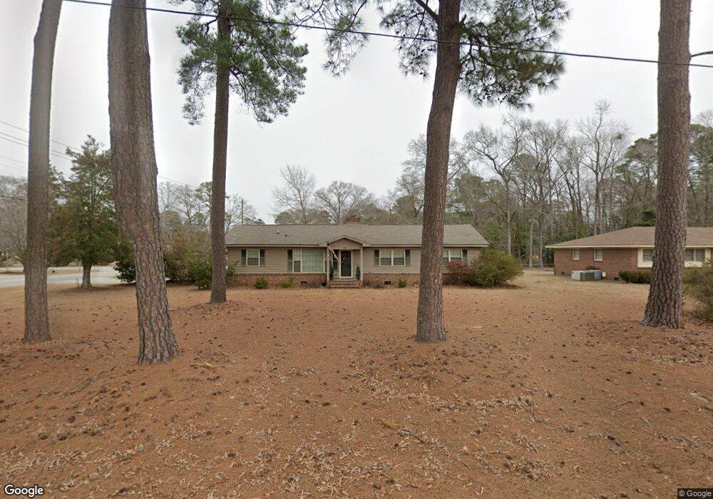
1459 Westmoreland Ave Florence, SC 29505
Estimated Value: $193,000 - $215,523
3
Beds
2
Baths
1,808
Sq Ft
$114/Sq Ft
Est. Value
About This Home
This home is located at 1459 Westmoreland Ave, Florence, SC 29505 and is currently estimated at $205,381, approximately $113 per square foot. 1459 Westmoreland Ave is a home located in Florence County with nearby schools including McLaurin Elementary School, Henry L. Sneed Middle School, and John W. Moore Middle School.
Ownership History
Date
Name
Owned For
Owner Type
Purchase Details
Closed on
Oct 18, 2023
Sold by
Terry Stanley O and Terry Donia G
Bought by
Terry Properties Of Florence Llc
Current Estimated Value
Purchase Details
Closed on
Aug 29, 2008
Sold by
Ross John
Bought by
Terry Stanley O and Terry Donia G
Home Financials for this Owner
Home Financials are based on the most recent Mortgage that was taken out on this home.
Original Mortgage
$88,800
Interest Rate
6.61%
Mortgage Type
Purchase Money Mortgage
Create a Home Valuation Report for This Property
The Home Valuation Report is an in-depth analysis detailing your home's value as well as a comparison with similar homes in the area
Home Values in the Area
Average Home Value in this Area
Purchase History
| Date | Buyer | Sale Price | Title Company |
|---|---|---|---|
| Terry Properties Of Florence Llc | -- | None Listed On Document | |
| Terry Stanley O | $111,000 | -- |
Source: Public Records
Mortgage History
| Date | Status | Borrower | Loan Amount |
|---|---|---|---|
| Previous Owner | Terry Stanley O | $88,800 |
Source: Public Records
Tax History Compared to Growth
Tax History
| Year | Tax Paid | Tax Assessment Tax Assessment Total Assessment is a certain percentage of the fair market value that is determined by local assessors to be the total taxable value of land and additions on the property. | Land | Improvement |
|---|---|---|---|---|
| 2024 | $3,147 | $6,003 | $800 | $5,203 |
| 2023 | $2,344 | $4,379 | $800 | $3,579 |
| 2022 | $2,369 | $4,379 | $800 | $3,579 |
| 2021 | $2,418 | $6,570 | $0 | $0 |
| 2020 | $2,313 | $6,570 | $0 | $0 |
| 2019 | $2,276 | $6,570 | $0 | $0 |
| 2018 | $2,187 | $6,570 | $0 | $0 |
| 2017 | $2,144 | $6,570 | $0 | $0 |
| 2016 | $2,100 | $6,570 | $0 | $0 |
| 2015 | $2,099 | $6,570 | $0 | $0 |
| 2014 | $2,004 | $0 | $0 | $0 |
Source: Public Records
Map
Nearby Homes
- 1801 Woods Dr
- 1770 Woods Dr
- 1779 S Saint Anthony Ave
- 1700 Woods Dr
- 1719 Furman Dr
- 1767 Marsh Ave
- 1311 Pinckney Ave
- 1768 Marsh Ave
- 1465 Gardener Rd
- 1311 Queens Ferry Rd
- 1303 Queensferry
- 1521 2nd Loop Rd
- 1809 Taylor Ct
- 1849 Sloane Ln
- 2206 Wellesly Ct
- 2211 Amberleigh Ct
- 1714 2nd Loop Rd
- 1174 Berkeley Ave
- 1175 Berkeley Ave
- 1800 Thistle Ct
- 1778 Woods Dr
- 1800 Woods Dr
- 1451 Westmoreland Ave
- 1807 Woods Dr
- 1774 Woods Dr
- 1801 Longwood Dr
- 1777 Woods Dr
- 1804 State Road S-21-600
- 1804 Woods Dr
- 1449 Westmoreland Ave
- 1811 Woods Dr
- 1800 Citadel St
- 1773 Woods Dr
- 1807 Longwood Dr
- 1804 Citadel St
- 1800 Longwood Dr
- 1808 Woods Dr
- 1815 Woods Dr
- 1766 Woods Dr
- 1769 Woods Dr