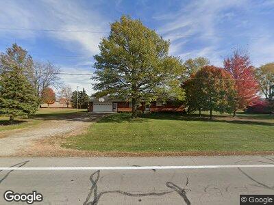
14595 State Route 127 New Weston, OH 45348
Estimated Value: $188,000 - $244,000
3
Beds
2
Baths
1,591
Sq Ft
$132/Sq Ft
Est. Value
About This Home
This home is located at 14595 State Route 127, New Weston, OH 45348 and is currently estimated at $210,264, approximately $132 per square foot. 14595 State Route 127 is a home with nearby schools including Versailles Elementary School, Versailles Middle School, and Versailles High School.
Ownership History
Date
Name
Owned For
Owner Type
Purchase Details
Closed on
Dec 23, 2009
Sold by
Huwer Marilyn C
Bought by
Huwer Marilyn C
Current Estimated Value
Home Financials for this Owner
Home Financials are based on the most recent Mortgage that was taken out on this home.
Original Mortgage
$187,500
Interest Rate
3.48%
Mortgage Type
Reverse Mortgage Home Equity Conversion Mortgage
Purchase Details
Closed on
Oct 18, 2004
Sold by
Huwer Victor
Bought by
Huwer Victor J and Huwer Marilyn C
Create a Home Valuation Report for This Property
The Home Valuation Report is an in-depth analysis detailing your home's value as well as a comparison with similar homes in the area
Home Values in the Area
Average Home Value in this Area
Purchase History
| Date | Buyer | Sale Price | Title Company |
|---|---|---|---|
| Huwer Marilyn C | -- | Attorney | |
| Huwer Victor J | -- | -- |
Source: Public Records
Mortgage History
| Date | Status | Borrower | Loan Amount |
|---|---|---|---|
| Closed | Huwer Marilyn C | $187,500 |
Source: Public Records
Tax History Compared to Growth
Tax History
| Year | Tax Paid | Tax Assessment Tax Assessment Total Assessment is a certain percentage of the fair market value that is determined by local assessors to be the total taxable value of land and additions on the property. | Land | Improvement |
|---|---|---|---|---|
| 2024 | $1,485 | $55,900 | $6,140 | $49,760 |
| 2023 | $1,508 | $55,900 | $6,140 | $49,760 |
| 2022 | $1,158 | $43,770 | $5,110 | $38,660 |
| 2021 | $1,216 | $43,770 | $5,110 | $38,660 |
| 2020 | $1,222 | $43,770 | $5,110 | $38,660 |
| 2019 | $969 | $36,800 | $5,110 | $31,690 |
| 2018 | $973 | $36,800 | $5,110 | $31,690 |
| 2017 | $720 | $36,800 | $5,110 | $31,690 |
| 2016 | $721 | $30,550 | $5,110 | $25,440 |
| 2015 | $721 | $30,550 | $5,110 | $25,440 |
| 2014 | $757 | $30,550 | $5,110 | $25,440 |
| 2013 | $819 | $30,300 | $4,860 | $25,440 |
Source: Public Records
Map
Nearby Homes
- 7430 Ohio 705
- 160 Mendenhall Rd
- 159 Mendenhall Rd
- 158 Mendenhall Rd
- 157 Mendenhall Rd
- 140 Liberty Dr
- 139 Liberty Dr
- 136 Liberty Dr
- 137 Liberty Dr
- 141 Liberty Dr
- 138 Liberty Dr
- 142 Liberty Dr
- 144 Liberty Dr
- 135 Veterans Dr
- 143 Liberty Dr
- 147 Liberty Dr
- 155 Liberty Dr
- 146 Liberty Dr
- 145 Liberty Dr
- 156 Veterans Dr
- 14595 State Route 127
- 14577 State Route 127
- 14617 State Route 127
- 14566 State Route 127
- 14627 State Route 127
- 14547 State Route 127
- 14544 State Route 127
- 14533 State Route 127
- 14660 State Route 127 Unit US
- 6458 State Route 705
- 6612 State Route 705
- 6688 State Route 705
- 14372 State Route 127
- 6704 State Route 705
- 14375 State Route 127
- 14368 State Route 127
- 6282 State Route 705
- 14358 State Route 127
- 14342 State Route 127
- 14600 Groff Rd
