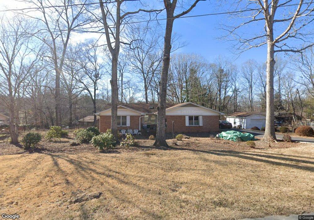
146 Atwood Dr Hendersonville, NC 28792
Estimated Value: $344,000 - $388,000
2
Beds
2
Baths
1,431
Sq Ft
$261/Sq Ft
Est. Value
About This Home
This home is located at 146 Atwood Dr, Hendersonville, NC 28792 and is currently estimated at $374,093, approximately $261 per square foot. 146 Atwood Dr is a home located in Henderson County with nearby schools including Sugarloaf Elementary School, Hendersonville Middle School, and Hendersonville High School.
Ownership History
Date
Name
Owned For
Owner Type
Purchase Details
Closed on
Aug 17, 2012
Sold by
Robinson Ray E
Bought by
Robinson William J and Robinson Karen L
Current Estimated Value
Home Financials for this Owner
Home Financials are based on the most recent Mortgage that was taken out on this home.
Original Mortgage
$120,000
Outstanding Balance
$18,401
Interest Rate
2.91%
Mortgage Type
Cash
Estimated Equity
$355,692
Create a Home Valuation Report for This Property
The Home Valuation Report is an in-depth analysis detailing your home's value as well as a comparison with similar homes in the area
Home Values in the Area
Average Home Value in this Area
Purchase History
| Date | Buyer | Sale Price | Title Company |
|---|---|---|---|
| Robinson William J | -- | -- |
Source: Public Records
Mortgage History
| Date | Status | Borrower | Loan Amount |
|---|---|---|---|
| Open | Robinson William J | $120,000 |
Source: Public Records
Tax History Compared to Growth
Tax History
| Year | Tax Paid | Tax Assessment Tax Assessment Total Assessment is a certain percentage of the fair market value that is determined by local assessors to be the total taxable value of land and additions on the property. | Land | Improvement |
|---|---|---|---|---|
| 2025 | $1,766 | $323,500 | $57,300 | $266,200 |
| 2024 | $1,766 | $323,500 | $57,300 | $266,200 |
| 2023 | $1,766 | $323,500 | $57,300 | $266,200 |
| 2022 | $1,227 | $180,200 | $28,600 | $151,600 |
| 2021 | $1,227 | $180,200 | $28,600 | $151,600 |
| 2020 | $1,227 | $180,200 | $0 | $0 |
| 2019 | $1,227 | $180,200 | $0 | $0 |
| 2018 | $1,092 | $159,400 | $0 | $0 |
| 2017 | $1,092 | $159,400 | $0 | $0 |
| 2016 | $1,092 | $159,400 | $0 | $0 |
| 2015 | -- | $159,400 | $0 | $0 |
| 2014 | -- | $153,800 | $0 | $0 |
Source: Public Records
Map
Nearby Homes
- 54 Lake Pointe Cir
- 200 Cranbrook Cir
- 300 Creekview Rd
- 201 Cranbrook Cir
- Carson Plan at The Townes at Stonecrest
- Lansing Plan at The Townes at Stonecrest
- Denver Plan at The Townes at Stonecrest
- 322 Creekview Rd
- 342 Creekview Rd
- 346 Creekview Rd
- 402 Deerfield Ct
- 350 Creekview Rd
- 354 Creekview Rd
- 362 Creekview Rd
- 302 Meadowbrook Ct
- 364 Creekview Rd
- Verwood Plan at Cantrell Hills
- Clifton Plan at Cantrell Hills
- Fleetwood Plan at Cantrell Hills
- Azalea Plan at Cantrell Hills
- 152 Atwood Dr
- 144 Atwood Dr
- 137 Greenfield Ln
- 136 Atwood Dr
- 155 Atwood Dr
- 133 Greenfield Ln
- 151 Atwood Dr
- 159 Atwood Dr
- 132 Atwood Dr
- 143 Atwood Dr
- 140 Greenfield Ln
- 129 Greenfield Ln
- 150 Greenfield Ln
- 139 Atwood Dr
- 138 Greenfield Ln
- 163 Atwood Dr
- 128 Atwood Dr
- 125 Greenfield Ln
- 134 Greenfield Ln
- 167 Atwood Dr