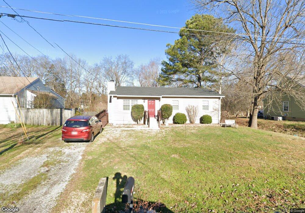
146 Brookridge Dr La Vergne, TN 37086
Estimated Value: $213,000 - $285,000
--
Bed
2
Baths
1,092
Sq Ft
$235/Sq Ft
Est. Value
About This Home
This home is located at 146 Brookridge Dr, La Vergne, TN 37086 and is currently estimated at $256,081, approximately $234 per square foot. 146 Brookridge Dr is a home located in Rutherford County with nearby schools including Rock Springs Elementary School, Rock Springs Middle School, and Stewarts Creek High School.
Ownership History
Date
Name
Owned For
Owner Type
Purchase Details
Closed on
Nov 9, 2006
Sold by
Winkelman Michele R
Bought by
Schlappi William G and Schlappi Donna
Current Estimated Value
Home Financials for this Owner
Home Financials are based on the most recent Mortgage that was taken out on this home.
Original Mortgage
$84,000
Outstanding Balance
$49,965
Interest Rate
6.31%
Estimated Equity
$206,116
Purchase Details
Closed on
Jul 26, 1996
Sold by
Smith Michael W
Bought by
Winkelman Michele R
Create a Home Valuation Report for This Property
The Home Valuation Report is an in-depth analysis detailing your home's value as well as a comparison with similar homes in the area
Home Values in the Area
Average Home Value in this Area
Purchase History
| Date | Buyer | Sale Price | Title Company |
|---|---|---|---|
| Schlappi William G | $105,000 | -- | |
| Winkelman Michele R | $74,500 | -- |
Source: Public Records
Mortgage History
| Date | Status | Borrower | Loan Amount |
|---|---|---|---|
| Open | Winkelman Michele R | $84,000 |
Source: Public Records
Tax History Compared to Growth
Tax History
| Year | Tax Paid | Tax Assessment Tax Assessment Total Assessment is a certain percentage of the fair market value that is determined by local assessors to be the total taxable value of land and additions on the property. | Land | Improvement |
|---|---|---|---|---|
| 2025 | $961 | $51,225 | $13,750 | $37,475 |
| 2024 | $961 | $51,225 | $13,750 | $37,475 |
| 2023 | $961 | $51,225 | $13,750 | $37,475 |
| 2022 | $828 | $51,225 | $13,750 | $37,475 |
| 2021 | $730 | $32,900 | $7,750 | $25,150 |
| 2020 | $730 | $32,900 | $7,750 | $25,150 |
| 2019 | $730 | $32,900 | $7,750 | $25,150 |
| 2018 | $925 | $32,900 | $0 | $0 |
| 2017 | $807 | $22,250 | $0 | $0 |
| 2016 | $807 | $22,250 | $0 | $0 |
| 2015 | $813 | $22,250 | $0 | $0 |
| 2014 | $553 | $22,250 | $0 | $0 |
| 2013 | -- | $19,375 | $0 | $0 |
Source: Public Records
Map
Nearby Homes
- 120 Stoneridge Pkwy
- 127 Brookridge Dr
- 810 Summer Hill Ln
- 110 Cedar Ridge Dr
- 2106 Debbie Ln
- 2107 Debbie Ln
- 303 Nasturtium Way
- 630 Knollwood Dr
- 120 Washer Dr
- 114 Vanguard Dr
- Johnson Plan at Mission Hills
- Sherwood Plan at Mission Hills
- Chatham Plan at Mission Hills
- Dakota Plan at Mission Hills
- Carolina Plan at Mission Hills
- Gibson Plan at Mission Hills
- 412 Penfold Alley
- High Point B Plan at Carothers Farms
- Grayson C-BSMT Plan at Carothers Farms
- Highland II Plan at Carothers Farms
- 148 Brookridge Dr
- 144 Brookridge Dr
- 142 Brookridge Dr
- 150 Brookridge Dr
- 581 Blake Moore Dr
- 143 Brookridge Dr
- 147 Brookridge Dr
- 583 Blake Moore Dr
- 579 Blake Moore Dr
- 149 Brookridge Dr
- 585 Blake Moore Dr
- 140 Brookridge Dr
- 152 Brookridge Dr
- 141 Brookridge Dr
- 577 Blake Moore Dr
- 141 Brookridge Ct
- 587 Blake Moore Dr
- 128 Stoneridge Pkwy
- 124 Stoneridge Pkwy
- 137 Brookridge Ct