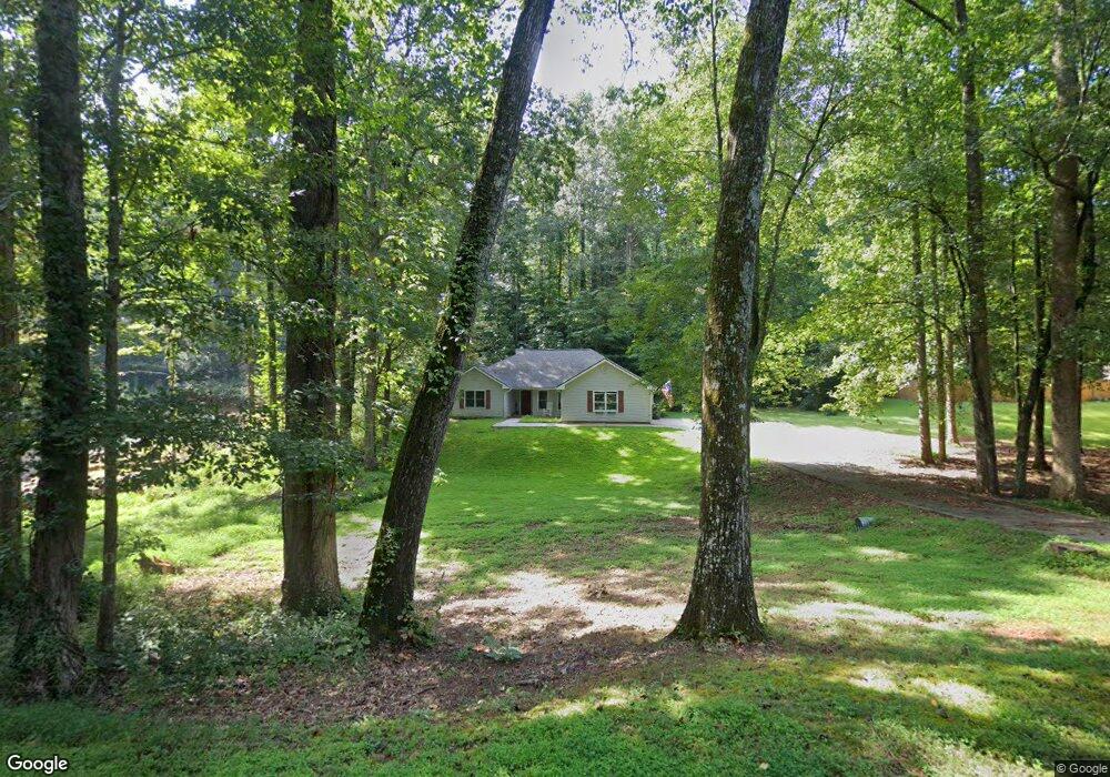
146 Browns Point Dawsonville, GA 30534
Dawson County NeighborhoodEstimated Value: $376,000 - $598,000
3
Beds
2
Baths
1,942
Sq Ft
$235/Sq Ft
Est. Value
About This Home
This home is located at 146 Browns Point, Dawsonville, GA 30534 and is currently estimated at $455,699, approximately $234 per square foot. 146 Browns Point is a home located in Dawson County with nearby schools including Kilough Elementary School, Dawson County Middle School, and Dawson County Junior High School.
Ownership History
Date
Name
Owned For
Owner Type
Purchase Details
Closed on
Apr 11, 2002
Sold by
Murphy Michael T and Murphy Roger K
Bought by
Haynes Arron F
Current Estimated Value
Purchase Details
Closed on
Oct 2, 1997
Sold by
Cochran Russell
Bought by
Murphy Roger K
Purchase Details
Closed on
Jun 13, 1997
Sold by
Biggs Kathyrn A D and Biggs B
Bought by
Cochran Russell
Purchase Details
Closed on
Sep 26, 1996
Bought by
Biggs Kathyrn A D and Biggs B
Create a Home Valuation Report for This Property
The Home Valuation Report is an in-depth analysis detailing your home's value as well as a comparison with similar homes in the area
Home Values in the Area
Average Home Value in this Area
Purchase History
| Date | Buyer | Sale Price | Title Company |
|---|---|---|---|
| Haynes Arron F | $131,100 | -- | |
| Murphy Roger K | $105,000 | -- | |
| Cochran Russell | $16,500 | -- | |
| Biggs Kathyrn A D | $76,400 | -- |
Source: Public Records
Tax History Compared to Growth
Tax History
| Year | Tax Paid | Tax Assessment Tax Assessment Total Assessment is a certain percentage of the fair market value that is determined by local assessors to be the total taxable value of land and additions on the property. | Land | Improvement |
|---|---|---|---|---|
| 2024 | $1,996 | $125,000 | $16,000 | $109,000 |
| 2023 | $2,000 | $134,600 | $16,000 | $118,600 |
| 2022 | $2,091 | $99,600 | $16,000 | $83,600 |
| 2021 | $1,958 | $88,560 | $16,000 | $72,560 |
| 2020 | $1,986 | $85,920 | $16,000 | $69,920 |
| 2019 | $1,823 | $78,400 | $16,000 | $62,400 |
| 2018 | $1,827 | $78,400 | $16,000 | $62,400 |
| 2017 | $1,443 | $62,334 | $14,400 | $47,934 |
| 2016 | $1,332 | $57,680 | $12,800 | $44,880 |
| 2015 | $1,374 | $57,680 | $12,800 | $44,880 |
| 2014 | $1,315 | $53,618 | $12,800 | $40,818 |
| 2013 | -- | $42,214 | $10,240 | $31,974 |
Source: Public Records
Map
Nearby Homes
- 307 Robertson Rd
- 104 Waters Edge
- 435 Robertson Rd
- 427 Dawson Pointe Pkwy
- 330 Lake Dr
- 518 Overlook Dr
- 347 Etowah Pkwy
- 75 Lake Dr
- 604 Oak Forest Dr
- 272 Indian Cove Dr
- 611 Elliott Rd
- 66 Chestnut Oak Ln
- 734 Kilough Church Rd
- 246 Overlook Cir
- 61 View Point Dr
- 1056 Overlook Dr
- 3 Henry Pirkle Dr
- 44 Eastview Dr
- 270 Sundown Dr
- 80 Eastview Dr
- 0 Browns Point Unit 8899777
- 00 Browns Point
- 0 Browns Point Unit 7056294
- 0 Browns Point Unit 7078361
- 0 Browns Point Unit 7177652
- 0 Poplar Trail
- 0 Poplar Trail Unit 7556721
- 0 Poplar Trail Unit 7477756
- 0 Poplar Trail Unit 7374499
- 0 Poplar Trail Unit 7284083
- 0 Poplar Trail Unit 8776193
- 0 Poplar Trail Unit 3137409
- 0 Poplar Trail Unit 7041072
- 0 Poplar Trail Unit 7275040
- 0 Poplar Trail Unit 7287808
- 0 Poplar Trail Unit 7356639
- 0 Poplar Trail Unit 7370086
- 0 Poplar Trail Unit 7452713
- 0 Poplar Trail Unit 7461715
- 0 Poplar Trail Unit 7485574