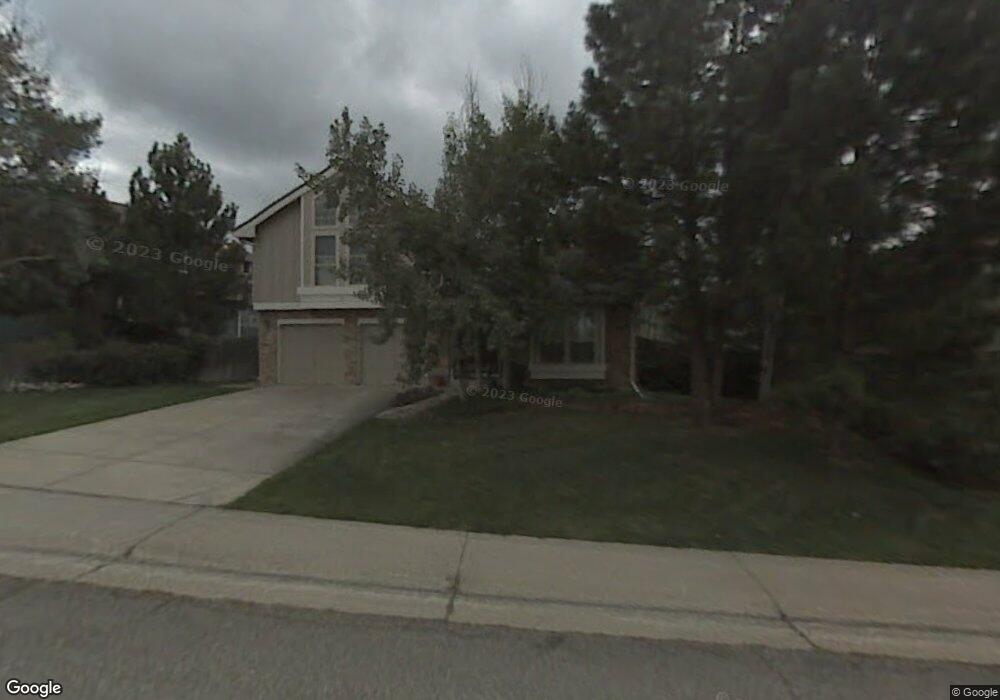
146 Clare Dr Castle Pines, CO 80108
Estimated Value: $819,000 - $946,000
4
Beds
4
Baths
3,882
Sq Ft
$223/Sq Ft
Est. Value
About This Home
This home is located at 146 Clare Dr, Castle Pines, CO 80108 and is currently estimated at $864,950, approximately $222 per square foot. 146 Clare Dr is a home located in Douglas County with nearby schools including Buffalo Ridge Elementary School, Rocky Heights Middle School, and Rock Canyon High School.
Ownership History
Date
Name
Owned For
Owner Type
Purchase Details
Closed on
Aug 5, 2022
Sold by
Min-Harris Family Trust
Bought by
Spencer Jennifer A
Current Estimated Value
Home Financials for this Owner
Home Financials are based on the most recent Mortgage that was taken out on this home.
Original Mortgage
$650,250
Outstanding Balance
$615,650
Interest Rate
4.38%
Mortgage Type
New Conventional
Estimated Equity
$249,300
Purchase Details
Closed on
Jul 19, 2017
Sold by
Harris Michael R and Min Harris Charlotte
Bought by
The Min Harris Family Trust
Home Financials for this Owner
Home Financials are based on the most recent Mortgage that was taken out on this home.
Original Mortgage
$351,500
Interest Rate
3.97%
Mortgage Type
New Conventional
Purchase Details
Closed on
May 23, 2017
Sold by
Harris Michael R and Min Harris Charlotte
Bought by
Harris Michael R and Min Harris Charlotte
Home Financials for this Owner
Home Financials are based on the most recent Mortgage that was taken out on this home.
Original Mortgage
$351,500
Interest Rate
3.97%
Mortgage Type
New Conventional
Purchase Details
Closed on
Jul 23, 2015
Sold by
The Weingartner Family Trust
Bought by
The Min Harris Family Trust
Home Financials for this Owner
Home Financials are based on the most recent Mortgage that was taken out on this home.
Original Mortgage
$366,500
Interest Rate
4.08%
Mortgage Type
New Conventional
Purchase Details
Closed on
Oct 7, 2014
Sold by
Weingartner Kathleen M and Weingartner Robert F
Bought by
The Weingartner Family Trust
Purchase Details
Closed on
Apr 22, 1994
Sold by
Weingartner Kathleen M
Bought by
Weingartner Kathleen M and Weingartner Robert F
Home Financials for this Owner
Home Financials are based on the most recent Mortgage that was taken out on this home.
Original Mortgage
$111,650
Interest Rate
7.71%
Purchase Details
Closed on
Nov 12, 1990
Sold by
Weingartner Robert F and Weingartner Kathleen M
Bought by
Weingartner Kathleen M
Purchase Details
Closed on
May 28, 1987
Sold by
Writer Corp
Bought by
Weingartner Robert F and Weingartner Kathleen M
Create a Home Valuation Report for This Property
The Home Valuation Report is an in-depth analysis detailing your home's value as well as a comparison with similar homes in the area
Home Values in the Area
Average Home Value in this Area
Purchase History
| Date | Buyer | Sale Price | Title Company |
|---|---|---|---|
| Spencer Jennifer A | $765,000 | None Listed On Document | |
| The Min Harris Family Trust | -- | None Available | |
| Harris Michael R | -- | Advantage Title Company | |
| The Min Harris Family Trust | $466,500 | Land Title Guarantee | |
| The Weingartner Family Trust | -- | None Available | |
| Weingartner Kathleen M | -- | -- | |
| Weingartner Kathleen M | -- | -- | |
| Weingartner Robert F | $164,300 | -- |
Source: Public Records
Mortgage History
| Date | Status | Borrower | Loan Amount |
|---|---|---|---|
| Open | Spencer Jennifer A | $650,250 | |
| Previous Owner | Harris Michael R | $351,500 | |
| Previous Owner | The Min Harris Family Trust | $366,500 | |
| Previous Owner | Weingartner Kathleen M | $111,650 |
Source: Public Records
Tax History Compared to Growth
Tax History
| Year | Tax Paid | Tax Assessment Tax Assessment Total Assessment is a certain percentage of the fair market value that is determined by local assessors to be the total taxable value of land and additions on the property. | Land | Improvement |
|---|---|---|---|---|
| 2024 | $5,390 | $58,140 | $9,870 | $48,270 |
| 2023 | $5,442 | $58,140 | $9,870 | $48,270 |
| 2022 | $3,688 | $38,240 | $7,130 | $31,110 |
| 2021 | $3,834 | $38,240 | $7,130 | $31,110 |
| 2020 | $3,900 | $38,610 | $6,160 | $32,450 |
| 2019 | $3,913 | $38,610 | $6,160 | $32,450 |
| 2018 | $3,559 | $34,630 | $4,730 | $29,900 |
| 2017 | $3,344 | $34,630 | $4,730 | $29,900 |
| 2016 | $3,431 | $31,220 | $6,050 | $25,170 |
| 2015 | $3,814 | $31,220 | $6,050 | $25,170 |
| 2014 | $1,660 | $25,920 | $5,570 | $20,350 |
Source: Public Records
Map
Nearby Homes
- 7263 Wembley Place
- 18 Brixham Ct
- 7207 Shoreham Dr
- 7412 Berkeley Ct
- 7218 Campden Place
- 1250 Bridgefield Rd
- 1249 Bridgefield Rd
- 577 Clarendon Loop
- 7369 Norfolk Place
- 252 Huntley Ct
- 7153 Othello St
- 6810 Brendon Place
- 166 Green Fee Cir
- 154 Back Nine Dr
- 431 Courtfield Way
- 7271 Brixham Cir
- 7145 Bedlam Dr
- 7156 Bedlam Dr
- 7083 Turweston Ln
- 6983 Ipswich Ct Unit Lot 0003