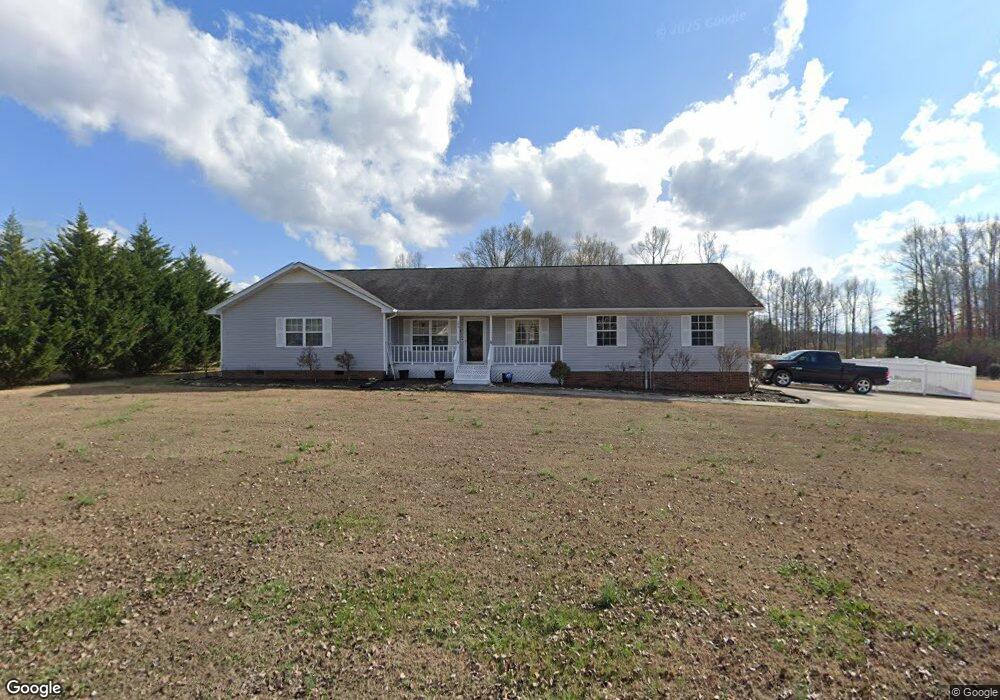
146 Co Rd 722 Athens, TN 37303
Estimated Value: $373,000 - $386,000
3
Beds
2
Baths
1,741
Sq Ft
$218/Sq Ft
Est. Value
About This Home
This home is located at 146 Co Rd 722, Athens, TN 37303 and is currently estimated at $379,548, approximately $218 per square foot. 146 Co Rd 722 is a home located in McMinn County with nearby schools including Christ's Legacy Academy.
Ownership History
Date
Name
Owned For
Owner Type
Purchase Details
Closed on
Jul 19, 2019
Sold by
Demko Diane D
Bought by
Demko Michael J
Current Estimated Value
Purchase Details
Closed on
Jul 21, 2011
Sold by
Gaby Thomas E
Bought by
Demko Michael J and Demko Diane D
Home Financials for this Owner
Home Financials are based on the most recent Mortgage that was taken out on this home.
Original Mortgage
$150,259
Interest Rate
4.52%
Mortgage Type
Commercial
Purchase Details
Closed on
Apr 11, 1995
Sold by
Sharp and Patsy
Bought by
Thomas Bagy
Purchase Details
Closed on
Nov 1, 1994
Bought by
Sharp Coy M and Sharp Patsy C
Purchase Details
Closed on
Sep 23, 1991
Bought by
Haren J S
Purchase Details
Closed on
Aug 26, 1991
Bought by
Haren J S
Create a Home Valuation Report for This Property
The Home Valuation Report is an in-depth analysis detailing your home's value as well as a comparison with similar homes in the area
Home Values in the Area
Average Home Value in this Area
Purchase History
| Date | Buyer | Sale Price | Title Company |
|---|---|---|---|
| Demko Michael J | -- | -- | |
| Demko Michael J | $145,000 | -- | |
| Thomas Bagy | $99,900 | -- | |
| Sharp Coy M | $11,200 | -- | |
| Haren J S | -- | -- | |
| Haren J S | -- | -- |
Source: Public Records
Mortgage History
| Date | Status | Borrower | Loan Amount |
|---|---|---|---|
| Previous Owner | Demko Michael J | $150,259 |
Source: Public Records
Tax History Compared to Growth
Tax History
| Year | Tax Paid | Tax Assessment Tax Assessment Total Assessment is a certain percentage of the fair market value that is determined by local assessors to be the total taxable value of land and additions on the property. | Land | Improvement |
|---|---|---|---|---|
| 2024 | $644 | $59,475 | $7,000 | $52,475 |
| 2023 | $644 | $59,475 | $7,000 | $52,475 |
| 2022 | $616 | $39,850 | $7,500 | $32,350 |
| 2021 | $616 | $39,850 | $7,500 | $32,350 |
| 2020 | $612 | $39,575 | $7,500 | $32,075 |
| 2019 | $612 | $39,575 | $7,500 | $32,075 |
| 2018 | $612 | $39,575 | $7,500 | $32,075 |
| 2017 | $590 | $36,550 | $5,675 | $30,875 |
| 2016 | $618 | $36,550 | $5,675 | $30,875 |
| 2015 | -- | $38,225 | $5,675 | $32,550 |
| 2014 | $617 | $38,208 | $0 | $0 |
Source: Public Records
Map
Nearby Homes
- 19 Shawnee Trail
- 114 County Road 7030
- 00 Belle Way
- 107 County Road 7001
- 1605 Brentwood Dr
- 1490 Housley Dr
- 1498 Housley Dr
- 1103 Skyridge Dr
- 966 Rocky Mount Rd
- 1313 English Ln
- 172 County Road 130
- 211 Pike St
- 254 County Road 132
- 909 S Matlock Ave
- 501 Lynnwood Dr
- Lot 3 & 4 County Rd 7004 7005
- 7 County Road 7004
- 5 County Road 7004
- 15 County Road 7004
- 504 Lynnwood Dr
- 146 County Road 722
- 146 County Road 722 Unit Madison Place
- 150 County Road 722
- 150 County Road 722
- 137 County Road 722
- 142 County Road 722
- 126 County Road 722
- 133 County Road 722
- 165 County Road 722
- 0 County Road 723
- 154 County Road 722
- 160 County Road 703
- 129 County Road 722
- 141 County Road 722
- 148 County Road 703
- 164 County Road 703
- 161 County Road 722
- 0 Co Rd 704
- 170 County Road 723
- 130 County Road 722