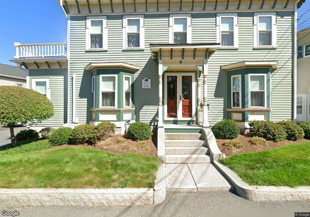
146 E Main St Gloucester, MA 01930
East Gloucester NeighborhoodEstimated Value: $642,000 - $803,655
4
Beds
2
Baths
2,448
Sq Ft
$289/Sq Ft
Est. Value
About This Home
This home is located at 146 E Main St, Gloucester, MA 01930 and is currently estimated at $708,664, approximately $289 per square foot. 146 E Main St is a home located in Essex County with nearby schools including East Gloucester Elementary School, Ralph B O'maley Middle School, and Gloucester High School.
Ownership History
Date
Name
Owned For
Owner Type
Purchase Details
Closed on
May 5, 1998
Sold by
Sutherland Rita
Bought by
Folse Philip J and Folse Theresa A
Current Estimated Value
Home Financials for this Owner
Home Financials are based on the most recent Mortgage that was taken out on this home.
Original Mortgage
$177,400
Interest Rate
7.04%
Mortgage Type
Purchase Money Mortgage
Create a Home Valuation Report for This Property
The Home Valuation Report is an in-depth analysis detailing your home's value as well as a comparison with similar homes in the area
Home Values in the Area
Average Home Value in this Area
Purchase History
| Date | Buyer | Sale Price | Title Company |
|---|---|---|---|
| Folse Philip J | $130,000 | -- |
Source: Public Records
Mortgage History
| Date | Status | Borrower | Loan Amount |
|---|---|---|---|
| Closed | Folse Philip J | $238,000 | |
| Closed | Folse Philip J | $266,000 | |
| Closed | Folse Philip J | $335,000 | |
| Closed | Folse Philip J | $177,400 |
Source: Public Records
Tax History
| Year | Tax Paid | Tax Assessment Tax Assessment Total Assessment is a certain percentage of the fair market value that is determined by local assessors to be the total taxable value of land and additions on the property. | Land | Improvement |
|---|---|---|---|---|
| 2025 | $6,668 | $686,000 | $166,900 | $519,100 |
| 2024 | $6,551 | $673,300 | $159,000 | $514,300 |
| 2023 | $6,769 | $639,200 | $141,900 | $497,300 |
| 2022 | $6,339 | $540,400 | $123,400 | $417,000 |
| 2021 | $6,129 | $492,700 | $112,200 | $380,500 |
| 2020 | $5,806 | $470,900 | $112,200 | $358,700 |
| 2019 | $5,302 | $417,800 | $112,200 | $305,600 |
| 2018 | $4,941 | $382,100 | $112,200 | $269,900 |
| 2017 | $4,719 | $357,800 | $106,900 | $250,900 |
| 2016 | $4,603 | $338,200 | $111,600 | $226,600 |
| 2015 | $4,520 | $331,100 | $111,600 | $219,500 |
Source: Public Records
Map
Nearby Homes
- 197 E Main St Unit 1
- 60 Rocky Neck Ave Unit 202
- 73 Rocky Neck Ave Unit 2
- 1 Wonson St
- 3 Mondello Square
- 139A Prospect St
- 191 Main St Unit 3
- 191 Main St Unit 2A
- 10 Seaview Rd
- 36 Eastern Ave
- 5 Wise Place
- 15 Raven Ln Unit 15
- 35 Middle St Unit 4
- 33 Middle St
- 50 Warner St
- 113 Pleasant St
- 19 Trask St Unit 2
- 11 Ocean View Dr
- 33 Maplewood Ave Unit 310
- 26 Marina Dr
- 146 E Main St Unit 2
- 150 E Main St
- 150R E Main St
- 154 E Main St
- 142 E Main St Unit 1
- 142 E Main St Unit C
- 142 E Main St Unit B
- 142 E Main St Unit A
- 142 E Main St Unit 3
- 142 E Main St Unit 2
- 2R Highland St
- 158 E Main St Unit 3
- 158 E Main St Unit 2
- 158 E Main St Unit 1
- 158 E Main St
- 156 E Main St
- 169 E Main St Unit 169 B
- 158 E Main Street (Mf)
- 105 E Main St Unit 1
- 1233 E Main St
Your Personal Tour Guide
Ask me questions while you tour the home.