Estimated Value: $80,000 - $142,000
--
Bed
1
Bath
864
Sq Ft
$131/Sq Ft
Est. Value
About This Home
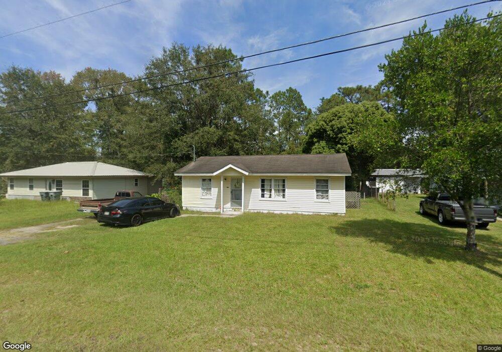
This home is located at 146 N Deborah Cir, Jesup, GA 31546 and is currently estimated at $113,317, approximately $131 per square foot. 146 N Deborah Cir is a home located in Wayne County with nearby schools including Martha Rawls Smith Elementary School, Arthur Williams Middle School, and Wayne County High School.
Ownership History
Date
Name
Owned For
Owner Type
Purchase Details
Closed on
Jul 27, 2012
Sold by
Paulus Jonathan J
Bought by
Lyons Charles A and Aspinwall Cami L
Current Estimated Value
Home Financials for this Owner
Home Financials are based on the most recent Mortgage that was taken out on this home.
Original Mortgage
$44,000
Outstanding Balance
$17,109
Interest Rate
3.68%
Mortgage Type
New Conventional
Estimated Equity
$96,208
Purchase Details
Closed on
Nov 10, 2006
Sold by
Smith Lester
Bought by
Paulus Jonathan and Paulus Gina
Purchase Details
Closed on
Jan 23, 2006
Sold by
Williams Christine
Bought by
Smith Lester
Create a Home Valuation Report for This Property
The Home Valuation Report is an in-depth analysis detailing your home's value as well as a comparison with similar homes in the area
Home Values in the Area
Average Home Value in this Area
Purchase History
| Date | Buyer | Sale Price | Title Company |
|---|---|---|---|
| Lyons Charles A | $43,000 | -- | |
| Paulus Jonathan | $46,000 | -- | |
| Smith Lester | $15,000 | -- |
Source: Public Records
Mortgage History
| Date | Status | Borrower | Loan Amount |
|---|---|---|---|
| Open | Lyons Charles A | $44,000 |
Source: Public Records
Tax History Compared to Growth
Tax History
| Year | Tax Paid | Tax Assessment Tax Assessment Total Assessment is a certain percentage of the fair market value that is determined by local assessors to be the total taxable value of land and additions on the property. | Land | Improvement |
|---|---|---|---|---|
| 2024 | $649 | $21,231 | $1,959 | $19,272 |
| 2023 | $554 | $15,647 | $1,970 | $13,677 |
| 2022 | $493 | $15,647 | $1,970 | $13,677 |
| 2021 | $528 | $15,647 | $1,970 | $13,677 |
| 2020 | $546 | $15,647 | $1,970 | $13,677 |
| 2019 | $562 | $15,647 | $1,970 | $13,677 |
| 2018 | $562 | $15,647 | $1,970 | $13,677 |
| 2017 | $484 | $15,647 | $1,970 | $13,677 |
| 2016 | $468 | $15,647 | $1,970 | $13,677 |
| 2014 | $469 | $15,647 | $1,970 | $13,677 |
| 2013 | -- | $15,646 | $1,969 | $13,677 |
Source: Public Records
Map
Nearby Homes
- 158 N Deborah Cir
- 1300 S Palm St
- 0 S Palm St Unit 10609054
- 0 S Palm St Unit 1656795
- 775 Catherine St
- 1101 S Palm St
- 805 Littlefield St
- 655 Littlefield St
- 985 Seven Oaks Rd
- 50 Ac Hwy 301
- 210 Purser Dr
- 945 S Palm St
- 1816 S Palm St
- 1812 S Palm St
- 0 U S 301
- 156 Hannah Dr
- 112 Vixenhill Dr
- 113 Vixenhill Dr
- 555 E Magnolia St
- 353 Chase Dr
- 150 N Deborah Cir
- 142 N Deborah Cir
- 138 N Deborah Cir
- 154 N Deborah Cir
- 151 N Deborah Cir
- 143 N Deborah Cir
- 134 N Deborah Cir
- 141 N Deborah Cir
- 155 N Deborah Cir
- 140 Ross Siding Rd
- 1106 S Palm St
- 147 Nancy St
- 135 N Deborah Cir
- 117 Villa Rd
- 140 S Deborah Cir
- 131 N Deborah Cir
- 126 N Deborah Cir
- 115 Villa Rd
- 127 N Deborah Cir
- 122 N Deborah Cir