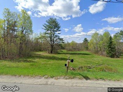
146 Quaker Ln Smithfield, ME 04978
Estimated Value: $338,000 - $465,000
4
Beds
3
Baths
2,020
Sq Ft
$194/Sq Ft
Est. Value
About This Home
This home is located at 146 Quaker Ln, Smithfield, ME 04978 and is currently estimated at $391,660, approximately $193 per square foot. 146 Quaker Ln is a home.
Ownership History
Date
Name
Owned For
Owner Type
Purchase Details
Closed on
May 29, 2007
Sold by
Collette Theodore W and Collette Debra J
Bought by
Leavitt Theodore L and Leavitt Dawn M
Current Estimated Value
Home Financials for this Owner
Home Financials are based on the most recent Mortgage that was taken out on this home.
Original Mortgage
$207,100
Outstanding Balance
$133,227
Interest Rate
6.27%
Mortgage Type
Purchase Money Mortgage
Estimated Equity
$238,451
Purchase Details
Closed on
Feb 13, 2006
Sold by
Noble Michael A and Noble Bethany S
Bought by
Collette Theodore W and Collette Debra J
Home Financials for this Owner
Home Financials are based on the most recent Mortgage that was taken out on this home.
Original Mortgage
$125,000
Interest Rate
6.27%
Mortgage Type
Unknown
Create a Home Valuation Report for This Property
The Home Valuation Report is an in-depth analysis detailing your home's value as well as a comparison with similar homes in the area
Home Values in the Area
Average Home Value in this Area
Purchase History
| Date | Buyer | Sale Price | Title Company |
|---|---|---|---|
| Leavitt Theodore L | -- | -- | |
| Collette Theodore W | -- | -- |
Source: Public Records
Mortgage History
| Date | Status | Borrower | Loan Amount |
|---|---|---|---|
| Open | Leavitt Theodore L | $207,100 | |
| Previous Owner | Collette Theodore W | $125,000 |
Source: Public Records
Tax History Compared to Growth
Tax History
| Year | Tax Paid | Tax Assessment Tax Assessment Total Assessment is a certain percentage of the fair market value that is determined by local assessors to be the total taxable value of land and additions on the property. | Land | Improvement |
|---|---|---|---|---|
| 2024 | $4,222 | $301,600 | $53,800 | $247,800 |
| 2023 | $3,439 | $204,700 | $36,400 | $168,300 |
| 2022 | $3,439 | $204,700 | $36,400 | $168,300 |
| 2021 | $3,418 | $204,700 | $36,400 | $168,300 |
| 2020 | $172 | $204,700 | $36,400 | $168,300 |
| 2019 | $3,418 | $204,700 | $36,400 | $168,300 |
| 2018 | $162 | $204,700 | $36,400 | $168,300 |
| 2017 | $3,480 | $204,700 | $36,400 | $168,300 |
| 2016 | $146 | $204,700 | $36,400 | $168,300 |
| 2015 | $3,398 | $204,700 | $36,400 | $168,300 |
| 2013 | -- | $204,700 | $36,400 | $168,300 |
Source: Public Records
Map
Nearby Homes
- 17 Groves Flat Ln
- M19 L5 Village Rd
- 162 Lake View Dr
- 7 Old Schoolhouse Rd
- 13 Kevin Blvd
- 600 Village Rd
- 339 Oak Hill Rd
- 101 Mercer Rd
- 63 Main St
- 21 Hatto Farm Rd
- M28 L6-2-1 Gilman Dr
- 18 Wedgewood Dr
- 608 Norridgewock Rd
- 191 Skowhegan Rd
- 901 Mercer Rd
- 27 Old Robinson Rd
- 457 Norridgewock Rd
- #00 Lincolnville Ave
- 325 Middle Rd
- 55 Monica Ridge
