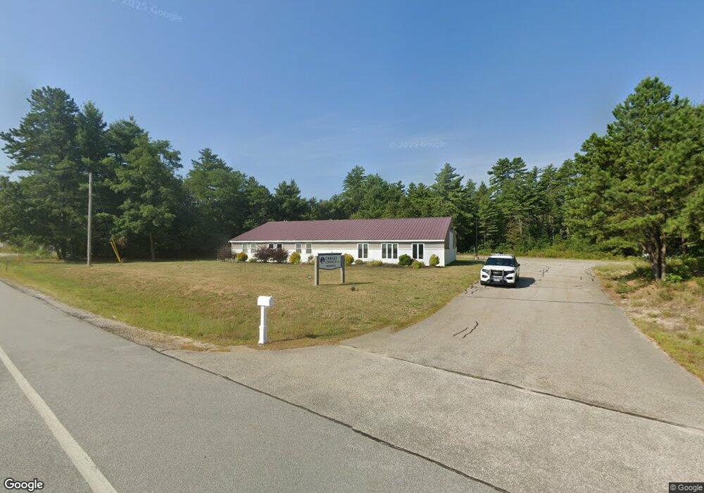
146 Sheep Davis Rd Pembroke, NH 03275
Estimated Value: $677,542
--
Bed
1
Bath
4,000
Sq Ft
$169/Sq Ft
Est. Value
About This Home
This home is located at 146 Sheep Davis Rd, Pembroke, NH 03275 and is currently estimated at $677,542, approximately $169 per square foot. 146 Sheep Davis Rd is a home located in Merrimack County with nearby schools including Pembroke Hill School, Pembroke Village School, and Three Rivers School.
Ownership History
Date
Name
Owned For
Owner Type
Purchase Details
Closed on
Dec 4, 2012
Sold by
Peace Cynthia
Bought by
First Presbyterian Chu
Current Estimated Value
Purchase Details
Closed on
Nov 29, 2001
Sold by
Mongan Marie M
Bought by
Peace Cynthia
Home Financials for this Owner
Home Financials are based on the most recent Mortgage that was taken out on this home.
Original Mortgage
$97,000
Interest Rate
6.66%
Mortgage Type
Commercial
Create a Home Valuation Report for This Property
The Home Valuation Report is an in-depth analysis detailing your home's value as well as a comparison with similar homes in the area
Home Values in the Area
Average Home Value in this Area
Purchase History
| Date | Buyer | Sale Price | Title Company |
|---|---|---|---|
| First Presbyterian Chu | $300,000 | -- | |
| First Presbyterian Chu | $300,000 | -- | |
| Peace Cynthia | $200,000 | -- | |
| Peace Cynthia | $200,000 | -- |
Source: Public Records
Mortgage History
| Date | Status | Borrower | Loan Amount |
|---|---|---|---|
| Open | Peace Cynthia | $125,000 | |
| Previous Owner | Peace Cynthia | $97,000 |
Source: Public Records
Tax History Compared to Growth
Tax History
| Year | Tax Paid | Tax Assessment Tax Assessment Total Assessment is a certain percentage of the fair market value that is determined by local assessors to be the total taxable value of land and additions on the property. | Land | Improvement |
|---|---|---|---|---|
| 2024 | -- | $857,200 | $305,800 | $551,400 |
| 2023 | -- | $688,800 | $201,900 | $486,900 |
| 2022 | $0 | $683,600 | $201,900 | $481,700 |
| 2021 | $0 | $683,600 | $201,900 | $481,700 |
| 2020 | $0 | $683,600 | $201,900 | $481,700 |
| 2019 | $0 | $683,600 | $201,900 | $481,700 |
| 2018 | $0 | $596,900 | $182,300 | $414,600 |
| 2017 | $0 | $596,900 | $182,300 | $414,600 |
| 2015 | -- | $596,900 | $182,300 | $414,600 |
| 2014 | -- | $596,900 | $182,300 | $414,600 |
| 2011 | $9,587 | $362,600 | $162,000 | $200,600 |
Source: Public Records
Map
Nearby Homes
- 667 Borough Rd
- 245 Beacon Hill Rd Unit B
- 1 Guay St
- 33 Mulberry St Unit 2
- 15 Bridle Path Trail
- 401 Sixth Range Rd
- 9 Strawberry Ln
- 58 Branch Turnpike Unit 8
- 58 Branch Turnpike Unit 26
- 24 Cricket Ln
- 50 Branch Turnpike
- 43 Branch Turnpike
- 59 Branch Turnpike
- 13 Ellsworth St
- 348 Brickett Hill Rd Unit 3
- 344 Brickett Hill Rd Unit 2
- 344 Brickett Hill Rd
- 340 Brickett Hill Rd
- 69 Manchester St Unit Lot 18
- 7 Highridge Trail
- 140 Sheep Davis Rd
- 140 Sheep Davis Rd Unit 1
- 200 Sheep Davis Rd
- 203 Sheep Davis Rd
- 711 Riverwood Dr
- 701 Riverwood Dr
- 0 Sheep Davis Rd
- 726 Clough Mill Rd
- 720-722 Riverwood Dr
- 702 Riverwood Dr
- 714 Riverwood Dr
- 716 Riverwood Dr
- 716 Riverwood Dr
- 110 Sheep Davis Rd
- 107 Sheep Davis Rd
- 716 Clough Mill Rd
- 713 Clough Mill Rd
- 414 Borough Rd
- 720 Riverwood Dr
- 710 Clough Mill Rd