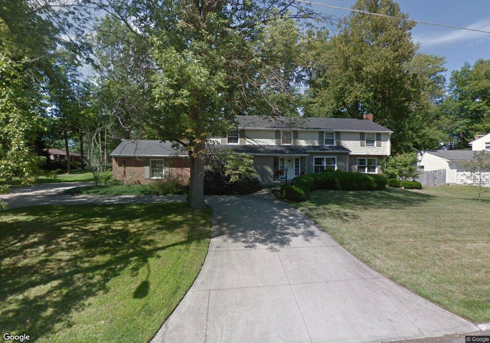
146 Sherbrook Rd Mansfield, OH 44907
Estimated Value: $269,000 - $358,000
About This Home
This home is located at 146 Sherbrook Rd, Mansfield, OH 44907 and is currently estimated at $314,441, approximately $70 per square foot. 146 Sherbrook Rd is a home located in Richland County with nearby schools including Mansfield Christian School, St. Peter's Elementary/Montessori School, and Mansfield Seventh-day Adventist School.
Ownership History
We collect this data history from publicly available records. To have your information removed, we recommend requesting removal directly through your county’s website.
Purchase Details
Home Financials for this Owner
Home Financials are based on the most recent Mortgage that was taken out on this home.Home Values in the Area
Average Home Value in this Area
Purchase History
We collect this data history from publicly available records. To have your information removed, we recommend requesting removal directly through your county’s website.
| Date | Buyer | Sale Price | Title Company |
|---|---|---|---|
| $178,000 | -- |
Mortgage History
We collect this data history from publicly available records. To have your information removed, we recommend requesting removal directly through your county’s website.
| Date | Status | Borrower | Loan Amount |
|---|---|---|---|
| Closed | $118,000 |
Tax History
We collect this data history from publicly available records. To have your information removed, we recommend requesting removal directly through your county’s website.
| Year | Tax Paid | Tax Assessment Tax Assessment Total Assessment is a certain percentage of the fair market value that is determined by local assessors to be the total taxable value of land and additions on the property. | Land | Improvement |
|---|---|---|---|---|
| 2025 | $3,523 | $87,340 | $10,800 | $76,540 |
| 2024 | $3,523 | $87,340 | $10,800 | $76,540 |
| 2023 | $4,090 | $87,340 | $10,800 | $76,540 |
| 2022 | $3,690 | $66,040 | $9,420 | $56,620 |
| 2021 | $3,716 | $66,040 | $9,420 | $56,620 |
| 2020 | $3,799 | $66,040 | $9,420 | $56,620 |
| 2019 | $3,569 | $55,970 | $7,980 | $47,990 |
| 2018 | $3,520 | $55,970 | $7,980 | $47,990 |
| 2017 | $3,425 | $55,970 | $7,980 | $47,990 |
| 2016 | $3,463 | $54,870 | $7,580 | $47,290 |
| 2015 | $3,308 | $54,870 | $7,580 | $47,290 |
| 2014 | $3,264 | $54,870 | $7,580 | $47,290 |
| 2012 | $3,163 | $57,750 | $7,980 | $49,770 |
Map
- 145 Elmridge Rd
- 141 Redwood Rd
- 0 Lexington Ave Unit 224009661
- 1091 Larchwood Rd
- 1200 S Main St
- 193 Ridgewood Blvd
- 50 Sunnyslope Dr
- 836 Peaceful Path
- 493 Logan Rd
- 1027 Sunset Blvd
- 472 Fairoaks Blvd
- 480 Fairoaks Blvd
- 48 Malone Rd
- 0 George Ave
- 1391 Beechdale Dr
- 665 Gilbert Ave
- 1578 Cape Cod Dr
- 540 Lexington Ave
- 1668 Nantucket Dr
- 69 Yoha Dr
- 142 Sherbrook Rd
- 149 Elmridge Rd
- 153 Elmridge Rd
- 149 Sherbrook Rd
- 138 Sherbrook Rd
- 153 Sherbrook Rd
- 157 Elmridge Rd
- 145 Sherbrook Rd
- 141 Elmridge Rd
- 157 Sherbrook Rd
- 160 Sherbrook Rd
- 141 Sherbrook Rd
- 161 Elmridge Rd
- 134 Sherbrook Rd
- 161 Sherbrook Rd
- 160 Elmridge Rd
- 150 Elmridge Rd
- 150 Redwood Rd
- 137 Elmridge Rd
- 148 Elmridge Rd
Ask me questions while you tour the home.