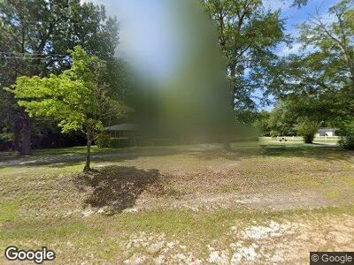
146 Southwind Rd Eastover, SC 29044
Estimated Value: $192,000 - $232,000
3
Beds
3
Baths
2,304
Sq Ft
$93/Sq Ft
Est. Value
About This Home
This home is located at 146 Southwind Rd, Eastover, SC 29044 and is currently estimated at $213,447, approximately $92 per square foot. 146 Southwind Rd is a home located in Richland County with nearby schools including Southeast Middle School and Lower Richland High School.
Ownership History
Date
Name
Owned For
Owner Type
Purchase Details
Closed on
Sep 19, 2008
Sold by
Moye Willie H
Bought by
Moye Ruby
Current Estimated Value
Home Financials for this Owner
Home Financials are based on the most recent Mortgage that was taken out on this home.
Original Mortgage
$188,028
Interest Rate
6.49%
Mortgage Type
FHA
Create a Home Valuation Report for This Property
The Home Valuation Report is an in-depth analysis detailing your home's value as well as a comparison with similar homes in the area
Home Values in the Area
Average Home Value in this Area
Purchase History
| Date | Buyer | Sale Price | Title Company |
|---|---|---|---|
| Moye Ruby | -- | -- |
Source: Public Records
Mortgage History
| Date | Status | Borrower | Loan Amount |
|---|---|---|---|
| Closed | Moye Willie Harmon | $36,000 | |
| Closed | Moye Willie H | $5,537 | |
| Closed | Moye Ruby | $3,438 | |
| Closed | Moye Willie H | $36,000 | |
| Closed | Moye Willie H | $190,848 | |
| Closed | Moye Ruby | $188,028 | |
| Closed | Moye Willie H | $141,743 | |
| Closed | Moye Willie | $82,500 |
Source: Public Records
Tax History Compared to Growth
Tax History
| Year | Tax Paid | Tax Assessment Tax Assessment Total Assessment is a certain percentage of the fair market value that is determined by local assessors to be the total taxable value of land and additions on the property. | Land | Improvement |
|---|---|---|---|---|
| 2024 | $964 | $141,700 | $0 | $0 |
| 2023 | $964 | $4,928 | $0 | $0 |
| 2022 | $832 | $123,200 | $7,500 | $115,700 |
| 2021 | $820 | $4,930 | $0 | $0 |
| 2020 | $831 | $4,930 | $0 | $0 |
| 2019 | $801 | $4,930 | $0 | $0 |
| 2018 | $494 | $4,750 | $0 | $0 |
| 2017 | $481 | $4,750 | $0 | $0 |
| 2016 | $478 | $4,750 | $0 | $0 |
| 2015 | $710 | $4,750 | $0 | $0 |
| 2014 | $693 | $118,800 | $0 | $0 |
| 2013 | -- | $4,750 | $0 | $0 |
Source: Public Records
Map
Nearby Homes
- 1215 Antioch Amez Church Rd
- 125 Wilbert Rd
- 108 Pond Arch Rd
- 165 Raven Brook Rd
- 1124 Pond Dr
- 239 House Rd
- 1001 Lincoln Park Dr
- 000 Community Pond Rd
- 2848 McCords Ferry Rd
- 117 Gilmore St
- 112 Roberts
- 264 Willie Wilson Rd
- 404 Sandhill Rd
- N/S Garners Ferry Rd
- 000 Vanboklen Rd
- 441 Main St
- 10810 Garners Ferry Rd
- 136 Dowdy St
- 120 Joyner
- 0 Mendenhall Rd
- 146 Southwind Rd
- 00 Lake Dogwood Cir
- 0 E S Congaree Run Rd Unit 572285
- 0 E S Congaree Run Rd Unit 549108
- TBD Community Pond Rd
- SS Garners Ferry Rd
- S/S Goffman Rd
- 0 Mt Elon Harmon Unit 596858
- 174 Southwind Rd
- 208 Southwind Rd
- E/S Detsata Trail
- 0 E S R McKenzie Garners Ferry Rd Unit 546071
- E/S R. McKenzie Garners Ferry Rd
- TBD Detsata Trail
- 142 Southwind Rd
- 21 John Flemming Ct
- 168 Southwind Rd
- 228 Southwind Rd
- TBD Chain Gang Rd
- 212 Southwind Rd
