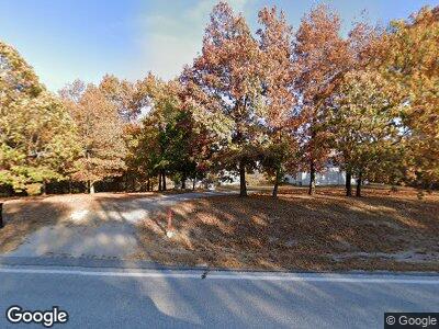
14600 N Highway 281 Lead Hill, AR 72644
Estimated Value: $279,839 - $342,000
--
Bed
--
Bath
1,184
Sq Ft
$267/Sq Ft
Est. Value
About This Home
This home is located at 14600 N Highway 281, Lead Hill, AR 72644 and is currently estimated at $316,613, approximately $267 per square foot. 14600 N Highway 281 is a home with nearby schools including Bergman Elementary School, Bergman Middle School, and Bergman High School.
Ownership History
Date
Name
Owned For
Owner Type
Purchase Details
Closed on
Jun 19, 2006
Sold by
Bronne Marshall
Bought by
Bronne Gayle
Current Estimated Value
Home Financials for this Owner
Home Financials are based on the most recent Mortgage that was taken out on this home.
Original Mortgage
$112,500
Interest Rate
6.66%
Mortgage Type
New Conventional
Purchase Details
Closed on
Jan 2, 2003
Bought by
Bronne
Create a Home Valuation Report for This Property
The Home Valuation Report is an in-depth analysis detailing your home's value as well as a comparison with similar homes in the area
Home Values in the Area
Average Home Value in this Area
Purchase History
| Date | Buyer | Sale Price | Title Company |
|---|---|---|---|
| Bronne Gayle | -- | None Available | |
| Bronne | $24,000 | -- |
Source: Public Records
Mortgage History
| Date | Status | Borrower | Loan Amount |
|---|---|---|---|
| Open | Bronne Marshall | $32,000 | |
| Open | Bronne Marshall | $100,800 | |
| Closed | Bronne Gayle | $112,500 |
Source: Public Records
Tax History Compared to Growth
Tax History
| Year | Tax Paid | Tax Assessment Tax Assessment Total Assessment is a certain percentage of the fair market value that is determined by local assessors to be the total taxable value of land and additions on the property. | Land | Improvement |
|---|---|---|---|---|
| 2024 | $895 | $26,430 | $1,550 | $24,880 |
| 2023 | $895 | $26,430 | $1,550 | $24,880 |
| 2022 | $567 | $26,430 | $1,550 | $24,880 |
| 2021 | $567 | $26,430 | $1,550 | $24,880 |
| 2020 | $558 | $24,330 | $1,560 | $22,770 |
| 2019 | $446 | $20,870 | $1,560 | $19,310 |
| 2018 | $436 | $20,870 | $1,560 | $19,310 |
| 2017 | $418 | $20,870 | $1,560 | $19,310 |
| 2016 | $418 | $20,340 | $1,560 | $18,780 |
| 2015 | $765 | $20,340 | $1,590 | $18,750 |
| 2014 | $418 | $20,340 | $1,590 | $18,750 |
Source: Public Records
Map
Nearby Homes
- 0 Grassy Gap Rd W
- 019-02659-000 Downes Rd E
- 0 Tract Aaaaaa-4 Off of Crumpler Cemetery Dr
- 10908 Pecks Dr
- TBD Pecks Dr
- 0 Tract Aaaaaa-3 Off of Crumpler Cemetery Dr
- Lots 16/17 Pecks Dr N
- 0000 Wilderness Springs - Tract Ccccc Trail
- 0 Ricks Rd Unit 1307564
- 0 Tract Sssss On Grassy Gap Rd
- 0 Tract Vvv On Meadow Creek Dr
- 0 Mercy Mountain Dr
- 020-05462-021 Cedar Creek Dr
- 0 Cedar Creek Dr
- 0 Meadow Creek Dr Unit 24016886
- 47 Cedar Creek Dr
- 0 5 49 Acres On Meadow Creek Dr
- 2216 Meadow Creek Dr
- Tract VVV on Meadow Creek Dr
- 0 Tract X On Meadow Creek Dr
- 14600 N Highway 281
- 14567 N Highway 281
- 14471 N 281 Hwy
- 14567 N 281 Hwy
- 14595 N Highway 281
- 14859 N Highway 281
- 14859 N Highway 281
- 50 Rushing Ridge Rd Unit A
- 5975 Myrna Ln
- 14968 N Highway 281
- 14968 N Highway 281
- 23 Downes Rd
- 15117 N Highway 281
- 15117 N Highway 281
- 15114 N Highway 281
- 13911 Highway 281 N
- 15208 N Highway 281
- 15208 N Highway 281
- 22 W James Dixon Ln
- 60 Rushing Ridge Rd
