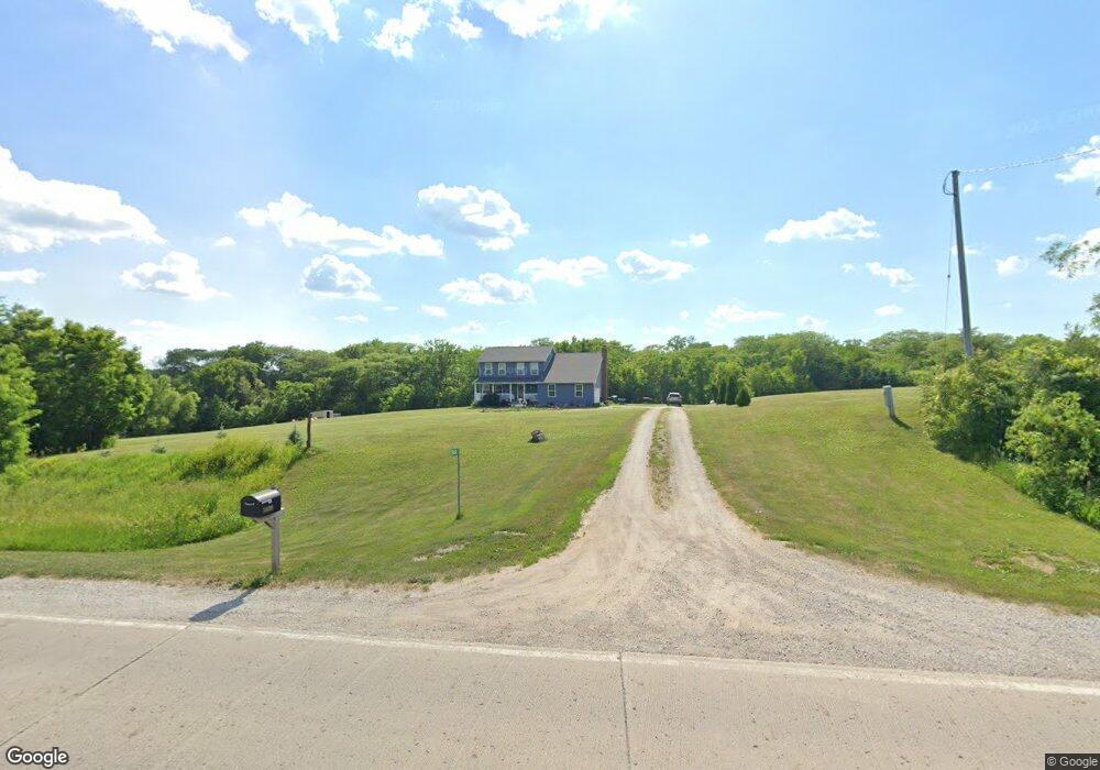
14600 S23 Hwy Milo, IA 50166
Warren County NeighborhoodEstimated Value: $388,000 - $566,000
5
Beds
5
Baths
2,110
Sq Ft
$239/Sq Ft
Est. Value
About This Home
This home is located at 14600 S23 Hwy, Milo, IA 50166 and is currently estimated at $503,794, approximately $238 per square foot. 14600 S23 Hwy is a home located in Warren County with nearby schools including Southeast Warren Primary School, Southeast Warren Intermediate School, and Southeast Warren Junior/Senior High School.
Ownership History
Date
Name
Owned For
Owner Type
Purchase Details
Closed on
Aug 28, 2007
Sold by
Deutsch Bank National Trust Co
Bought by
Hanawalt Sarah E
Current Estimated Value
Home Financials for this Owner
Home Financials are based on the most recent Mortgage that was taken out on this home.
Original Mortgage
$158,000
Outstanding Balance
$130,148
Interest Rate
6.63%
Mortgage Type
New Conventional
Estimated Equity
$373,646
Create a Home Valuation Report for This Property
The Home Valuation Report is an in-depth analysis detailing your home's value as well as a comparison with similar homes in the area
Home Values in the Area
Average Home Value in this Area
Purchase History
| Date | Buyer | Sale Price | Title Company |
|---|---|---|---|
| Hanawalt Sarah E | $215,000 | None Available |
Source: Public Records
Mortgage History
| Date | Status | Borrower | Loan Amount |
|---|---|---|---|
| Open | Hanawalt Sarah E | $158,000 |
Source: Public Records
Tax History Compared to Growth
Tax History
| Year | Tax Paid | Tax Assessment Tax Assessment Total Assessment is a certain percentage of the fair market value that is determined by local assessors to be the total taxable value of land and additions on the property. | Land | Improvement |
|---|---|---|---|---|
| 2025 | $5,034 | $512,500 | $130,800 | $381,700 |
| 2024 | $4,892 | $415,900 | $64,400 | $351,500 |
| 2023 | $3,936 | $419,600 | $68,100 | $351,500 |
| 2022 | $3,662 | $306,100 | $63,100 | $243,000 |
| 2021 | $3,762 | $306,100 | $63,100 | $243,000 |
| 2020 | $3,762 | $289,200 | $63,100 | $226,100 |
| 2019 | $3,668 | $292,900 | $66,800 | $226,100 |
| 2018 | $4,002 | $262,300 | $0 | $0 |
| 2017 | $4,002 | $262,300 | $0 | $0 |
| 2016 | $3,762 | $243,300 | $0 | $0 |
| 2015 | $3,762 | $243,300 | $0 | $0 |
| 2014 | $3,710 | $243,300 | $0 | $0 |
Source: Public Records
Map
Nearby Homes
- 14720 S23 Hwy
- 329 Spruce St
- 16623 S23 Hwy
- 209 N 2nd St
- 212 Pine St
- 308 S 3rd St
- 13426 169th Ln
- 118 Oak St
- 16437 173rd Ave
- 17283 S23 Hwy
- 3906 Meadow Rose Ln
- 3870 Meadow Rose Ln
- 3863 Meadow Rose Ln
- 3875 Meadow Rose Ln
- 3846 Meadow Rose Ln
- 3858 Meadow Rose Ln
- 3918 Meadow Rose Ln
- 3894 Meadow Rose Ln
- 3834 Meadow Rose Ln
- TBD 22 88 Acres St