Estimated Value: $239,889 - $610,000
Studio
--
Bath
1
Sq Ft
$477,222/Sq Ft
Est. Value
About This Home
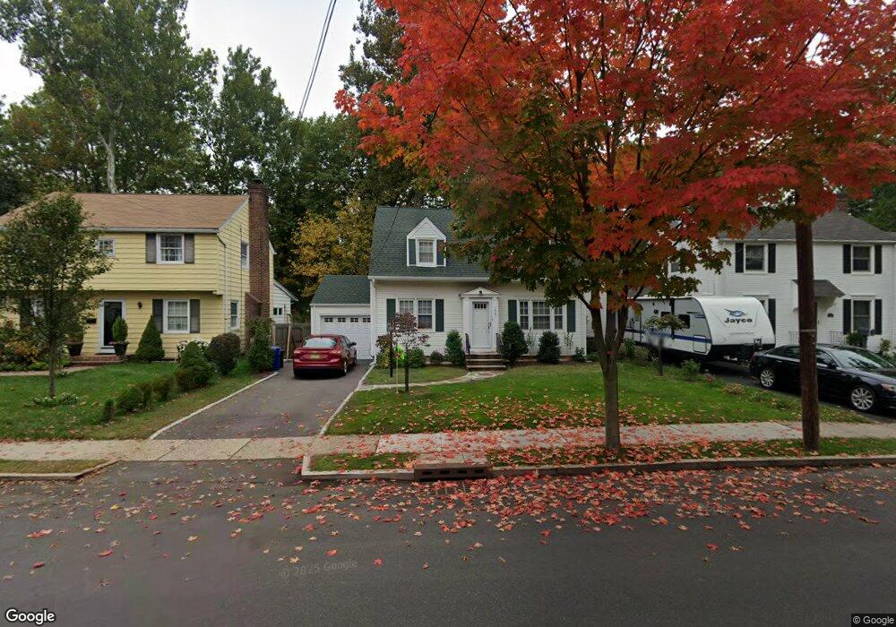
This home is located at 1461 Brookside Dr, Union, NJ 07083 and is currently estimated at $477,222, approximately $477,222 per square foot. 1461 Brookside Dr is a home located in Union County with nearby schools including Livingston Elementary School, Union High School, and St Michael Parish School.
Ownership History
Date
Name
Owned For
Owner Type
Purchase Details
Closed on
Aug 30, 2016
Sold by
Balint Gregory J, Exc
Bought by
Balint Richard and Balint Joseph
Current Estimated Value
Purchase Details
Closed on
Jan 20, 2011
Sold by
Balint Mary
Bought by
Balint Mary
Purchase Details
Closed on
Apr 1, 1998
Sold by
Balint Joseph G and Balint Mary
Bought by
Balint Joseph G and Balint Mary
Create a Home Valuation Report for This Property
The Home Valuation Report is an in-depth analysis detailing your home's value as well as a comparison with similar homes in the area
Home Values in the Area
Average Home Value in this Area
Purchase History
| Date | Buyer | Sale Price | Title Company |
|---|---|---|---|
| Balint Richard | -- | -- | |
| Balint Mary | -- | None Available | |
| Balint Joseph G | -- | -- |
Source: Public Records
Tax History
| Year | Tax Paid | Tax Assessment Tax Assessment Total Assessment is a certain percentage of the fair market value that is determined by local assessors to be the total taxable value of land and additions on the property. | Land | Improvement |
|---|---|---|---|---|
| 2025 | $10,103 | $45,200 | $20,900 | $24,300 |
| 2024 | $9,794 | $45,200 | $20,900 | $24,300 |
| 2023 | $9,794 | $45,200 | $20,900 | $24,300 |
| 2022 | $9,454 | $45,200 | $20,900 | $24,300 |
| 2021 | $9,225 | $45,200 | $20,900 | $24,300 |
| 2020 | $9,041 | $45,200 | $20,900 | $24,300 |
| 2019 | $8,919 | $45,200 | $20,900 | $24,300 |
| 2018 | $8,767 | $45,200 | $20,900 | $24,300 |
| 2017 | $8,638 | $45,200 | $20,900 | $24,300 |
| 2016 | $8,427 | $45,200 | $20,900 | $24,300 |
| 2015 | $8,287 | $45,200 | $20,900 | $24,300 |
| 2014 | $8,102 | $45,200 | $20,900 | $24,300 |
Source: Public Records
Map
Nearby Homes
- 1453 Morris Ave
- 950 Carteret Ave
- 1393 Cornell Place
- 1090 Salem Rd
- 1250 Erhardt St
- 365 Broadwell Ave
- 985 Arnet Ave
- 969 Arnet Ave
- 1611 N Sunset Place
- 875 Salem Rd
- 169 Valley View Rd
- 600 Plymouth Rd
- 292 Crann St
- 542 Leo St
- 564 Chapman St
- 537 Us Highway 22
- 130 Valley View Rd
- 525 Us Highway 22
- 552 Paul St Unit 8
- 1218 Schmidt Ave
- 1457 Brookside Dr
- 1465 Brookside Dr
- 1455 Brookside Dr
- 1471 Brookside Dr
- 1449 Brookside Dr
- 1475 Brookside Dr
- 1045 Norton Rd
- 1456 Brookside Dr
- 1447 Brookside Dr
- 1477 Brookside Dr
- 1041 Norton Rd
- 4 Skyview Rd
- 1466 Brookside Dr
- 1443 Brookside Dr
- 1483 Brookside Dr
- 1039 Norton Rd
- 1083 Azalea Rd
- 40 Skyview Rd
- 8 Skyview Rd
- 1487 Brookside Dr
Your Personal Tour Guide
Ask me questions while you tour the home.