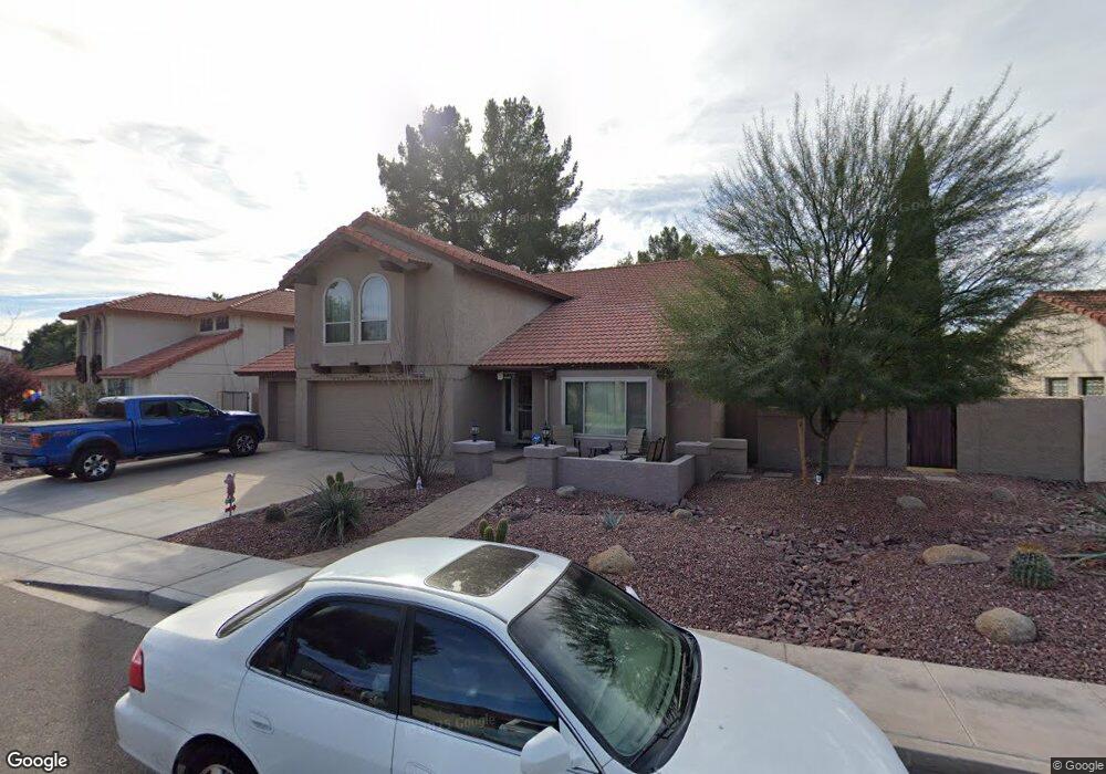
1463 N Desoto St Chandler, AZ 85224
Central Ridge NeighborhoodEstimated Value: $531,470 - $650,000
3
Beds
3
Baths
2,415
Sq Ft
$256/Sq Ft
Est. Value
About This Home
This home is located at 1463 N Desoto St, Chandler, AZ 85224 and is currently estimated at $617,868, approximately $255 per square foot. 1463 N Desoto St is a home located in Maricopa County with nearby schools including Chandler Traditional Academy - Goodman, Andersen Junior High School, and Chandler High School.
Ownership History
Date
Name
Owned For
Owner Type
Purchase Details
Closed on
Nov 19, 2019
Sold by
Gruwell Ashley and Gruwell Victoria A
Bought by
Gruwell Ashley C and Gruwell Victoria A
Current Estimated Value
Purchase Details
Closed on
May 1, 2003
Sold by
Bollenbacher Peter and Tomkins Michelle
Bought by
Gruwell Ashley and Gruwell Victoria A
Home Financials for this Owner
Home Financials are based on the most recent Mortgage that was taken out on this home.
Original Mortgage
$173,600
Outstanding Balance
$75,065
Interest Rate
5.72%
Mortgage Type
New Conventional
Estimated Equity
$542,803
Create a Home Valuation Report for This Property
The Home Valuation Report is an in-depth analysis detailing your home's value as well as a comparison with similar homes in the area
Home Values in the Area
Average Home Value in this Area
Purchase History
| Date | Buyer | Sale Price | Title Company |
|---|---|---|---|
| Gruwell Ashley C | -- | None Available | |
| Gruwell Ashley | $217,000 | Fidelity National Title |
Source: Public Records
Mortgage History
| Date | Status | Borrower | Loan Amount |
|---|---|---|---|
| Open | Gruwell Ashley | $173,600 |
Source: Public Records
Tax History Compared to Growth
Tax History
| Year | Tax Paid | Tax Assessment Tax Assessment Total Assessment is a certain percentage of the fair market value that is determined by local assessors to be the total taxable value of land and additions on the property. | Land | Improvement |
|---|---|---|---|---|
| 2025 | $2,289 | $29,387 | -- | -- |
| 2024 | $2,211 | $27,988 | -- | -- |
| 2023 | $2,211 | $45,030 | $9,000 | $36,030 |
| 2022 | $2,133 | $33,760 | $6,750 | $27,010 |
| 2021 | $2,236 | $31,780 | $6,350 | $25,430 |
| 2020 | $2,226 | $29,870 | $5,970 | $23,900 |
| 2019 | $2,141 | $28,320 | $5,660 | $22,660 |
| 2018 | $2,073 | $27,950 | $5,590 | $22,360 |
| 2017 | $1,932 | $26,400 | $5,280 | $21,120 |
| 2016 | $1,862 | $25,820 | $5,160 | $20,660 |
| 2015 | $1,804 | $23,470 | $4,690 | $18,780 |
Source: Public Records
Map
Nearby Homes
- 2875 W Highland St Unit 1102
- 2875 W Highland St Unit 1190
- 2875 W Highland St Unit 1112
- 2609 W Upland Dr
- 2173 E La Vieve Ln
- 2663 W Estrella Dr
- 1962 N Blackstone Dr
- 2702 W Brooks St
- 3111 W Baylor Ln
- 3165 W Golden Ln
- 2571 W Park Ave
- 2541 W Park Ave
- 2221 W Rockwell Dr
- 2431 W Los Arboles Place
- 2050 N 90th Place
- 1367 N Los Altos Dr
- 2580 W Shannon Ct
- 2007 E Ranch Rd
- 2100 W Lemon Tree Place Unit 29
- 2100 W Lemon Tree Place Unit 78
- 1469 N Desoto St
- 1457 N Desoto St
- 1442 N Woodside Rd
- 1464 N Desoto St
- 1437 N Spire Ct
- 1451 N Desoto St Unit 1
- 1456 N Desoto St
- 1452 N Desoto St
- 1434 N Woodside Rd
- 1449 N Woodside Rd
- 1468 N Woodside Rd
- 1431 N Spire Ct
- 1441 N Woodside Rd
- 1441 N Woodside Rd
- 1445 N Desoto St
- 1438 N Spire Ct
- 1448 N Desoto St
- 1433 N Woodside Rd
- 1426 N Woodside Rd
- 1472 N Woodside Rd