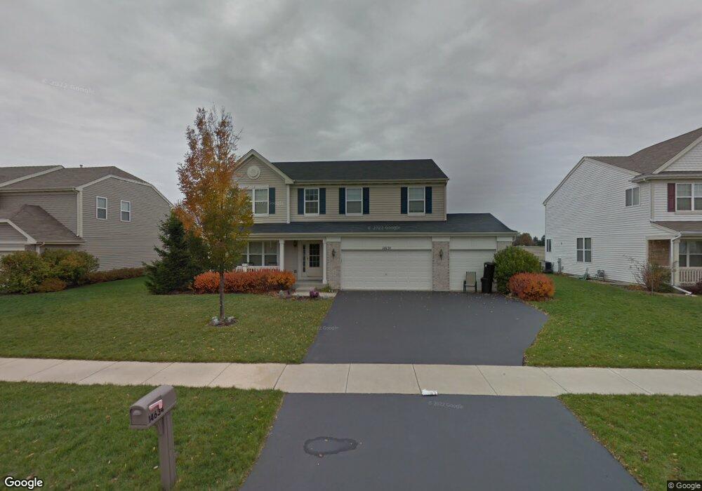
14634 Capital Dr Plainfield, IL 60544
West Plainfield NeighborhoodEstimated Value: $493,000 - $531,000
4
Beds
3
Baths
2,864
Sq Ft
$178/Sq Ft
Est. Value
About This Home
This home is located at 14634 Capital Dr, Plainfield, IL 60544 and is currently estimated at $510,153, approximately $178 per square foot. 14634 Capital Dr is a home located in Will County with nearby schools including Lincoln Elementary School, Richard Ira Jones Middle School, and Plainfield North High School.
Ownership History
Date
Name
Owned For
Owner Type
Purchase Details
Closed on
Aug 14, 2006
Sold by
Drh Cambridge Homes Inc
Bought by
Snedden Justin K and Snedden Teryl A
Current Estimated Value
Home Financials for this Owner
Home Financials are based on the most recent Mortgage that was taken out on this home.
Original Mortgage
$203,640
Outstanding Balance
$122,727
Interest Rate
6.83%
Mortgage Type
Purchase Money Mortgage
Estimated Equity
$387,426
Create a Home Valuation Report for This Property
The Home Valuation Report is an in-depth analysis detailing your home's value as well as a comparison with similar homes in the area
Home Values in the Area
Average Home Value in this Area
Purchase History
| Date | Buyer | Sale Price | Title Company |
|---|---|---|---|
| Snedden Justin K | $310,000 | First American |
Source: Public Records
Mortgage History
| Date | Status | Borrower | Loan Amount |
|---|---|---|---|
| Open | Snedden Justin K | $203,640 |
Source: Public Records
Tax History Compared to Growth
Tax History
| Year | Tax Paid | Tax Assessment Tax Assessment Total Assessment is a certain percentage of the fair market value that is determined by local assessors to be the total taxable value of land and additions on the property. | Land | Improvement |
|---|---|---|---|---|
| 2024 | $9,832 | $141,365 | $30,220 | $111,145 |
| 2023 | $9,832 | $127,678 | $27,294 | $100,384 |
| 2022 | $8,821 | $114,672 | $24,514 | $90,158 |
| 2021 | $8,329 | $107,170 | $22,910 | $84,260 |
| 2020 | $8,209 | $104,129 | $22,260 | $81,869 |
| 2019 | $7,918 | $99,218 | $21,210 | $78,008 |
| 2018 | $7,264 | $89,795 | $19,730 | $70,065 |
| 2017 | $7,035 | $85,332 | $18,749 | $66,583 |
| 2016 | $6,857 | $81,385 | $17,882 | $63,503 |
| 2015 | $6,397 | $76,239 | $16,751 | $59,488 |
| 2014 | $6,397 | $73,548 | $16,160 | $57,388 |
| 2013 | $6,397 | $73,548 | $16,160 | $57,388 |
Source: Public Records
Map
Nearby Homes
- 14633 S Greenbriar Dr
- 14627 S Greenbriar Dr
- 14615 S Greenbriar Dr
- 14749 S Greenbriar Dr
- 14755 S Greenbriar Dr
- 14761 S Greenbriar Dr
- 14801 S Greenbriar Dr
- 25309 Federal Cir
- 14807 S Greenbriar Dr
- 25531 Sandalwood Ln
- 14712 S Azalia Cir
- 14704 S Azalia Cir
- 14664 S Azalia Cir
- 14813 S Greenbriar Dr
- 14660 W Azalia Cir
- 14700 S Azalia Cir
- 14700 W Azalia Cir
- 14704 W Azalia Cir
- 14712 W Azalia Cir
- 14708 S Azalia Cir
- 14628 Capital Dr
- 14640 Capital Dr
- 14622 Capital Dr
- 14646 Capital Dr
- 25333 Gettysburg Rd Unit 5
- 14641 Capital Dr Unit 5
- 14616 Capital Dr
- 14706 Capital Dr
- 14647 Capital Dr
- 25332 Gettysburg Rd
- 25327 Gettysburg Rd
- 14610 Capital Dr
- 14707 Capital Dr
- 14712 Capital Dr
- 25326 Gettysburg Rd
- 25321 Gettysburg Rd
- 14502 Colonial Pkwy
- 14713 Capital Dr Unit 5
- 14604 Capital Dr
- 14718 Capital Dr