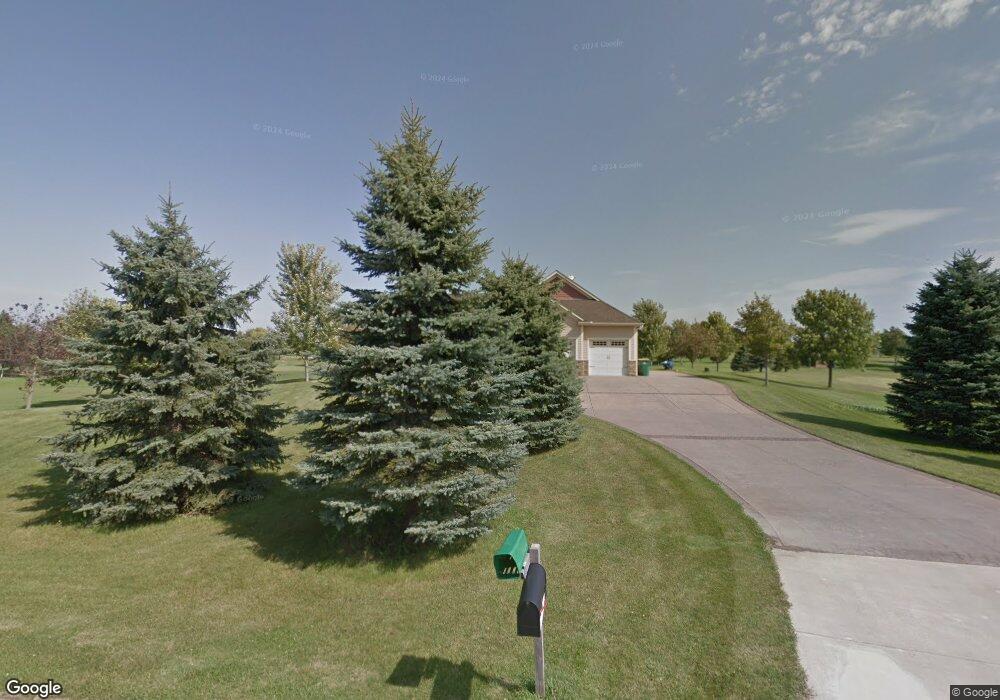
14660 Furlong Cir Hastings, MN 55033
Estimated Value: $620,000 - $773,000
2
Beds
3
Baths
2,067
Sq Ft
$335/Sq Ft
Est. Value
About This Home
This home is located at 14660 Furlong Cir, Hastings, MN 55033 and is currently estimated at $691,819, approximately $334 per square foot. 14660 Furlong Cir is a home located in Dakota County with nearby schools including Christa Mcauliffe Elementary School, Hastings Middle School, and Hastings High School.
Ownership History
Date
Name
Owned For
Owner Type
Purchase Details
Closed on
Apr 8, 2015
Sold by
Wilmer David P and Wilmer Diane C
Bought by
Johnke Neil and Johnke Jaci
Current Estimated Value
Home Financials for this Owner
Home Financials are based on the most recent Mortgage that was taken out on this home.
Original Mortgage
$140,000
Interest Rate
3.73%
Mortgage Type
New Conventional
Purchase Details
Closed on
May 22, 2009
Sold by
Bac Home Loan Servicing Lp
Bought by
Wilmer David P and Wilmer Diane C
Purchase Details
Closed on
Nov 5, 2004
Sold by
Thomas M & Carrie A Furlong Living Trust
Bought by
Myrlie Jason
Create a Home Valuation Report for This Property
The Home Valuation Report is an in-depth analysis detailing your home's value as well as a comparison with similar homes in the area
Home Values in the Area
Average Home Value in this Area
Purchase History
| Date | Buyer | Sale Price | Title Company |
|---|---|---|---|
| Johnke Neil | $381,500 | Burnet Title | |
| Wilmer David P | $325,000 | -- | |
| Myrlie Jason | $160,000 | -- |
Source: Public Records
Mortgage History
| Date | Status | Borrower | Loan Amount |
|---|---|---|---|
| Closed | Johnke Neil | $140,000 |
Source: Public Records
Tax History Compared to Growth
Tax History
| Year | Tax Paid | Tax Assessment Tax Assessment Total Assessment is a certain percentage of the fair market value that is determined by local assessors to be the total taxable value of land and additions on the property. | Land | Improvement |
|---|---|---|---|---|
| 2024 | $4,966 | $667,500 | $186,700 | $480,800 |
| 2023 | $4,966 | $664,500 | $186,700 | $477,800 |
| 2022 | $4,592 | $656,600 | $186,600 | $470,000 |
| 2021 | $4,546 | $585,200 | $169,700 | $415,500 |
| 2020 | $4,328 | $559,900 | $161,600 | $398,300 |
| 2019 | $4,076 | $512,500 | $153,900 | $358,600 |
| 2018 | $4,093 | $455,800 | $146,600 | $309,200 |
| 2017 | $3,833 | $439,300 | $139,600 | $299,700 |
| 2016 | $4,161 | $411,400 | $140,200 | $271,200 |
| 2015 | -- | $437,400 | $140,200 | $297,200 |
| 2014 | -- | $407,916 | $131,244 | $276,672 |
| 2013 | -- | $356,141 | $117,332 | $238,809 |
Source: Public Records
Map
Nearby Homes
- 13551 Idell Ave
- 11973 Grey Cloud Trail S
- 1967 Sierra Dr Unit 303
- 1960 Rose Way
- 1924 Rose Way Unit 609
- 2109 Westpointe Dr
- 2725 General Sieben Dr
- 2117 Westpointe Dr
- 2157 Westpointe Dr
- 2173 Westpointe Dr
- 2189 Westpointe Dr
- 2160 Ridge Pointe Dr
- 1832 Ridgepointe N
- 2120 Ridge Pointe Dr
- 1817 Ridgepointe Ct
- 1824 Fallbrooke Dr
- 1821 Fallbrooke Dr
- 1478 Pringle Ct
- Alley Plan at Heritage Ridge
- Hudson Plan at Heritage Ridge
- 14660 14660 Furlong Cir
- xx2 Furlong Cir
- 14650 Furlong Cir
- 14670 Furlong Cir
- 14640 Furlong Cir
- 14676 Fischer Ave
- 14690 Furlong Cir
- 14700 Furlong Cir
- 14710 Furlong Cir
- 6601 Courthouse Blvd
- 6675 Courthouse Blvd
- XXXX Hastings Trail
- 6830 Courthouse Blvd
- 14040 Furlong Trail
- 14034 Furlong Trail
- 14140 Furlong Trail
- 14120 Furlong Trail
- 14028 Furlong Trail
- 14028 Furlong Trail
- 14090 Furlong Trail