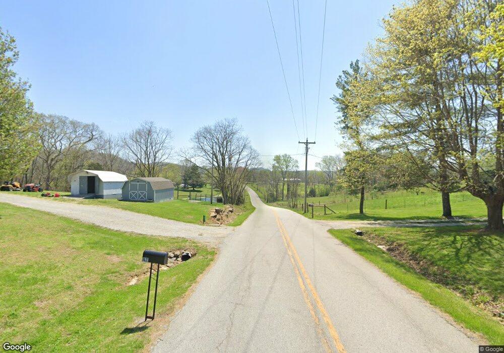
1467 E Level Green Rd Brodhead, KY 40409
Estimated Value: $161,000 - $222,000
3
Beds
1
Bath
1,656
Sq Ft
$115/Sq Ft
Est. Value
About This Home
This home is located at 1467 E Level Green Rd, Brodhead, KY 40409 and is currently estimated at $190,366, approximately $114 per square foot. 1467 E Level Green Rd is a home located in Rockcastle County with nearby schools including Rockcastle County High School.
Ownership History
Date
Name
Owned For
Owner Type
Purchase Details
Closed on
Jul 4, 2022
Sold by
Lovell William and Lovell Marcella
Bought by
Lovell Brent and Lovell Lauryn
Current Estimated Value
Purchase Details
Closed on
Dec 27, 2016
Sold by
Falin Rachel and Falin Wesley
Bought by
Robbins James C
Purchase Details
Closed on
Jun 14, 2008
Sold by
Childress Mary Ann and Childress Rickie D
Bought by
Childress Rickie D
Home Financials for this Owner
Home Financials are based on the most recent Mortgage that was taken out on this home.
Original Mortgage
$69,600
Interest Rate
5.97%
Mortgage Type
New Conventional
Create a Home Valuation Report for This Property
The Home Valuation Report is an in-depth analysis detailing your home's value as well as a comparison with similar homes in the area
Home Values in the Area
Average Home Value in this Area
Purchase History
| Date | Buyer | Sale Price | Title Company |
|---|---|---|---|
| Lovell Brent | -- | -- | |
| Lovell Brent | -- | None Listed On Document | |
| Robbins James C | $85,000 | None Available | |
| Childress Rickie D | -- | None Available |
Source: Public Records
Mortgage History
| Date | Status | Borrower | Loan Amount |
|---|---|---|---|
| Previous Owner | Childress Rickie D | $69,600 |
Source: Public Records
Tax History Compared to Growth
Tax History
| Year | Tax Paid | Tax Assessment Tax Assessment Total Assessment is a certain percentage of the fair market value that is determined by local assessors to be the total taxable value of land and additions on the property. | Land | Improvement |
|---|---|---|---|---|
| 2024 | $860 | $105,000 | $0 | $0 |
| 2023 | $869 | $105,000 | $0 | $0 |
| 2022 | $698 | $85,000 | $0 | $0 |
| 2021 | $703 | $85,000 | $0 | $0 |
| 2020 | $703 | $85,000 | $0 | $0 |
| 2019 | $698 | $85,000 | $0 | $0 |
| 2018 | $696 | $85,000 | $0 | $0 |
| 2017 | $692 | $85,000 | $0 | $0 |
| 2016 | $700 | $87,900 | $0 | $0 |
| 2015 | -- | $87,900 | $0 | $0 |
| 2010 | -- | $87,000 | $0 | $0 |
Source: Public Records
Map
Nearby Homes
- 403 Bandy Rd
- 305 Lone Oak Rd
- 999 Shug Rd
- 4265 Willailla Rd
- 120 James Latham Rd
- 50 James Latham Rd
- 388 Rolling Hills Rd
- 7375 Kentucky 461
- 6939 Kentucky 461
- 200 Maxwell Ln
- 999-B Spiro Rd
- 999-A Spiro Rd
- 999 Spiro Rd
- 205 Willowtree Ln
- 16935 Kentucky 39
- 4560 Hwy 934
- 49 Solar Dr
- 44 Solar Dr
- 9835 Kentucky 328
- 23 Pokeberry Ln
- 1521 E Level Green Rd
- 1603 E Level Green Rd
- 1187 E Level Green Rd
- 1187 E Level Green Rd
- 1103 E Level Green Rd
- 1621 E Level Green Rd
- 1779 E Level Green Rd
- 1741 E Level Green Rd
- 1778 E Level Green Rd
- 1603 E Level Green Rd
- 2007 E Level Green Rd
- 1037 E Level Green Rd
- 3062 Wabd Jones Rd
- 2854 Wabd Jones Rd
- 360 Richlands Rd
- 360 Richlands Rd
- 2226 E Level Green Rd
- 2226 E Level Green Rd
- 2738 Wabd Jones Rd
- 2626 Wabd Jones Rd
