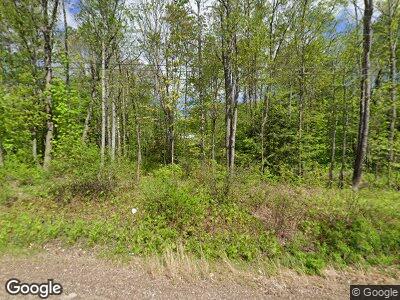
1467 Lewiston Rd Litchfield, ME 04350
Estimated Value: $257,937 - $367,000
--
Bed
--
Bath
1,040
Sq Ft
$285/Sq Ft
Est. Value
About This Home
This home is located at 1467 Lewiston Rd, Litchfield, ME 04350 and is currently estimated at $296,734, approximately $285 per square foot. 1467 Lewiston Rd is a home located in Kennebec County with nearby schools including Libby-Tozier School, Sabattus Primary School, and Carrie Ricker School.
Ownership History
Date
Name
Owned For
Owner Type
Purchase Details
Closed on
Jan 27, 2020
Sold by
Dumais Dorothy E
Bought by
Daggett John L and Daggett Rita A
Current Estimated Value
Create a Home Valuation Report for This Property
The Home Valuation Report is an in-depth analysis detailing your home's value as well as a comparison with similar homes in the area
Home Values in the Area
Average Home Value in this Area
Purchase History
| Date | Buyer | Sale Price | Title Company |
|---|---|---|---|
| Daggett John L | -- | None Available | |
| Daggett John L | -- | None Available | |
| Dumais Dorothy E | -- | None Available | |
| Dumais Dorothy E | -- | None Available |
Source: Public Records
Mortgage History
| Date | Status | Borrower | Loan Amount |
|---|---|---|---|
| Open | Daggett John L | $45,000 | |
| Open | Daggett John L | $154,672 | |
| Previous Owner | Daggett John L | $172,800 |
Source: Public Records
Tax History Compared to Growth
Tax History
| Year | Tax Paid | Tax Assessment Tax Assessment Total Assessment is a certain percentage of the fair market value that is determined by local assessors to be the total taxable value of land and additions on the property. | Land | Improvement |
|---|---|---|---|---|
| 2024 | $3,149 | $221,000 | $57,600 | $163,400 |
| 2023 | $2,984 | $221,000 | $57,600 | $163,400 |
| 2022 | $2,896 | $184,200 | $48,000 | $136,200 |
| 2021 | $2,603 | $184,200 | $48,000 | $136,200 |
| 2020 | $2,616 | $184,200 | $48,000 | $136,200 |
| 2019 | $2,579 | $184,200 | $48,000 | $136,200 |
| 2018 | $2,887 | $178,787 | $42,500 | $136,287 |
| 2017 | $2,914 | $180,460 | $42,500 | $137,960 |
| 2016 | $2,914 | $180,460 | $42,500 | $137,960 |
| 2015 | $2,809 | $180,628 | $42,500 | $138,128 |
| 2014 | $2,595 | $182,135 | $42,500 | $139,635 |
| 2013 | $2,242 | $182,303 | $42,500 | $139,803 |
Source: Public Records
Map
Nearby Homes
- 47 Fickett Dr
- 0 Route 9-126 Litchfield Dr Unit 1604469
- 0 Rd Unit 1590643
- 86-A Kenway Dr
- 69 Scott Dr
- 1363 Hallowell Rd
- 20 Lucien Ln
- 12 Cattail Ln
- 75 Grant Rd
- 18 Garland Lane Extension
- 1161 Hallowell Litchfield Rd
- TBD Woods Rd
- 88 Woodland Dr
- TBD Woodland Dr
- 485 Peacepipe Dr Unit B
- 1335 High St
- 30 Pamrok Ln
- 106 Frost Dr
- 51 Forest Ln
- 11 Balsam Ln
- 1467 Lewiston Rd
- 1458 Lewiston Rd
- 17 Hideaway Ln
- 1 Hideaway Ln
- 1493 Lewiston Rd
- 1479 Lewiston Rd
- 1864 Hallowell Rd
- 25 Dennis Hill Rd
- 17 Dennis Hill Rd
- 11 Dennis Hill Rd
- 0 Dennis Hill Unit 499515
- 0 Dennis Hill Rd Unit 254781
- 0 Dennis Hill Unit 853651
- 0 Dennis Hill Rd Unit 204564
- 0 Dennis Hill Unit 408843
- 0 Dennis Hill Unit 408395
- 0 Dennis Hill Unit 771497
- 0 Dennis Hill Unit 545527
- 0 Dennis Hill Unit 928052
- 0 Dennis Hill Rd Unit 974292
