Estimated Value: $194,985 - $211,000
3
Beds
2
Baths
1,858
Sq Ft
$109/Sq Ft
Est. Value
About This Home
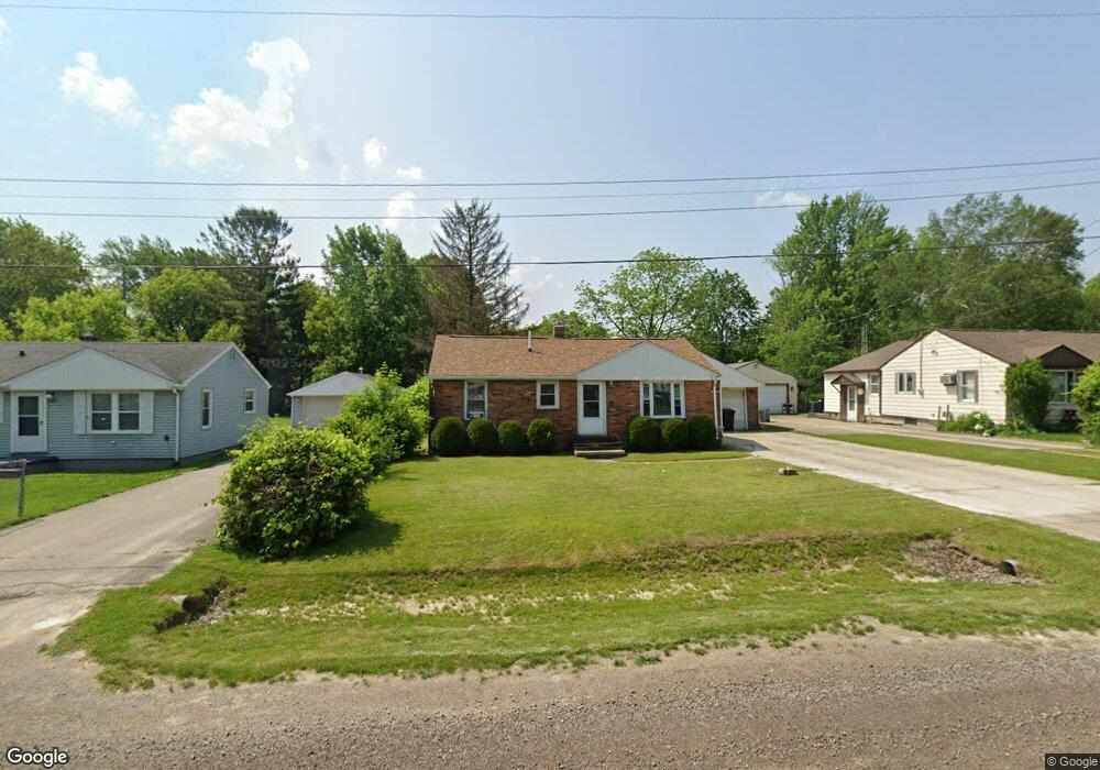
This home is located at 1467 Mark St, Flint, MI 48507 and is currently estimated at $203,246, approximately $109 per square foot. 1467 Mark St is a home located in Genesee County with nearby schools including Carman-Ainsworth High School.
Ownership History
Date
Name
Owned For
Owner Type
Purchase Details
Closed on
Jan 20, 2010
Sold by
Zintsmaster John A
Bought by
Windsor Mary
Current Estimated Value
Home Financials for this Owner
Home Financials are based on the most recent Mortgage that was taken out on this home.
Original Mortgage
$30,400
Outstanding Balance
$20,101
Interest Rate
5.09%
Mortgage Type
New Conventional
Estimated Equity
$183,145
Purchase Details
Closed on
Jul 10, 2009
Sold by
Pepitone Victoria
Bought by
Zintsmaster John A
Purchase Details
Closed on
Jul 3, 2008
Sold by
Us Bank Na
Bought by
Pepitone Victoria
Purchase Details
Closed on
Apr 27, 2007
Sold by
Luscomb Charles Henry and Luscomb Carol S
Bought by
Us Bank Na and Structured Asset Investment Loan Trust 2
Create a Home Valuation Report for This Property
The Home Valuation Report is an in-depth analysis detailing your home's value as well as a comparison with similar homes in the area
Home Values in the Area
Average Home Value in this Area
Purchase History
| Date | Buyer | Sale Price | Title Company |
|---|---|---|---|
| Windsor Mary | $38,000 | Sky Title Agency | |
| Zintsmaster John A | -- | None Available | |
| Griffin Kristen L | -- | First American Title Ins Co | |
| Zintsmaster John A | -- | None Available | |
| Pepitone Victoria | $20,000 | Attorneys Title | |
| Us Bank Na | $115,656 | None Available |
Source: Public Records
Mortgage History
| Date | Status | Borrower | Loan Amount |
|---|---|---|---|
| Open | Griffin Kristen L | $30,400 | |
| Closed | Zintsmaster John A | $30,400 |
Source: Public Records
Tax History
| Year | Tax Paid | Tax Assessment Tax Assessment Total Assessment is a certain percentage of the fair market value that is determined by local assessors to be the total taxable value of land and additions on the property. | Land | Improvement |
|---|---|---|---|---|
| 2025 | $2,559 | $108,600 | $0 | $0 |
| 2024 | $1,309 | $104,400 | $0 | $0 |
| 2023 | $1,353 | $87,200 | $0 | $0 |
| 2022 | $1,109 | $63,700 | $0 | $0 |
| 2021 | $2,144 | $56,000 | $0 | $0 |
| 2020 | $1,088 | $47,500 | $0 | $0 |
| 2019 | $1,075 | $42,400 | $0 | $0 |
| 2018 | $2,060 | $38,900 | $0 | $0 |
| 2017 | $2,208 | $38,900 | $0 | $0 |
| 2016 | $2,051 | $38,100 | $0 | $0 |
| 2015 | $1,438 | $37,800 | $0 | $0 |
| 2014 | $853 | $36,100 | $0 | $0 |
| 2012 | -- | $36,300 | $36,300 | $0 |
Source: Public Records
Map
Nearby Homes
- 1489 Maria St
- 4139 Moulton Dr
- G4203 van Slyke Rd
- 1508 W Bristol Rd
- 1408 Williamsburg Rd
- 2077 Kingswood Dr
- 1151 Bristol Rd
- 2029 Gerard St
- 1446 Stephens Ave
- 4444 Carmanwood Dr
- 1203 Pickwick Place
- 1111 W Mclean Ave
- 1119 W Bergin Ave
- 1121 W Boatfield Ave
- 4462 Westmont Dr
- 1097 W Buder Ave
- 1111 Trotwood Ln
- 1085 W Parkwood Ave
- 4460 Bristolwood Dr
- 1051 W Mclean Ave
Your Personal Tour Guide
Ask me questions while you tour the home.