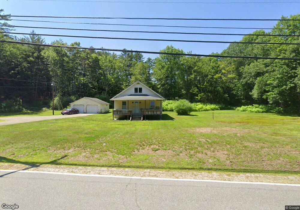
1467 Us Route 3 Campton, NH 03223
Estimated Value: $268,000 - $370,000
2
Beds
1
Bath
1,423
Sq Ft
$237/Sq Ft
Est. Value
About This Home
This home is located at 1467 Us Route 3, Campton, NH 03223 and is currently estimated at $337,920, approximately $237 per square foot. 1467 Us Route 3 is a home located in Grafton County with nearby schools including Campton Elementary School, Plymouth Regional High School, and Mount Prospect Academy.
Ownership History
Date
Name
Owned For
Owner Type
Purchase Details
Closed on
Feb 27, 1998
Sold by
Dearborn Est George H
Bought by
Clogston James L
Current Estimated Value
Home Financials for this Owner
Home Financials are based on the most recent Mortgage that was taken out on this home.
Original Mortgage
$14,000
Outstanding Balance
$2,523
Interest Rate
6.85%
Estimated Equity
$335,397
Create a Home Valuation Report for This Property
The Home Valuation Report is an in-depth analysis detailing your home's value as well as a comparison with similar homes in the area
Home Values in the Area
Average Home Value in this Area
Purchase History
| Date | Buyer | Sale Price | Title Company |
|---|---|---|---|
| Clogston James L | $67,900 | -- |
Source: Public Records
Mortgage History
| Date | Status | Borrower | Loan Amount |
|---|---|---|---|
| Open | Clogston James L | $14,000 |
Source: Public Records
Tax History Compared to Growth
Tax History
| Year | Tax Paid | Tax Assessment Tax Assessment Total Assessment is a certain percentage of the fair market value that is determined by local assessors to be the total taxable value of land and additions on the property. | Land | Improvement |
|---|---|---|---|---|
| 2024 | $5,552 | $322,400 | $145,000 | $177,400 |
| 2023 | $5,193 | $180,500 | $69,000 | $111,500 |
| 2022 | $4,561 | $180,500 | $69,000 | $111,500 |
| 2021 | $4,507 | $180,500 | $69,000 | $111,500 |
| 2020 | $4,373 | $180,200 | $69,000 | $111,200 |
| 2019 | $4,182 | $180,200 | $69,000 | $111,200 |
| 2018 | $4,026 | $157,700 | $55,000 | $102,700 |
| 2017 | $3,911 | $157,700 | $55,000 | $102,700 |
| 2016 | $3,767 | $157,700 | $55,000 | $102,700 |
| 2015 | $3,636 | $158,700 | $55,000 | $103,700 |
| 2014 | $3,723 | $158,700 | $55,000 | $103,700 |
| 2013 | $3,494 | $174,800 | $57,400 | $117,400 |
Source: Public Records
Map
Nearby Homes
- 5 Wildwood Dr
- 71 Carla Ct
- Lot 15 Kelly Way
- 10-6 Page Rd
- 0 Lower Beech Hill Rd Unit 5029667
- 73 Ellsworth Hill Rd
- 4 Seven Sisters Cir
- 72 Crescent St
- 20 Wildflower Ln Unit 208-97-9-2
- 20 Wildflower Ln Unit 208-97-9-1
- 18 Wildflower Ln Unit 208-97-8-01
- 51 Turkey Jim Rd
- 172 Merrill Rd
- 23 Cider Mill Dr
- 90 Sunset Cir
- 8 Avery Rd
- 311 Ellsworth Hill Rd
- 14 Heritage Hill Rd
- 000 Smith Rd Unit 2
- 000 Smith Rd
- 1472 Us Route 3
- 1475 Us Route 3
- 1475 Us Route 3
- 1459 Us Route 3
- 1459 U S 3
- 1451 Us Route 3
- 40 Red Sleigh Rd Unit 21
- 40 Red Sleigh Rd Unit 28
- 40 Red Sleigh Rd Unit 26
- 40 Red Sleigh Rd Unit 30
- 40 Red Sleigh Rd Unit 22
- 40 Red Sleigh Rd Unit 24
- 40 Red Sleigh Rd Unit 25
- 40 Red Sleigh Rd Unit 26 & 27
- 40 Red Sleigh Rd Unit 28 & 29
- 5 Red Sleigh Rd Unit 22 & 23
- 40 Red Sleigh Rd Unit s 21 thru 30
- 1482 Us Route 3
- 1487 Us Route 3
- 1487 Us Route 3