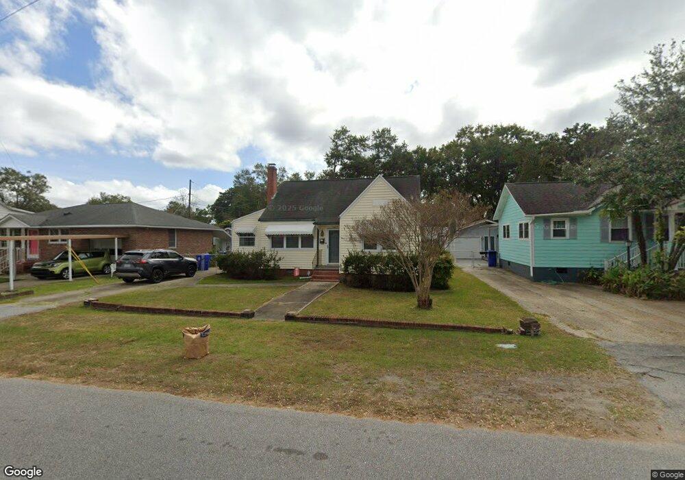
1467 Wando Rd North Charleston, SC 29405
Park Circle NeighborhoodEstimated Value: $361,000 - $484,000
2
Beds
1
Bath
1,000
Sq Ft
$413/Sq Ft
Est. Value
About This Home
This home is located at 1467 Wando Rd, North Charleston, SC 29405 and is currently estimated at $413,306, approximately $413 per square foot. 1467 Wando Rd is a home located in Charleston County with nearby schools including North Charleston Elementary School, Morningside Middle, and North Charleston High.
Ownership History
Date
Name
Owned For
Owner Type
Purchase Details
Closed on
Sep 24, 2015
Sold by
Hiott Bobby Lee and Hiott Cynthia C
Bought by
Hiott Bobby Lee and Hiott Cynthia C
Current Estimated Value
Purchase Details
Closed on
Nov 8, 2013
Sold by
Hiott Bobby Lee and Hiott Cynthia C
Bought by
Hiott Bobby Lee and Hiott Cynthia C
Purchase Details
Closed on
Apr 7, 2011
Sold by
Hiott Bobby Lee and Hiott Cynthia C
Bought by
Hiott Bobby Lee and Hiott Cynthia C
Purchase Details
Closed on
Jul 15, 2002
Sold by
Hawkins John W As Trustee
Bought by
Hiott Bobby Lee and Hiott Cynthia C
Create a Home Valuation Report for This Property
The Home Valuation Report is an in-depth analysis detailing your home's value as well as a comparison with similar homes in the area
Home Values in the Area
Average Home Value in this Area
Purchase History
| Date | Buyer | Sale Price | Title Company |
|---|---|---|---|
| Hiott Bobby Lee | -- | -- | |
| Hiott Bobby Lee | -- | -- | |
| Hiott Bobby Lee | -- | -- | |
| Hiott Bobby Lee | $58,000 | Lowcountry Title Services Ll |
Source: Public Records
Tax History Compared to Growth
Tax History
| Year | Tax Paid | Tax Assessment Tax Assessment Total Assessment is a certain percentage of the fair market value that is determined by local assessors to be the total taxable value of land and additions on the property. | Land | Improvement |
|---|---|---|---|---|
| 2024 | $2,153 | $6,640 | $0 | $0 |
| 2023 | $2,153 | $6,640 | $0 | $0 |
| 2022 | $2,008 | $6,640 | $0 | $0 |
| 2021 | $1,992 | $6,640 | $0 | $0 |
| 2020 | $1,976 | $6,640 | $0 | $0 |
| 2019 | $1,802 | $5,780 | $0 | $0 |
| 2017 | $1,697 | $5,780 | $0 | $0 |
| 2016 | $1,648 | $5,780 | $0 | $0 |
| 2015 | $1,596 | $5,780 | $0 | $0 |
| 2014 | $1,380 | $0 | $0 | $0 |
| 2011 | -- | $0 | $0 | $0 |
Source: Public Records
Map
Nearby Homes
- 4805 Berckman Rd
- 1657 E Montague Ave
- 4923 Parkside Dr
- 4737 Marlboro Rd
- 4745 Churchill Rd
- 4915 Ashby Ave
- 4714 Marlboro Rd
- 1514 Cuyler Ln
- 4625 Durant Ave
- 4543 Mixson Ave
- 4587 Summey St
- 4577 Summey St
- 5158 E Liberty Park Cir
- 4968 Victoria Ave
- 5304 E Dolphin St
- 1213 Chesterfield Rd
- 4566 Durant Ave
- 4942 W Liberty Park Cir
- 4530 Holly St
- 1181 Park Place S
- 1461 Wando Rd
- 4856 Mixson Ave
- 4850 Mixson Ave
- 1455 Wando Rd
- 1455 Wando Rd
- 4846 Mixson Ave
- 1449 Wando Rd
- 4813 Berckman Rd
- 4834 Mixson Ave
- 4811 Berckman Rd
- 4815 Berckman Rd
- 4809 Berckman Rd
- 4807 Berckman Rd
- 4820 Mixson Ave
- 1431 Wando Rd
- 4803 Berckman Rd
- 4873 Williams Ave
- 4867 Williams Ave
- 4857 Williams Ave
- 4820 Berckman Rd