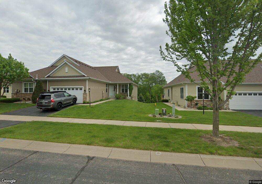
1468 Riverpointe Rd Watertown, MN 55388
Estimated Value: $298,000 - $418,302
3
Beds
3
Baths
1,601
Sq Ft
$235/Sq Ft
Est. Value
About This Home
This home is located at 1468 Riverpointe Rd, Watertown, MN 55388 and is currently estimated at $376,576, approximately $235 per square foot. 1468 Riverpointe Rd is a home located in Carver County with nearby schools including Watertown-Mayer Elementary School, Watertown-Mayer Middle School, and Watertown Mayer High School.
Ownership History
Date
Name
Owned For
Owner Type
Purchase Details
Closed on
Jan 30, 2008
Sold by
Donnays Riverpointe Trails Llc
Bought by
Holmes Darrel S
Current Estimated Value
Home Financials for this Owner
Home Financials are based on the most recent Mortgage that was taken out on this home.
Original Mortgage
$185,000
Outstanding Balance
$116,998
Interest Rate
6.11%
Mortgage Type
New Conventional
Estimated Equity
$259,578
Create a Home Valuation Report for This Property
The Home Valuation Report is an in-depth analysis detailing your home's value as well as a comparison with similar homes in the area
Home Values in the Area
Average Home Value in this Area
Purchase History
| Date | Buyer | Sale Price | Title Company |
|---|---|---|---|
| Holmes Darrel S | $237,930 | -- |
Source: Public Records
Mortgage History
| Date | Status | Borrower | Loan Amount |
|---|---|---|---|
| Open | Holmes Darrel S | $185,000 |
Source: Public Records
Tax History Compared to Growth
Tax History
| Year | Tax Paid | Tax Assessment Tax Assessment Total Assessment is a certain percentage of the fair market value that is determined by local assessors to be the total taxable value of land and additions on the property. | Land | Improvement |
|---|---|---|---|---|
| 2025 | $4,558 | $398,500 | $85,000 | $313,500 |
| 2024 | $4,496 | $373,500 | $60,000 | $313,500 |
| 2023 | $4,374 | $373,500 | $60,000 | $313,500 |
| 2022 | $4,206 | $370,400 | $56,300 | $314,100 |
| 2021 | $4,102 | $285,400 | $37,800 | $247,600 |
| 2020 | $4,084 | $273,500 | $37,800 | $235,700 |
| 2019 | $3,880 | $270,500 | $36,000 | $234,500 |
| 2018 | $3,604 | $270,500 | $36,000 | $234,500 |
| 2017 | $3,164 | $239,500 | $32,600 | $206,900 |
| 2016 | $3,180 | $194,300 | $0 | $0 |
| 2015 | $2,234 | $153,100 | $0 | $0 |
| 2014 | $2,234 | $121,500 | $0 | $0 |
Source: Public Records
Map
Nearby Homes
- 555 Industrial Blvd
- 536 Industrial Blvd
- 575 Industrial Blvd
- 516 Industrial Blvd
- 1290 Knight Ln
- 1221 Bishop Cir
- 1201 Bishop Cir
- 829 Reo Rd
- XXX Newton Ave SE
- 600 Jefferson Ave SW
- 865 Quail Ct
- 408 Franklin Ave SW
- 313 Angel Ave SW
- xxx Stevens St SW
- 593 Sienna Dr
- 578 Sienna Dr
- 605 Stevens St SW Unit 43
- 604 White St SW Unit 35
- 604 White St SW
- 115 Riverside Terrace Dr Unit 115
- 1466 Riverpointe Rd
- 1466 1466 River Pointe Rd
- 1474 Riverpointe Rd
- 1476 Riverpointe Rd
- XXX Riverpointe Rd
- 1456 Riverpointe Rd
- 1433 Riverpointe Rd
- 1427 Riverpointe Rd
- 1454 Riverpointe Rd
- 1454 1454 River Pointe Rd
- 1486 Riverpointe Rd
- 1473 Riverpointe Rd
- 1485 Riverpointe Road D
- 1446 1446 Riverpointe Rd
- 1446 Riverpointe Rd
- 1453 Riverpointe Rd
- 1455 Riverpointe Rd
- 1488 Riverpointe Rd
- 1442 Riverpointe Rd
- 1475 Riverpointe Rd