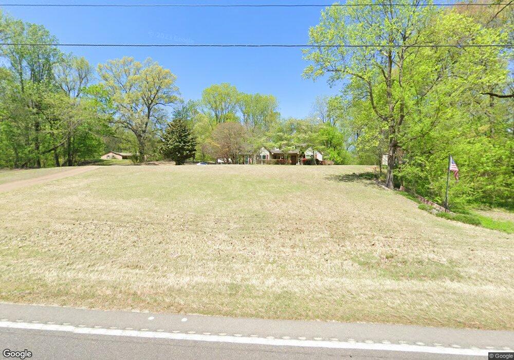
14686 State Route 59 W Drummonds, TN 38023
Estimated Value: $249,481 - $305,000
--
Bed
--
Bath
1,968
Sq Ft
$135/Sq Ft
Est. Value
About This Home
This home is located at 14686 State Route 59 W, Drummonds, TN 38023 and is currently estimated at $265,120, approximately $134 per square foot. 14686 State Route 59 W is a home with nearby schools including Brighton Elementary School, Brighton Middle School, and Brighton High School.
Ownership History
Date
Name
Owned For
Owner Type
Purchase Details
Closed on
Jan 30, 1991
Bought by
Rodgers Larry G and Rodgers Marcia E
Current Estimated Value
Purchase Details
Closed on
Sep 20, 1990
Bought by
Secretary Of Housing & Urban Development
Purchase Details
Closed on
Aug 23, 1990
Bought by
First Tennessee Na
Purchase Details
Closed on
May 19, 1989
Bought by
Hill Dan W and Hill Debbie
Purchase Details
Closed on
Jun 20, 1985
Bought by
Bowers Donald and Bowers Kay
Create a Home Valuation Report for This Property
The Home Valuation Report is an in-depth analysis detailing your home's value as well as a comparison with similar homes in the area
Home Values in the Area
Average Home Value in this Area
Purchase History
| Date | Buyer | Sale Price | Title Company |
|---|---|---|---|
| Rodgers Larry G | $79,200 | -- | |
| Secretary Of Housing & Urban Development | -- | -- | |
| First Tennessee Na | $77,900 | -- | |
| Hill Dan W | $92,500 | -- | |
| Bowers Donald | -- | -- |
Source: Public Records
Tax History Compared to Growth
Tax History
| Year | Tax Paid | Tax Assessment Tax Assessment Total Assessment is a certain percentage of the fair market value that is determined by local assessors to be the total taxable value of land and additions on the property. | Land | Improvement |
|---|---|---|---|---|
| 2024 | $887 | $58,300 | $6,575 | $51,725 |
| 2023 | $887 | $58,300 | $6,575 | $51,725 |
| 2022 | $839 | $41,125 | $4,825 | $36,300 |
| 2021 | $839 | $41,125 | $4,825 | $36,300 |
| 2020 | $839 | $41,125 | $4,825 | $36,300 |
| 2019 | $782 | $32,300 | $4,475 | $27,825 |
| 2018 | $782 | $32,300 | $4,475 | $27,825 |
| 2017 | $782 | $32,300 | $4,475 | $27,825 |
| 2016 | $782 | $32,300 | $4,475 | $27,825 |
| 2015 | $781 | $32,300 | $4,475 | $27,825 |
| 2014 | $765 | $31,641 | $0 | $0 |
Source: Public Records
Map
Nearby Homes
- 0 Dolan Rd Unit 10206733
- 630 Glen Springs Rd
- 8539 Campground Rd
- 0000 Bowers Rd
- 2664 Glen Springs Rd
- 0 Richardson Landing Rd Unit 10207422
- 0 Richardson Landing Rd Unit LotWP000 16969392
- 0 Richardson Landing Rd Unit 10161338
- 340 Lillie Ln
- 05 Richardson Landing Rd
- 8508 Campground Rd
- 97 Richardson Lake Dr
- 59 Pryor Rd
- 951 Sloan Rd
- 52 Wilkinsville Rd
- 3053 Drummonds Rd
- 243 Morgan Way
- 2212 Drummonds Rd
- 118 Robert L Ellis Dr
- 1739 Tate Rd
- 0 Girl Scout Rd Unit 10001726
- 0 Girl Scout Rd Unit 10014067
- 0 Girl Scout Rd Unit 10101723
- 3 Girl Scout Rd
- 000 59 Hwy
- 14722 State Route 59 W
- 14750 State Route 59 W
- 14791 Hwy 59 W
- 349 Randolph Rd
- 89 Randolph Rd
- 234 Randolph Rd
- 14907 State Route 59 W
- 154 Randolph Rd
- 403 Randolph Rd
- 385 Randolph Rd
- 0000 Randolph Rd
- 80 Randolph Rd
- 14900 State Route 59 W
- 338 Randolph Rd
- 418 Randolph Rd