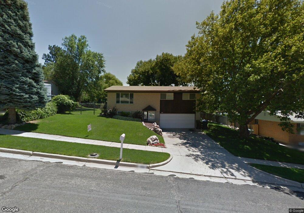
1469 Harrop St Ogden, UT 84404
Horace Mann NeighborhoodEstimated Value: $379,217 - $404,000
3
Beds
1
Bath
1,040
Sq Ft
$372/Sq Ft
Est. Value
About This Home
This home is located at 1469 Harrop St, Ogden, UT 84404 and is currently estimated at $387,304, approximately $372 per square foot. 1469 Harrop St is a home located in Weber County with nearby schools including Mound Fort Junior High School and Ben Lomond High School.
Ownership History
Date
Name
Owned For
Owner Type
Purchase Details
Closed on
Nov 15, 2012
Sold by
Norris William D and Norris Marcia H
Bought by
William D Norris Properties 1469 Harrop
Current Estimated Value
Purchase Details
Closed on
Jul 27, 2012
Sold by
Nussbaum Justin R and Nussbaum Traci D
Bought by
Norris William D and Norris Marcia H
Home Financials for this Owner
Home Financials are based on the most recent Mortgage that was taken out on this home.
Original Mortgage
$240,000
Interest Rate
3.65%
Mortgage Type
Purchase Money Mortgage
Purchase Details
Closed on
May 2, 2005
Sold by
Douglas Richard Keith and Douglas Billie Obrien
Bought by
Nussbaum Justin R and Nussbaum Traci D
Home Financials for this Owner
Home Financials are based on the most recent Mortgage that was taken out on this home.
Original Mortgage
$20,600
Interest Rate
5.92%
Mortgage Type
Credit Line Revolving
Create a Home Valuation Report for This Property
The Home Valuation Report is an in-depth analysis detailing your home's value as well as a comparison with similar homes in the area
Home Values in the Area
Average Home Value in this Area
Purchase History
| Date | Buyer | Sale Price | Title Company |
|---|---|---|---|
| William D Norris Properties 1469 Harrop | -- | None Available | |
| Norris William D | -- | Bonneville Superior Title Co | |
| Nussbaum Justin R | -- | Mountain View Title |
Source: Public Records
Mortgage History
| Date | Status | Borrower | Loan Amount |
|---|---|---|---|
| Previous Owner | Norris William D | $240,000 | |
| Previous Owner | Nussbaum Justin R | $20,600 | |
| Previous Owner | Nussbaum Justin R | $82,400 |
Source: Public Records
Tax History Compared to Growth
Tax History
| Year | Tax Paid | Tax Assessment Tax Assessment Total Assessment is a certain percentage of the fair market value that is determined by local assessors to be the total taxable value of land and additions on the property. | Land | Improvement |
|---|---|---|---|---|
| 2025 | $2,562 | $360,465 | $118,604 | $241,861 |
| 2024 | $2,562 | $338,000 | $118,608 | $219,392 |
| 2023 | $2,548 | $341,000 | $109,017 | $231,983 |
| 2022 | $2,842 | $387,000 | $94,219 | $292,781 |
| 2021 | $2,158 | $263,000 | $59,333 | $203,667 |
| 2020 | $1,935 | $216,000 | $44,415 | $171,585 |
| 2019 | $1,928 | $202,000 | $39,429 | $162,571 |
| 2018 | $1,647 | $169,000 | $34,401 | $134,599 |
| 2017 | $1,432 | $135,000 | $31,700 | $103,300 |
| 2016 | $1,314 | $66,427 | $14,904 | $51,523 |
| 2015 | $1,325 | $66,427 | $14,904 | $51,523 |
| 2014 | $1,341 | $66,427 | $15,445 | $50,982 |
Source: Public Records
Map
Nearby Homes
- 3270 N 3325 W Unit 386B
- 462 Hiland Rd
- 446 Robins Ave
- 1568 Hudson St Unit 1
- 1363 Lewis Dr
- 1427 Sheridan Dr
- 1302 Harrop St
- 1274 5th St
- 3088 N 3075 W
- 724 Hislop Dr
- 727 Robins Ave
- 1243 Hudson St
- 777 Simoron Dr
- 131 Taylor Ave
- 261 Van Buren Ave
- 1272 Earl Dr
- 1120 Cross St
- 223 N Harrison Blvd
- 1034 1st St
- 1115 Cross St
- 564 E 400 St S
- 454 Hiland Rd
- 1457 Harrop St
- 3215 N 3450 W Unit 319
- 2718 N 3225 W Unit 128
- 3278 N 3325 W Unit 384D
- 2701 N 3225 W Unit 125
- 2717 N 3225 W Unit 126
- 2693 N 3225 W Unit 124
- 3278 N 3325 W Unit 382B
- 3278 N 3325 W Unit 383
- 3278 N 3325 W Unit 381
- 3505 W 3275 N Unit 328
- 3439 W 3275 N
- 3240 N 3450 W Unit 312
- 3193 N 3475 W Unit 339
- 3270 N 3325 W Unit 385
- 3320 W 3275 N Unit 301
- 3278 N 3325 W
- 3270 N 3325 W Unit 387