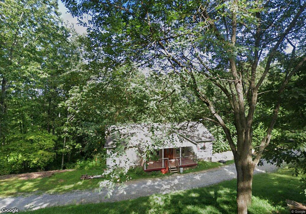
147 Bill Brown Ln La Follette, TN 37766
Estimated Value: $234,000 - $300,000
3
Beds
2
Baths
1,248
Sq Ft
$215/Sq Ft
Est. Value
About This Home
This home is located at 147 Bill Brown Ln, La Follette, TN 37766 and is currently estimated at $267,859, approximately $214 per square foot. 147 Bill Brown Ln is a home located in Campbell County.
Ownership History
Date
Name
Owned For
Owner Type
Purchase Details
Closed on
Oct 23, 2020
Sold by
Baird William E and Baird Amy
Bought by
Kitts J R
Current Estimated Value
Purchase Details
Closed on
Sep 19, 2011
Sold by
Bank Of New York Mellon Tr
Bought by
Baird William E
Home Financials for this Owner
Home Financials are based on the most recent Mortgage that was taken out on this home.
Original Mortgage
$24,440
Interest Rate
4.26%
Mortgage Type
Commercial
Purchase Details
Closed on
Jul 21, 2011
Sold by
Taylor David
Bought by
Bank Of New York Mellon Trust
Home Financials for this Owner
Home Financials are based on the most recent Mortgage that was taken out on this home.
Original Mortgage
$24,440
Interest Rate
4.26%
Mortgage Type
Commercial
Purchase Details
Closed on
Mar 11, 2005
Sold by
Rutherford Bill A
Bought by
Taylor David and Taylor Pamela
Purchase Details
Closed on
Jan 6, 1993
Bought by
Wright George B and Susan Renee
Purchase Details
Closed on
Apr 20, 1992
Bought by
Nelson William H
Create a Home Valuation Report for This Property
The Home Valuation Report is an in-depth analysis detailing your home's value as well as a comparison with similar homes in the area
Home Values in the Area
Average Home Value in this Area
Purchase History
| Date | Buyer | Sale Price | Title Company |
|---|---|---|---|
| Kitts J R | $64,900 | None Available | |
| Baird William E | $30,550 | -- | |
| Bank Of New York Mellon Trust | $78,300 | -- | |
| Taylor David | $65,550 | -- | |
| Wright George B | $34,500 | -- | |
| Nelson William H | -- | -- |
Source: Public Records
Mortgage History
| Date | Status | Borrower | Loan Amount |
|---|---|---|---|
| Previous Owner | Baird William E | $24,440 |
Source: Public Records
Tax History Compared to Growth
Tax History
| Year | Tax Paid | Tax Assessment Tax Assessment Total Assessment is a certain percentage of the fair market value that is determined by local assessors to be the total taxable value of land and additions on the property. | Land | Improvement |
|---|---|---|---|---|
| 2025 | $649 | $53,375 | $0 | $0 |
| 2024 | $649 | $53,375 | $8,800 | $44,575 |
| 2023 | $517 | $25,025 | $2,775 | $22,250 |
| 2022 | $517 | $25,025 | $2,775 | $22,250 |
| 2021 | $517 | $25,025 | $2,775 | $22,250 |
| 2020 | $507 | $25,025 | $2,775 | $22,250 |
| 2019 | $517 | $25,025 | $2,775 | $22,250 |
| 2018 | $477 | $21,200 | $1,750 | $19,450 |
| 2017 | $477 | $21,200 | $1,750 | $19,450 |
| 2016 | $477 | $21,200 | $1,750 | $19,450 |
| 2015 | $422 | $21,200 | $1,750 | $19,450 |
| 2014 | -- | $21,200 | $1,750 | $19,450 |
| 2013 | -- | $21,200 | $1,750 | $19,450 |
Source: Public Records
Map
Nearby Homes
- 286 Lewis White Ln
- 647 Coolidge Rd
- 2473 Long Hollow Rd
- 689 Ivey Hollow Rd
- 174 Old Ivey Hollow Rd
- 640 Camp Ridge Rd
- 1123 Pleasant Ridge Rd
- 0 Dr
- 1184 Davis Chapel Rd
- 0 Gamble Ln
- 111 Mckinney Rd
- 1971 Demory Rd
- 0 Fairway Dr Unit 1306388
- 143 Northbridge Ln
- 143 N Bridge Ln
- 129 Bridgeview Ln
- 180 Donna Ln
- 309 Marina Ln
- 258 Marina Ln
- 679 Waterfront Tr
- 129 Bill Brown Ln
- 158 Bill Brown Ln
- 176 Bill Brown Ln
- 181 Bill Brown Ln
- 2131 Long Hollow Rd
- 108 Lewis White Ln
- 203 Bill Brown Ln
- 144 Lewis White Ln
- 2143 Long Hollow Rd
- 136 Lewis White Ln
- 112 Lewis White Ln
- 190 Bill Brown Ln
- 228 Bill Brown Ln
- 139 Lewis White Ln
- 2074 Long Hollow Rd
- 166 Lewis White Ln
- 2080 Long Hollow Rd
- 2032 Long Hollow Rd
- 244 Bill Brown Ln
- 224 Lewis White Ln