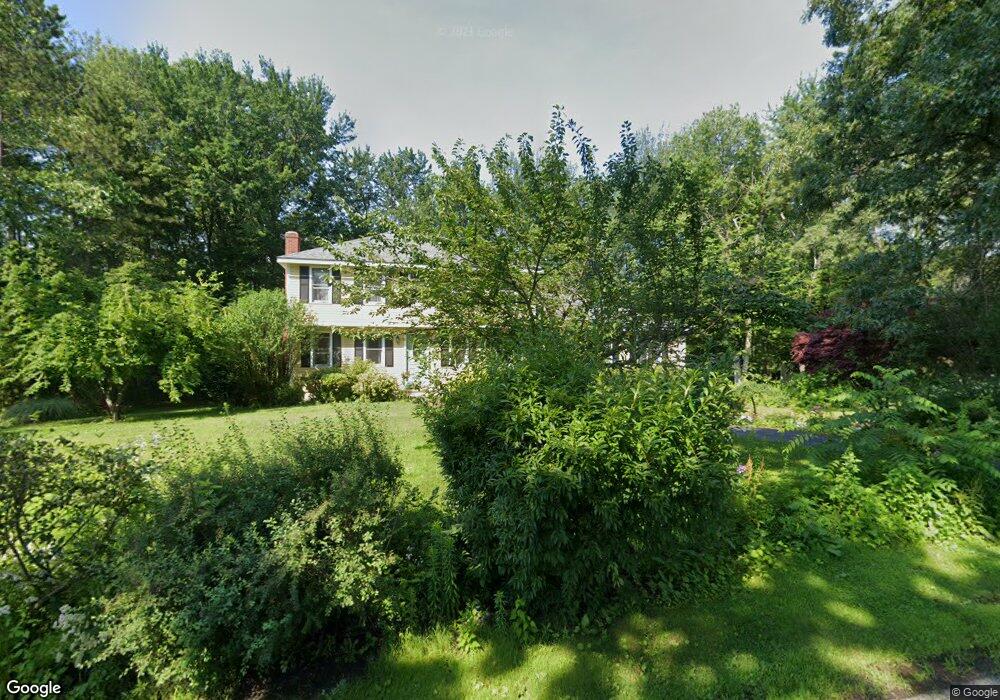
147 Dudley Rd Sutton, MA 01590
Estimated Value: $654,176 - $753,000
4
Beds
3
Baths
2,324
Sq Ft
$304/Sq Ft
Est. Value
About This Home
This home is located at 147 Dudley Rd, Sutton, MA 01590 and is currently estimated at $706,544, approximately $304 per square foot. 147 Dudley Rd is a home located in Worcester County with nearby schools including Sutton Elementary School, Sutton Middle School, and Sutton High School.
Ownership History
Date
Name
Owned For
Owner Type
Purchase Details
Closed on
Jun 27, 2016
Sold by
Green Amos H and Green Karin M
Bought by
Jacques William R and Jacques Katharine M
Current Estimated Value
Home Financials for this Owner
Home Financials are based on the most recent Mortgage that was taken out on this home.
Original Mortgage
$346,545
Outstanding Balance
$272,801
Interest Rate
3.57%
Mortgage Type
New Conventional
Estimated Equity
$433,743
Purchase Details
Closed on
Apr 2, 1999
Sold by
Kawolis Paul F and Kawolis Ramona A
Bought by
Green Amos H and Green Karin M
Home Financials for this Owner
Home Financials are based on the most recent Mortgage that was taken out on this home.
Original Mortgage
$100,000
Interest Rate
6.78%
Mortgage Type
Purchase Money Mortgage
Create a Home Valuation Report for This Property
The Home Valuation Report is an in-depth analysis detailing your home's value as well as a comparison with similar homes in the area
Home Values in the Area
Average Home Value in this Area
Purchase History
| Date | Buyer | Sale Price | Title Company |
|---|---|---|---|
| Jacques William R | $375,000 | -- | |
| Green Amos H | $235,000 | -- |
Source: Public Records
Mortgage History
| Date | Status | Borrower | Loan Amount |
|---|---|---|---|
| Open | Jacques William R | $346,545 | |
| Previous Owner | Green Amos H | $130,000 | |
| Previous Owner | Green Amos H | $100,000 |
Source: Public Records
Tax History
| Year | Tax Paid | Tax Assessment Tax Assessment Total Assessment is a certain percentage of the fair market value that is determined by local assessors to be the total taxable value of land and additions on the property. | Land | Improvement |
|---|---|---|---|---|
| 2025 | $7,439 | $618,900 | $178,100 | $440,800 |
| 2024 | $7,394 | $583,100 | $170,100 | $413,000 |
| 2023 | $6,872 | $496,200 | $153,800 | $342,400 |
| 2022 | $6,561 | $432,200 | $117,200 | $315,000 |
| 2021 | $6,426 | $401,600 | $117,200 | $284,400 |
| 2020 | $6,369 | $401,600 | $117,200 | $284,400 |
| 2019 | $6,220 | $376,500 | $117,200 | $259,300 |
| 2018 | $5,978 | $361,200 | $117,200 | $244,000 |
| 2017 | $5,828 | $353,200 | $103,100 | $250,100 |
| 2016 | $5,740 | $344,100 | $103,100 | $241,000 |
| 2015 | $5,534 | $331,800 | $103,100 | $228,700 |
| 2014 | $5,159 | $305,600 | $108,000 | $197,600 |
Source: Public Records
Map
Nearby Homes
- 5 Mogren Dr
- 2 Jessica j Dr
- 4 Jessica j Dr
- 128 Worcester Providence Turnpike
- 124 Worcester Providence Turnpike
- 8 Sycamore Cir
- 168 Burbank Rd
- 38 W Main St
- 7 Canal St
- 37-39 Main St
- 152 W Main St Unit A
- 99 Burbank Road Lot 182
- 99 Burbank Rd
- 66 Buttonwood Ave
- Lot 1 Cooper Rd
- 8 Autumn Gate Cir
- 17 Lincoln Ave
- 150 Ariel Cir
- 8 Lincoln Ave
- 11 Laurel Dr
- 122 S Main St
- 120 S Main St
- 145 Dudley Rd
- 150 Dudley Rd
- 123 S Main St
- 121 S Main St
- 118 S Main St
- 143 Dudley Rd
- 114 S Main St
- 115 S Main St
- 110 S Main St
- 9 Leia Cir
- 10 Leia Cir
- 111 S Main St Unit 2
- 111 S Main St
- 111 S Main St Unit Lower
- 111 S Main St Unit 1
- 109 S Main St Unit 1
- 109 S Main St
- 131 Dudley Rd
Your Personal Tour Guide
Ask me questions while you tour the home.