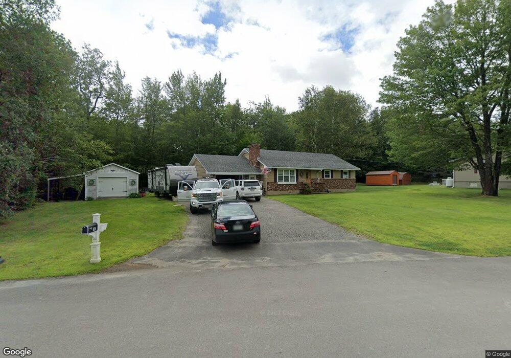
147 Minuteman Dr Millinocket, ME 04462
Estimated Value: $204,518 - $253,000
Studio
--
Bath
--
Sq Ft
13,068
Sq Ft Lot
About This Home
This home is located at 147 Minuteman Dr, Millinocket, ME 04462 and is currently estimated at $223,880. 147 Minuteman Dr is a home with nearby schools including Granite Street School and Stearns Junior/Senior High School.
Ownership History
Date
Name
Owned For
Owner Type
Purchase Details
Closed on
Jul 12, 2021
Sold by
Deane Geoffrey M
Bought by
Mills Miranda
Current Estimated Value
Home Financials for this Owner
Home Financials are based on the most recent Mortgage that was taken out on this home.
Original Mortgage
$126,262
Outstanding Balance
$113,565
Interest Rate
2.9%
Mortgage Type
Purchase Money Mortgage
Estimated Equity
$110,315
Purchase Details
Closed on
Jul 23, 2018
Sold by
Mills Barry M
Bought by
Deane Geoffrey M
Home Financials for this Owner
Home Financials are based on the most recent Mortgage that was taken out on this home.
Original Mortgage
$117,762
Interest Rate
4.5%
Mortgage Type
FHA
Create a Home Valuation Report for This Property
The Home Valuation Report is an in-depth analysis detailing your home's value as well as a comparison with similar homes in the area
Home Values in the Area
Average Home Value in this Area
Purchase History
| Date | Buyer | Sale Price | Title Company |
|---|---|---|---|
| Mills Miranda | -- | None Available | |
| Deane Geoffrey M | -- | -- |
Source: Public Records
Mortgage History
| Date | Status | Borrower | Loan Amount |
|---|---|---|---|
| Open | Mills Miranda | $126,262 | |
| Previous Owner | Deane Geoffrey M | $117,762 |
Source: Public Records
Tax History
| Year | Tax Paid | Tax Assessment Tax Assessment Total Assessment is a certain percentage of the fair market value that is determined by local assessors to be the total taxable value of land and additions on the property. | Land | Improvement |
|---|---|---|---|---|
| 2025 | $3,445 | $149,800 | $12,900 | $136,900 |
| 2024 | $3,447 | $124,900 | $6,900 | $118,000 |
| 2023 | $2,857 | $101,300 | $6,900 | $94,400 |
| 2022 | $2,667 | $90,400 | $6,900 | $83,500 |
| 2021 | $2,486 | $76,500 | $6,900 | $69,600 |
| 2020 | $2,468 | $72,600 | $6,900 | $65,700 |
| 2019 | $2,396 | $72,600 | $6,900 | $65,700 |
| 2018 | $2,360 | $72,600 | $6,900 | $65,700 |
| 2017 | $2,345 | $72,600 | $6,900 | $65,700 |
| 2016 | $2,272 | $72,600 | $6,900 | $65,700 |
| 2015 | $2,153 | $72,600 | $6,900 | $65,700 |
| 2014 | $2,149 | $72,600 | $6,900 | $65,700 |
Source: Public Records
Map
Nearby Homes
- 59 Heritage Dr
- 152 Minuteman Dr
- 51 Heritage Dr
- 142 Minuteman Dr
- 127 Minuteman Dr
- 43 Heritage Dr
- 43 Heritage Dr
- 260 Massachusetts Ave
- 50 Heritage Dr
- 268 Massachusetts Ave
- 276 Massachusetts Ave
- 35 Heritage Dr
- 42 Heritage Dr
- 27 Heritage Dr
- 284 Massachusetts Ave
- 115 Minuteman Dr
- 261 Massachusetts Ave
- 126 Minuteman Dr
- 247 Massachusetts Ave
- 34 Heritage Dr
Your Personal Tour Guide
Ask me questions while you tour the home.