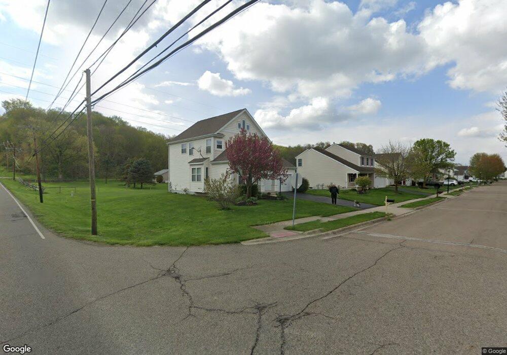
1471 Pheasant Run Dr Newark, OH 43055
Estimated Value: $339,000 - $390,000
3
Beds
3
Baths
2,082
Sq Ft
$171/Sq Ft
Est. Value
About This Home
This home is located at 1471 Pheasant Run Dr, Newark, OH 43055 and is currently estimated at $356,481, approximately $171 per square foot. 1471 Pheasant Run Dr is a home located in Licking County with nearby schools including Legend Elementary School, Liberty Middle School, and Newark High School.
Ownership History
Date
Name
Owned For
Owner Type
Purchase Details
Closed on
May 27, 2005
Sold by
M I Homes Of Central Ohio Llc
Bought by
Metcalf Thomas R and Metcalf Linda K
Current Estimated Value
Home Financials for this Owner
Home Financials are based on the most recent Mortgage that was taken out on this home.
Original Mortgage
$145,450
Interest Rate
9.45%
Mortgage Type
Fannie Mae Freddie Mac
Create a Home Valuation Report for This Property
The Home Valuation Report is an in-depth analysis detailing your home's value as well as a comparison with similar homes in the area
Home Values in the Area
Average Home Value in this Area
Purchase History
| Date | Buyer | Sale Price | Title Company |
|---|---|---|---|
| Metcalf Thomas R | $194,000 | Transohio Residential Title |
Source: Public Records
Mortgage History
| Date | Status | Borrower | Loan Amount |
|---|---|---|---|
| Previous Owner | Metcalf Thomas R | $145,450 |
Source: Public Records
Tax History Compared to Growth
Tax History
| Year | Tax Paid | Tax Assessment Tax Assessment Total Assessment is a certain percentage of the fair market value that is determined by local assessors to be the total taxable value of land and additions on the property. | Land | Improvement |
|---|---|---|---|---|
| 2024 | $2,939 | $92,020 | $21,000 | $71,020 |
| 2023 | $2,956 | $92,020 | $21,000 | $71,020 |
| 2022 | $2,489 | $70,840 | $14,700 | $56,140 |
| 2021 | $2,610 | $70,840 | $14,700 | $56,140 |
| 2020 | $2,672 | $70,840 | $14,700 | $56,140 |
| 2019 | $2,477 | $64,230 | $12,250 | $51,980 |
| 2018 | $2,478 | $0 | $0 | $0 |
| 2017 | $2,396 | $0 | $0 | $0 |
| 2016 | $2,367 | $0 | $0 | $0 |
| 2015 | $2,419 | $0 | $0 | $0 |
| 2014 | $3,619 | $0 | $0 | $0 |
| 2013 | $2,383 | $0 | $0 | $0 |
Source: Public Records
Map
Nearby Homes
- 1831 Churchill Downs Rd
- 681 Woods Edge Ln
- 437 Hunters Ct
- 714 Olde Creek Dr
- 1684 Churchill Downs Rd
- 1631 W Turkey Run Dr
- 1670 Naughtingham Rd
- 1649 W Turkey Run Dr
- 1345 Sherwood Downs Rd W
- 734 Whitetail Loop
- 763 Whitetail Loop
- 750 Whitetail Loop
- 267 N Vernon Ave
- 752 Whitetail Loop
- 336 Myrtle Ave
- 1518 Constitution Ct
- 139 Aqueduct Ave
- 1954 Iselin St
- 1948 Jamesburg St
- 1738 Scioto Way
- 1477 Pheasant Run Dr
- 1483 Pheasant Run Dr
- 5041 Price Rd NE
- 1476 S Wild Turkey Dr
- 1489 Pheasant Run Dr
- 545 Price Rd
- 535 Price Rd
- 1475 S Wild Turkey Dr
- 1480 S Wild Turkey Dr
- 569 Price Rd
- 527 Price Rd
- 1495 Pheasant Run Dr
- 1485 S Wild Turkey Dr
- 521 Price Rd
- 573 Price Rd
- 1496 Pheasant Run Dr
- 1501 Pheasant Run Dr
- 1484 S Wild Turkey Dr
- 0 Pheasant Run Dr Unit 3061 2506255
- 0 Pheasant Run Dr Unit 3061 2544483