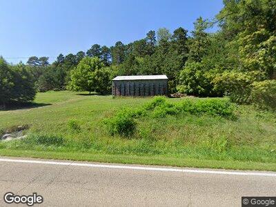
1474 State Route 325 S Thurman, OH 45685
Estimated Value: $188,000 - $258,000
2
Beds
2
Baths
2,060
Sq Ft
$109/Sq Ft
Est. Value
About This Home
This home is located at 1474 State Route 325 S, Thurman, OH 45685 and is currently estimated at $223,978, approximately $108 per square foot. 1474 State Route 325 S is a home located in Gallia County with nearby schools including Gallia Academy High School.
Ownership History
Date
Name
Owned For
Owner Type
Purchase Details
Closed on
Dec 7, 2017
Sold by
Matson Eric H and Matson Lesley
Bought by
Woods Tressie L
Current Estimated Value
Purchase Details
Closed on
May 4, 2010
Sold by
Matson Eric H and Matson Lesley
Bought by
Hatson Erice H
Purchase Details
Closed on
Jan 22, 2003
Sold by
Mannon Kenneth L
Bought by
Hill Floyd Harold
Purchase Details
Closed on
Dec 10, 1997
Sold by
Blair James
Bought by
Mannon Kenneth L
Purchase Details
Closed on
Oct 1, 1990
Create a Home Valuation Report for This Property
The Home Valuation Report is an in-depth analysis detailing your home's value as well as a comparison with similar homes in the area
Home Values in the Area
Average Home Value in this Area
Purchase History
| Date | Buyer | Sale Price | Title Company |
|---|---|---|---|
| Woods Tressie L | $140,000 | None Available | |
| Hatson Erice H | -- | None Available | |
| Hill Floyd Harold | $6,000 | -- | |
| Mannon Kenneth L | -- | -- | |
| -- | $66,500 | -- |
Source: Public Records
Tax History Compared to Growth
Tax History
| Year | Tax Paid | Tax Assessment Tax Assessment Total Assessment is a certain percentage of the fair market value that is determined by local assessors to be the total taxable value of land and additions on the property. | Land | Improvement |
|---|---|---|---|---|
| 2024 | $1,710 | $50,590 | $8,660 | $41,930 |
| 2023 | $1,861 | $50,590 | $8,660 | $41,930 |
| 2022 | $1,583 | $42,230 | $7,330 | $34,900 |
| 2021 | $1,579 | $42,230 | $7,330 | $34,900 |
| 2020 | $1,579 | $42,230 | $7,330 | $34,900 |
| 2019 | $1,183 | $31,730 | $6,660 | $25,070 |
| 2018 | $1,153 | $31,730 | $6,660 | $25,070 |
| 2017 | $1,153 | $31,730 | $6,660 | $25,070 |
| 2016 | $1,074 | $30,280 | $6,220 | $24,060 |
| 2015 | $1,254 | $35,370 | $6,220 | $29,150 |
| 2013 | $1,231 | $34,450 | $6,220 | $28,230 |
| 2012 | $1,230 | $34,450 | $6,220 | $28,230 |
Source: Public Records
Map
Nearby Homes
- 37 Pine St
- 101 E College St
- 157 Wayne Ln
- 614 Ohio 325
- 0 Kyer Rd
- 63 Dewitt Dr
- 837 Centerpoint Rd
- 0 Oak Ridge Dr
- 0 Deer Creek Rd
- 11097 State Route 141
- 0 Left Fork Rd
- 880 Graham School Rd
- 25 Hudson Rd
- 395 Vale Rd
- 17 Pine Hill Rd
- 0 Jackson Pike
- 9675 Ohio 554
- 1963 Patriot Rd
- 2035 Graham School Rd
- 0 Porter Rd
- 1474 State Route 325 S
- 1488 State Route 325 S
- 1558 State Route 325 S
- 1581 State Route 325 S
- 1218 S R 325
- 2882 Garners Ford Rd
- 2656 Garners Ford Rd
- 1688 State Route 325 S
- 2960 Garners Ford Rd
- 2992 Garners Ford Rd
- 2961 Garners Ford Rd
- 1740 State Route 325 S
- 1786 State Route 325 S
- 1786 State Route 325 S
- 3076 Garners Ford Rd
- 78 Shelton Rd
- 22 Shelton Rd
- 3121 Garners Ford Rd
- 19 Shelton Rd
- 3156 Garners Ford Rd