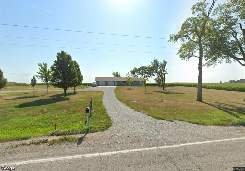
1476 Highway 69 Osceola, IA 50213
Estimated Value: $330,000 - $385,000
3
Beds
2
Baths
1,248
Sq Ft
$285/Sq Ft
Est. Value
About This Home
This home is located at 1476 Highway 69, Osceola, IA 50213 and is currently estimated at $355,662, approximately $284 per square foot. 1476 Highway 69 is a home with nearby schools including Clarke Community Elementary School, Clarke Middle School, and Clarke Community High School.
Ownership History
Date
Name
Owned For
Owner Type
Purchase Details
Closed on
Jan 14, 2011
Sold by
Killhan Mark and Killhan Carol
Bought by
Robinson Stanley and Robinson Rita
Current Estimated Value
Home Financials for this Owner
Home Financials are based on the most recent Mortgage that was taken out on this home.
Original Mortgage
$180,000
Outstanding Balance
$120,706
Interest Rate
4.44%
Mortgage Type
Future Advance Clause Open End Mortgage
Estimated Equity
$234,956
Purchase Details
Closed on
Dec 28, 2010
Sold by
Criss Patricia S
Bought by
Blakely Gary L
Home Financials for this Owner
Home Financials are based on the most recent Mortgage that was taken out on this home.
Original Mortgage
$180,000
Outstanding Balance
$120,706
Interest Rate
4.44%
Mortgage Type
Future Advance Clause Open End Mortgage
Estimated Equity
$234,956
Create a Home Valuation Report for This Property
The Home Valuation Report is an in-depth analysis detailing your home's value as well as a comparison with similar homes in the area
Home Values in the Area
Average Home Value in this Area
Purchase History
| Date | Buyer | Sale Price | Title Company |
|---|---|---|---|
| Robinson Stanley | $29,000 | -- | |
| Blakely Gary L | $147,500 | -- |
Source: Public Records
Mortgage History
| Date | Status | Borrower | Loan Amount |
|---|---|---|---|
| Open | Blakely Gary L | $180,000 |
Source: Public Records
Tax History Compared to Growth
Tax History
| Year | Tax Paid | Tax Assessment Tax Assessment Total Assessment is a certain percentage of the fair market value that is determined by local assessors to be the total taxable value of land and additions on the property. | Land | Improvement |
|---|---|---|---|---|
| 2024 | $4,510 | $275,710 | $42,360 | $233,350 |
| 2023 | $3,790 | $232,420 | $42,360 | $190,060 |
| 2022 | $3,418 | $182,090 | $42,370 | $139,720 |
| 2021 | $2,132 | $110,780 | $1,420 | $109,360 |
| 2020 | $2,056 | $110,780 | $1,420 | $109,360 |
| 2019 | $1,956 | $101,330 | $0 | $0 |
| 2018 | $1,896 | $101,330 | $0 | $0 |
| 2017 | $1,896 | $113,830 | $0 | $0 |
| 2016 | $2,134 | $113,830 | $0 | $0 |
| 2014 | $2,006 | $86,420 | $0 | $0 |
Source: Public Records
Map
Nearby Homes
- 2600 Robin St
- 000 Starline Ave
- 0000 Starline Ave
- 2431 Kendall St
- 0 230th Ave
- 000 Kendall St
- 1013 260th Ave
- 718 Roosevelt Blvd
- 2840 Pacific St
- 117 W Logan St
- 601 N Main St
- 219 N East St
- 213 W Logan St
- 213 N Adams St
- 1364 Liberty Hwy
- 215 W Clay St
- 131 N Park St
- 119 N Park St
- 321 W Clay St
- 220 Eastside Dr
- 1471 U S 69
- 1488 Highway 69 Unit US
- 1489 Highway 69
- 1499 Highway 69
- 1460 Highway 69 Unit US
- 1469 Highway 69
- 1469 Highway 69
- 1500 Highway 69 Unit US
- 1457 Highway 69 Unit US
- 1448 Highway 69 Unit US
- 1448 Hwy 69
- 1504 Highway 69 Unit US
- 1504 U S 69
- 2511 Norman St
- 1509 Highway 69 Unit US
- 1509 Highway 69
- 2519 Norman St
- 1510 250th Ave
- 1520 250th Ave Unit B
- 1520 250th Ave Unit A