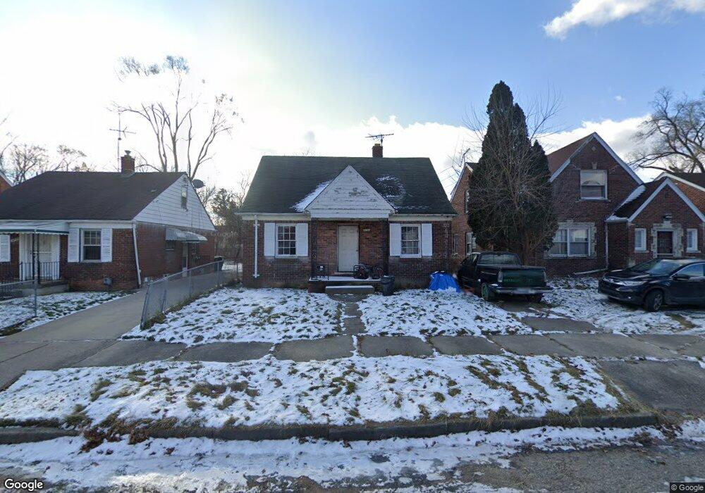
14784 Lannette St Detroit, MI 48213
Outer Drive-Hayes NeighborhoodEstimated Value: $52,000 - $62,000
--
Bed
1
Bath
1,018
Sq Ft
$57/Sq Ft
Est. Value
About This Home
This home is located at 14784 Lannette St, Detroit, MI 48213 and is currently estimated at $58,528, approximately $57 per square foot. 14784 Lannette St is a home located in Wayne County with nearby schools including Edward 'Duke' Ellington Conservatory of Music and Art, Charles L. Spain Elementary-Middle School, and Denby High School.
Ownership History
Date
Name
Owned For
Owner Type
Purchase Details
Closed on
Jan 23, 2017
Sold by
Williams Christine
Bought by
Williams Francesca
Current Estimated Value
Purchase Details
Closed on
Jan 6, 2015
Sold by
Wayne County Treasurer
Bought by
Detroit Land Bank Authority
Purchase Details
Closed on
Dec 29, 2014
Sold by
Robinson Harold
Bought by
Williams Christine
Purchase Details
Closed on
Jan 3, 2013
Sold by
Waggoner James and Waggoner Michelle
Bought by
Robinson Eugene
Create a Home Valuation Report for This Property
The Home Valuation Report is an in-depth analysis detailing your home's value as well as a comparison with similar homes in the area
Home Values in the Area
Average Home Value in this Area
Purchase History
| Date | Buyer | Sale Price | Title Company |
|---|---|---|---|
| Williams Francesca | -- | None Available | |
| Detroit Land Bank Authority | -- | None Available | |
| Williams Christine | -- | None Available | |
| Robinson Eugene | -- | None Available |
Source: Public Records
Tax History Compared to Growth
Tax History
| Year | Tax Paid | Tax Assessment Tax Assessment Total Assessment is a certain percentage of the fair market value that is determined by local assessors to be the total taxable value of land and additions on the property. | Land | Improvement |
|---|---|---|---|---|
| 2025 | -- | $0 | $0 | $0 |
| 2024 | -- | $0 | $0 | $0 |
| 2023 | $0 | $0 | $0 | $0 |
| 2022 | $0 | $0 | $0 | $0 |
| 2021 | $0 | $0 | $0 | $0 |
| 2020 | $1,549 | $0 | $0 | $0 |
| 2019 | $1,549 | $0 | $0 | $0 |
| 2018 | $0 | $0 | $0 | $0 |
| 2017 | $960 | $0 | $0 | $0 |
| 2016 | $240 | $9,600 | $0 | $0 |
| 2015 | $960 | $9,600 | $0 | $0 |
| 2013 | $1,337 | $13,365 | $0 | $0 |
| 2010 | -- | $19,594 | $1,109 | $18,485 |
Source: Public Records
Map
Nearby Homes
- 14750 Lannette St
- 14811 Rosemary St
- 14756 Rosemary St
- 9675 E Outer Dr
- 9722 E Outer Dr
- 14931 Flanders St
- 9776 E Outer Dr
- 14258 Glenfield St
- 10201 Hayes St
- 14851 Alma St
- 14895 Alma St
- 9892 E Outer Dr
- 14434 Houston Whittier St
- 15046 Mayfield St
- 14466 Chelsea Ave
- 15074 Mayfield St
- 10904 Mogul St
- 10891 Mogul St
- 13423 Kilbourne St
- 14421 Houston Whittier St
- 14790 Lannette St
- 14776 Lannette St
- 14800 Lannette St
- 14768 Lannette St
- 14760 Lannette St
- 14808 Lannette St
- 14765 Kilbourne St
- 14773 Kilbourne St
- 14779 Kilbourne St
- 14759 Kilbourne St
- 14787 Kilbourne St
- 14753 Kilbourne St
- 14791 Lannette St
- 14816 Lannette St
- 14783 Lannette St
- 14799 Lannette St
- 14775 Lannette St
- 14795 Kilbourne St
- 14745 Kilbourne St
- 14742 Lannette St