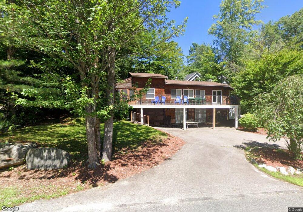
148 Cummings Cove Rd Meredith, NH 03253
Estimated Value: $906,000 - $1,524,000
2
Beds
2
Baths
1,265
Sq Ft
$882/Sq Ft
Est. Value
About This Home
This home is located at 148 Cummings Cove Rd, Meredith, NH 03253 and is currently estimated at $1,116,096, approximately $882 per square foot. 148 Cummings Cove Rd is a home with nearby schools including Inter-Lakes Elementary School.
Ownership History
Date
Name
Owned For
Owner Type
Purchase Details
Closed on
Aug 14, 2020
Sold by
Depew Jennifer F and Depew Paul W
Bought by
Fleming Andrew C and Fleming Elizabeth S
Current Estimated Value
Home Financials for this Owner
Home Financials are based on the most recent Mortgage that was taken out on this home.
Original Mortgage
$432,000
Outstanding Balance
$383,214
Interest Rate
3%
Mortgage Type
New Conventional
Estimated Equity
$732,882
Create a Home Valuation Report for This Property
The Home Valuation Report is an in-depth analysis detailing your home's value as well as a comparison with similar homes in the area
Home Values in the Area
Average Home Value in this Area
Purchase History
| Date | Buyer | Sale Price | Title Company |
|---|---|---|---|
| Fleming Andrew C | $540,000 | None Available |
Source: Public Records
Mortgage History
| Date | Status | Borrower | Loan Amount |
|---|---|---|---|
| Open | Fleming Andrew C | $432,000 |
Source: Public Records
Tax History Compared to Growth
Tax History
| Year | Tax Paid | Tax Assessment Tax Assessment Total Assessment is a certain percentage of the fair market value that is determined by local assessors to be the total taxable value of land and additions on the property. | Land | Improvement |
|---|---|---|---|---|
| 2024 | $9,645 | $940,100 | $703,300 | $236,800 |
| 2023 | $9,298 | $940,100 | $703,300 | $236,800 |
| 2022 | $7,094 | $507,800 | $328,100 | $179,700 |
| 2021 | $6,473 | $482,000 | $328,100 | $153,900 |
| 2020 | $6,758 | $482,000 | $328,100 | $153,900 |
| 2019 | $5,418 | $341,000 | $226,200 | $114,800 |
| 2018 | $5,326 | $341,000 | $226,200 | $114,800 |
| 2016 | $5,425 | $348,000 | $244,800 | $103,200 |
| 2015 | $5,290 | $348,000 | $244,800 | $103,200 |
| 2014 | $5,146 | $347,000 | $244,800 | $102,200 |
| 2013 | $5,000 | $347,000 | $244,800 | $102,200 |
Source: Public Records
Map
Nearby Homes
- Lot 21 Cummings Cove Rd
- Lot 22 Cummings Cove Rd
- 11 Quimby Rd
- 39 Lake Country Rd
- 103 Meredith Neck Rd
- 113-117 Pinnacle Park Rd
- 75 Neal Shore Rd
- 765 Scenic Rd
- 106 Needle Eye Rd
- 37
- 45 Stern Castle Place Unit 32
- 00 Nh Rte 132 Route
- 38 Stern Castle Place Unit 30
- Lot 12-3 Needle Eye Rd
- Lot 12-5 Needle Eye Rd
- 598 Scenic Rd Unit 2
- 598 Scenic Rd Unit 1
- 97 Soleil Mountain Unit 82
- 94 Soleil Mountain Unit 8
- 99 Pleasant St
- 160 Cummings Cove Rd
- 152 Cummings Cove Rd
- 144 Cummings Cove Rd
- 32 Wotanda Ln
- 43 Old Hubbard Rd
- 30 Wotanda Ln
- 31 Wotanda Ln
- 28 Wotanda Ln
- 49 Old Hubbard Rd
- 41 Old Hubbard Rd
- 41 Old Hubbard Road and Boat Slip
- 136 Cummings Cove Rd
- 48 Old Hubbard Rd
- 39 Old Hubbard Rd
- 27 Wotanda Ln
- 56 Old Barn Rd
- 26 Wotanda Ln
- 54 Old Barn Rd
- 0 Old Hubbard Rd
- 37 Old Hubbard Rd